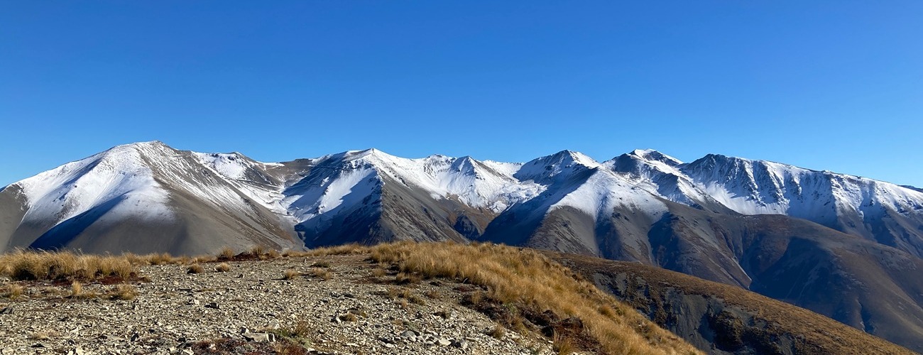
Mt Lyndon
Korowai/Torlesse Tussocklands Park
Mt Lyndon (1489 m) lies just west of Porters Pass in Korowai/Torlesse Tussocklands Park. An unofficial but well-trodden route leads from Lake Lyndon to the summit, allowing the peak to be climbed in a short to half-day walk.
| Details | |
| Length | 7 km return |
| Time Required | 3-4 hr return |
| Trail Type | Unmarked route |
| Physical Difficulty | Moderate |
| Uses | Walking and trail running |
| Start Elevation | 840 m |
| Max Elevation | 1489 m |
Mt Lyndon Route is an unofficial, unmaintained route. Those with navigation experience can continue along the range to Red Hill and beyond.
1 hr 10 min from Christchurch
There is no official, marked track to the summit of Mt Lyndon, but the easiest and commonly-used route begins at the southern end of Lake Lyndon, next to Lake Lyndon Lodge.
Heading west on SH73, turn left onto Lyndon Road at Lake Lyndon (look for the sign stating ‘Fine weather road only’) and follow the gravel road to the end of the lake. Turn right onto the vehicle track that leads around the head of the lake to Lake Lyndon Lodge, where you can park.
Note that while most of the route lies within Korowai/Torlesse Tussocklands Park, a short section of approximately 500 m near the start crosses private land belonging to Brooksdale Station. This section extends from roughly halfway between the lodge and the saddle to about the 1100 m contour. Access across this land is at the discretion of the landowner, and permission should be obtained before crossing.
From the lodge, follow the obvious worn track through the pasture which heads up the gully behind, following the fence line. This route heads up the gully, crossing the creek several times before steepening as it climbs to a low saddle. At the saddle, look back down the gully to see the fairly obvious trace of the Porters Pass Fault, indicated by the linear scree feature that heads back towards the lake.
From the saddle, the way ahead is fairly obvious in clear conditions; it’s pretty much straight up the mountainside. The route heads more or less in a straight line upwards through knee-high tussock and subalpine scrub, and across open scree patches, climbing around 500 vertical metres to the summit.
The broad, rounded mountaintop is mainly bare scree, with tufts of tussock and mats of alpine hebes. A cairn marks the true summit. Enjoy expansive views west across the Porter Valley to the Craigieburn Range. Head to the eastern edge of the summit to view Lake Lyndon 650 m below.
Return the way you came. Alternatively, you can make a circuit by descending the spur to the east, the one that faces the direction of SH73 as it comes off Porters Pass. Note that this is much steeper than the ridge you climbed. Once at the bottom, you can return to where you started by walking along the lake edge.
Red Hill
From the summit of Mt Lyndon it’s possible to traverse the unnamed range that leads to Red Hill (1641 m), all of which is within the Korowai/Torlesse Tussocklands Park. The broad, open tops allow straightforward travel in clear conditions; there are no marked tracks, but as there is a single ridgeline between the two summits, you can simply pick your way along the most obvious route. It’s 5.2 km between the respective summits of Mt Lyndon and Red Hill, and though it’s only 150 m higher than Mt Lyndon, the undulations along the ridge mean there’s about 500 m of extra climbing, so expect a return trip to take an additional 3-4 hr. As the valley immediately south/southeast of the range is private land part of Brooksdale Station, you’ll have to return the way you came, rather than taking a shortcut off the ridge.
Cloudy Hill (1442 m) is another named peak that can be reached from Mt Lyndon. Likewise, there’s no official route, so getting there requires you to navigate across the open tops.


Mt Lyndon is an alpine environment, so proper preparation is essential to ensure a safe trip. The track reaches a high elevation and is very exposed. Make sure you carry plenty of water with you as there are no reliable or safe water sources along the route.
See the Mountain Safety Council website for useful information on preparing for the outdoors.
Mt Lyndon Route is an unofficial, unmaintained route. Those with navigation experience can continue along the range to Red Hill and beyond.