Fenella Hut
Kahurangi National Park
Fenella Hut is located at the head of Cobb Valley, in Kahurangi National Park. The hut is a relatively easy walk up Cobb Valley, and is a great base for day trips to nearby lakes and peaks, namely Kakapo Peak, Aorere Peak and Round Lake.
| Details | |
| Length | 12.2 km one way Trilobite Hut to Cobb Hut; 13.4 km one way Trilobite Hut to Fenella Hut |
| Time Required | 1 hr 30 min to Chaffey Hut; 4 hr to Cobb Hut; 4 hr 30 min to Fenella Hut |
| Trail Type | Tramping track |
| Physical Difficulty | Moderate |
| Uses | Walking and trail running |
| Start Elevation | 830 m |
| Finish Elevation | 1100 m |
2 hr 30 min from Nelson
From Richmond, head west along State Highway 60. After you’ve driven over Tākaka Hill, turn left at Upper Tākaka onto Cobb Dam Road, and follow it up Cobb Valley. The road is narrow with steep drop-offs to the Tākaka River below, and it is unsealed beyond the turbine house. It reaches 1100 m elevation at Cobb Ridge, meaning snow and ice can be present throughout the year. When you reach the small collection of houses near the reservoir’s edge, turn left and follow the road past the end of the reservoir to Trilobite Hut, where there is a parking area.
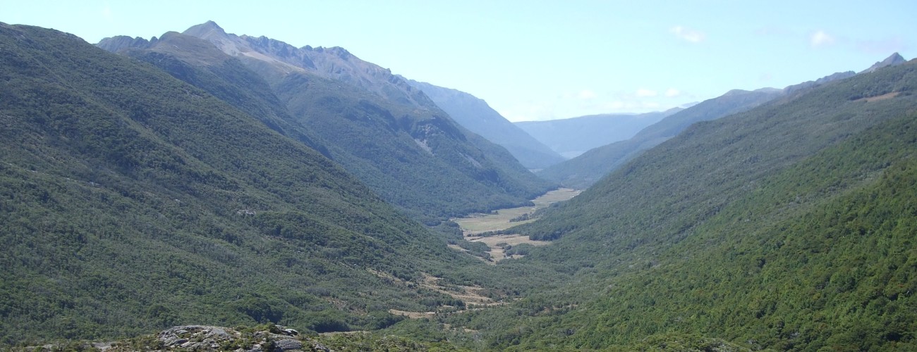
The track follows the grassy river flats on the true right of the Cobb River, which meanders across the valley floor. The beech-clad valley sides rise steeply to the Lockett and Peel Ranges on the eastern and western sides of the valley respectively. The track alternates between beech forest, matagouri scrub and open grasslands.
The walk up the valley is mostly flat, making it relatively easy. Several ancient glacial moraines are crossed along the way, left behind by glaciers that retreated from the valley around 17,000 years ago. The broad Cobb Valley was shaped by repeated glaciation during the Quaternary period, and glacial landforms such as moraines, till deposits and smoothed bedrock can be seen throughout the valley.
About 1 hr 30 min (5.6 km) from the start, you’ll reach Chaffey Hut. The hut is named after Henry Chaffey, who passed through the valley on his way to the Roaring Lion catchment, the next valley to the west. The Basic Hut has the unusual feature of a sloping floor. By the early 2000s, the hut had fallen into a dilapidated state, with the front completely open to the elements. It was rebuilt by the Golden Bay Deerstalkers Association and reopened in August 2012.
Beyond Chaffey Hut, the track crosses Chaffey Stream, climbs over a moraine deposit and continues up the western side of the valley across river flats for 4.5 km to the historic Cobb Tent Camp. At this point, the track re-enters the forest, which becomes increasingly subalpine in character, with dracophyllum, mossy mountain beech forest and numerous small streams. Cobb Hut is a further kilometre beyond the tent camp.
Cobb Hut provides a more rustic alternative to Fenella Hut if the latter is full. The four-bunk Basic Hut is located among mountain beech forest approximately 10 minutes down-valley from Fenella Hut. Built in the 1940s as part of the Cobb Hydro Scheme, the hut originally stood further down the valley and was relocated to its present site following completion of the dam in the 1950s. A rainfall gauge was once maintained nearby, with observations collected to support investigations into the feasibility of the hydro scheme.
| Cobb Hut | |||
| Hut Type | Standard Hut | Capacity | 4 |
| Bookings | Not required; first in, first served | Elevation | 1020 m |
Fenella Hut is another 30 minutes beyond Cobb Hut. From Cobb Hut, the track climbs alongside one of the headwater tributaries of the Cobb River, passing over ice-smoothed bedrock before ascending into the upper basin where the hut is located. Extensive stone paving and causeways assist passage through the basin’s boggy sections.
Fenella Hut sits above a red tussock meadow and offers spectacular views west to Xenicus Peak and north towards Aorere Peak. The hut is named after Fenella Druce, a mountaineer who was killed in 1977 when the hut she was staying in on Barron Saddle, in Aoraki / Mount Cook National Park, was blown away during severe winds. Fenella Hut is a great base for exploring the various topographical features around the head of Cobb Valley.
| Fenella Hut | |||
| Hut Type | Serviced Hut | Capacity | 12 |
| Bookings | Required | Elevation | 1100 m |
Lake Cobb and Round Lake
The saddle separating the Cobb Valley from the Burgoo Stream catchment is notable for its extensive ice-smoothed rock outcrops, which form distinctive north–south ridges across the landscape. A track leads from Fenella Hut to a small tarn on the saddle before traversing these glacially sculpted rock formations and descending through beech forest to the shores of Lake Cobb, which was formed when a large moraine left behind by a retreating glacier dammed the valley outlet. In 1948, during development of the Cobb Hydro Scheme, a small dam made of tree trunks and stone was constructed at the lake outlet, raising the level of the natural lake and increasing storage within the catchment. Water stored in the lake could then be released as required to supplement flows to the Cobb Reservoir downstream. The dam was blasted open in 1955.
The craggy bluffs of Xenicus Peak, named after the genus of the New Zealand rock wren (Xenicus), rise steeply above the northern side of the lake. The track follows the southern shoreline before continuing beyond the head of the lake and climbing steeply into the cirque that contains Round Lake. From here, experienced trampers can make an unmarked ascent of Mt Gibbs (1645 m), whose summit offers expansive views of Aorere Peak, Island Lake and the surrounding mountains. Like Lake Cobb, Round Lake was also dammed for then hydro scheme, and due to its more difficult location, only stone and peat were used.
Beyond Lake Cobb, the route is not a circuit, so you will need to return the same way.
Waingaro Peak
A marked route climbs the eastern side of the valley, beginning a short distance beyond Fenella Hut. The route ascends through beech forest before emerging above the bushline and continuing via marked poles to a saddle on the Douglas Range. From here, it is a straightforward climb along the ridge, following cairns to the summit of Waingaro Peak (1604 m).
Kakapo Peak (1783 m) lies a further 3 km northeast along the range. While achievable as a side trip, it is a significantly more demanding undertaking and requires a substantial weather window for an out-and-back journey. The Douglas Range also continues southwest from the saddle, eventually providing access to Lonely Lake Hut and Adelaide Tarn Hut.
The Cobb Valley is a mountainous environment. You should always be prepared for wet and freezing conditions. See the Mountain Safety Council website for useful information on preparing for the outdoors.
Sources and further reading
1. Blair, A. K. (1994). The Cobb: The History of Cobb River Hydro-Electric Power Scheme.
2. Shulmeister, J., McKay, R., Singer, C., & McLea, W. (2001). Glacial Geology of the Cobb Valley, Northwest Nelson. New Zealand Journal of Geology and Geophysics, 44(1), 47–54.