Boulder Bank Route
Boulder Bank Scenic Reserve
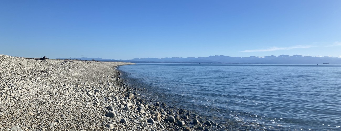
The Boulder Bank / Te Taero a Kereopa is a rare 13 km-long boulder spit that separates Nelson Haven from Tasman Bay. As there is no official track, Boulder Bank is best enjoyed as an out-and-back walk of whatever length suits your ability and interest.
| Details | |
| Length | 7.2 km one way Boulder Bank Dr to lighthouse; 3.1 km one way Boulder Bank Dr to the Glen |
| Time Required | Allow 45 min for a short walk; 3-4 hr one way Boulder Bank Dr to lighthouse |
| Trail Type | Unformed route |
| Physical Difficulty | Moderate |
| Uses | Walking |
| Seasonal Restriction | From 15 Aug to end of Feb, dogs are prohibited from the western 4 km of the Boulder Bank to protect nesting shorebirds. |
Boulder Bank Route does not connect to any other official tracks.
10 min from central Nelson
The Boulder Bank can be accessed from Boulder Bank Dr, a short drive north of central Nelson. From central Nelson, head north along SH6. Just after passing Marybank, turn left onto Boulder Bank Dr, which bounds the northern edge of Nelson Haven, and follow it to the parking area on the coast.
Alternatively, you can continue further north along SH6 and turn left onto Glen Rd, which leads to the small settlement of The Glen, where there’s also a parking area.
From the car park at the end of Boulder Bank Drive, an unmaintained but obvious worn path, compacted by walkers, heads out along the top of the bank. There is no defined destination, and you can walk as far as you wish before returning the way you came. Most visitors only walk a short distance before turning back, either at a point of their choosing or at one of the driftwood forts that have been built along the bank and provide an informal destination.
To the west, the open waters of Tasman Bay stretch toward D’Urville Island and the western ranges. To the east lies the sheltered inlet of Nelson Haven, with views across to Atawhai and Nelson City. The contrast between the calm harbour and the exposed outer coast is one of the defining features of the walk.
About a kilometre from the car park, reduced foot traffic means the boulders are less compacted and the worn path becomes less distinct. From here, you will need to continue directly across the boulder surface itself. The granite boulders are generally stable and easy to negotiate, though care is required as the uneven footing can be tiring over longer distances.
The Boulder Bank is sparsely vegetated, though hardy coastal plants occur in places and seabirds are commonly seen. Near the southern end, the historic Boulder Bank Lighthouse has stood since 1862 and remains one of New Zealand’s oldest operational lighthouses. The lighthouse is roughly 7.2 km from Boulder Bank Dr.
Be aware that the route is highly exposed. There is no shelter, drinking water or shade along the Boulder Bank, and strong winds can make progress difficult. The uneven boulder surface can also be hard on ankles and knees over longer distances.
Boulder Bank Drive to The Glen
An unofficial but obvious worn path also exists between Boulder Bank Drive and The Glen. This largely follows the upper beach, where walkers have compacted the boulders into a more comfortable route. Unlike the southern section, Nelson Haven has been reclaimed along the inland side of this part of the Boulder Bank. Walking this section is a good option if you have two vehicles available, allowing a one-way trip rather than an out-and-back walk. From The Glen, you can also continue north along the beachfront towards Mackay Bluff (note that you cannot access Cable Bay from here and must return the way you came).
Boulder Bank Formation
The Boulder Bank formed over thousands of years through the action of longshore drift. Hard granodiorite rocks eroded from the base of Mackay Bluff, between The Glen and Cable Bay, have been transported southwest along the coast by waves and currents. Over time, these boulders accumulated to form the remarkable 13 km-long natural barrier that separates Nelson Haven from Tasman Bay.
The relatively sheltered waters of Tasman Bay have played an important role in the Boulder Bank’s formation. With comparatively little wave energy, the boulders have been able to remain largely intact rather than being broken down into smaller stones, gravel, or sand as they would be in a more exposed coastal environment.
At its southern end, The Cut was excavated through the Boulder Bank in 1906 to provide safer access for vessels entering and leaving Port Nelson. Prior to its construction, ships were required to navigate the narrow tidal channel between Haulashore Island and Rocks Road. This route proved hazardous and was responsible for several shipwrecks, including that of the Fifeshire in 1842. The remains of the vessel can still be seen at low tide near the western end of Rocks Road.
Sources and further reading
1. Johnston, M. R. (2001). Nelson Boulder Bank. New Zealand Journal of Geology and Geophysics, 44(1), 79–88.
2. Warren, K. J. (2009). Rolling Stones: Nelson’s Boulder Bank, Its Place in Our History and Hearts.
Boulder Bank Route does not connect to any other official tracks.