Jimmy Lee Creek Circuit is short native bush walk right on the edge of Richmond. The track begins on Hill Street and heads up Jimmy Lee Creek gully, climbing to Grassy Saddle (230 m) halfway up Barnicoat Range, before dropping down into Will’s Gully and returning to Hill Street.
| Details | |
| Length | 2.8 km one way |
| Time Required | 45 min – 1 hr one way |
| Trail Type | Walking track/Tramping track |
| Physical Difficulty | Moderate |
| Uses | Walking and trail running |
| Direction | Either |
| Start Elevation | 50 m (Hill St; either end) |
| Max Elevation | 230 m (Grassy Saddle) |
If any layers fail to load, try clearing your cache and refreshing the page.
Dellside Reserve
Walking, trail running and MTB
Henry Road (Kingsland Forest)
Walking, trail running and MTB

5 min from central Richmond
Jimmy Lee Creek Walkway officially starts on Washbourn Drive, opposite Washbourn Gardens in Richmond, though the more interesting part of it begins on Hill Street. The northern end is just south of the Hill St-Queen St intersection (you’ll see the track heading into the native bush that comes right to the road edge). The southern end is just north of the Hill St-Hart Road intersection (look for the sign reading ‘Dellside Reserve’).
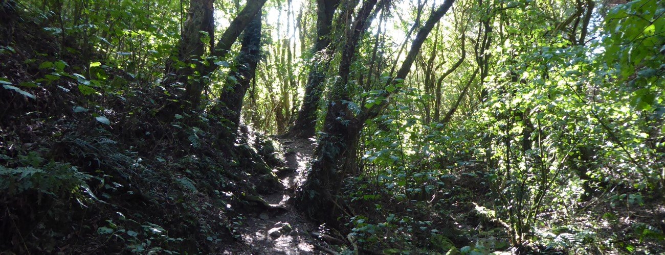
Starting at the northern end from Hill St, the track follows the creek through native bush of Jimmy Lee Creek Reserve, which includes mahoe, putaputaweta and titoki. Native Bird Recovery Richmond has been undertaking pest control in the reserve for more than a decade, which has seen increasing numbers of many native bird species (you will see the information panel at the track start). There is a bird feeding station and viewing platform close to the track start. After 500 m you will reach a kissing gate, after which an alternative loop can be taken on the right. The alternative route climbs higher up the gully side and is a better option when the creek is running high or when the lower gully is wet and muddy. After this point there are several crossings of the usually-small creek.
The track reaches an intersection with Cypress Road (a forestry road that connects to Lodestone Gully) where the alternative loop connects back to the main track. Go up the steps that continue up the gully to a historic dam (which used to supply water to a local farm). Soon after you will reach some mossy wooden markers that signal a left-hand turnoff to a rough scout track that continues up the gully to the top of Barnicoat Range. A little further on the track reaches the edge of Kingsland Forest and climbs steeply to Grassy Saddle (230 m). There is an alternative option just before the forestry, where a slightly longer track on the right zig-zags up to Grassy Saddle at a gentler gradient. There is a picnic table at the saddle, and Henry Road continues uphill (very steeply) through Kingsland Forest to Fowler Road and Richmond Fire Lookout.
From Grassy Saddle the track zig-zags down into Will’s Gully through native tree plantings, and then goes down Fossil Steps and crosses Hart Creek. The track climbs up the side of the gully above the creek and heads straight down to Hill St.
Turn right on Hill St to return to where you started.


Jimmy Lee Creek Circuit is short native bush walk right on the edge of Richmond. The track begins on Hill Street and heads up Jimmy Lee Creek gully, climbing to Grassy Saddle (230 m) halfway up Barnicoat Range, before dropping down into Will’s Gully and returning to Hill Street.
| Details | |
| Length | 2.8 km one way |
| Time Required | 45 min – 1 hr one way |
| Trail Type | Walking track/Tramping track |
| Physical Difficulty | Moderate |
| Uses | Walking and trail running |
| Direction | Either |
| Start Elevation | 50 m (Hill St; either end) |
| Max Elevation | 230 m (Grassy Saddle) |
5 min from central Richmond
Jimmy Lee Creek Walkway officially starts on Washbourn Drive, opposite Washbourn Gardens in Richmond, though the more interesting part of it begins on Hill Street. The northern end is just south of the Hill St-Queen St intersection (you’ll see the track heading into the native bush that comes right to the road edge). The southern end is just north of the Hill St-Hart Road intersection (look for the sign reading ‘Dellside Reserve’).
Starting at the northern end from Hill St, the track follows the creek through native bush of Jimmy Lee Creek Reserve, which includes mahoe, putaputaweta and titoki. Native Bird Recovery Richmond has been undertaking pest control in the reserve for more than a decade, which has seen increasing numbers of many native bird species (you will see the information panel at the track start). There is a bird feeding station and viewing platform close to the track start. After 500 m you will reach a kissing gate, after which an alternative loop can be taken on the right. The alternative route climbs higher up the gully side and is a better option when the creek is running high or when the lower gully is wet and muddy. After this point there are several crossings of the usually-small creek.
The track reaches an intersection with Cypress Road (a forestry road that connects to Lodestone Gully) where the alternative loop connects back to the main track. Go up the steps that continue up the gully to a historic dam (which used to supply water to a local farm). Soon after you will reach some mossy wooden markers that signal a left-hand turnoff to a rough scout track that continues up the gully to the top of Barnicoat Range. A little further on the track reaches the edge of Kingsland Forest and climbs steeply to Grassy Saddle (230 m). There is an alternative option just before the forestry, where a slightly longer track on the right zig-zags up to Grassy Saddle at a gentler gradient. There is a picnic table at the saddle, and Henry Road continues uphill (very steeply) through Kingsland Forest to Fowler Road and Richmond Fire Lookout.
From Grassy Saddle the track zig-zags down into Will’s Gully through native tree plantings, and then goes down Fossil Steps and crosses Hart Creek. The track climbs up the side of the gully above the creek and heads straight down to Hill St.
Turn right on Hill St to return to where you started.
Dellside Reserve
Walking, trail running and MTB
Henry Road (Kingsland Forest)
Walking, trail running and MTB
Updated 18 February 2019