Hacket Track follows Hacket Creek through the Dun Mountain Mineral Belt and gives access to Whispering Falls, historic chromite mines and tramping tracks deeper in Mt Richmond Forest Park. It’s a great option as a short walk or easy overnight tramp, with Hacket Hut and Browning Hut being the second and third closest huts to Nelson respectively. Hacket Track, Hacket Hut and Hacket Creek are named after Thomas Ridge Hacket (1830-84), a Nelson geologist who was the director of Dun Mountain Mining Company for a time, and also owned land in nearby Serpentine Valley.
| Details | |
| Length | 7.7 km return to Whispering Falls; 5.8 km one way to Hacket Hut; 8.1 km one way to Browning Hut |
| Time Required | 2 hr 15 min return to Whispering Falls; 2 hr one way to Hacket Hut; 3 hr one way to Browning Hut |
| Trail Type | Gravel road/Tramping track |
| Physical Difficulty | Moderate |
| Uses | Walking, trail running and MTB |
| Direction | Either |
| Start Elevation | 120 m (Hacket car park) |
| Max Elevation | 220 m (Whispering Falls) or 270 m (Hacket Hut) |
If any layers fail to load, try clearing your cache and refreshing the page.

30 min from Nelson
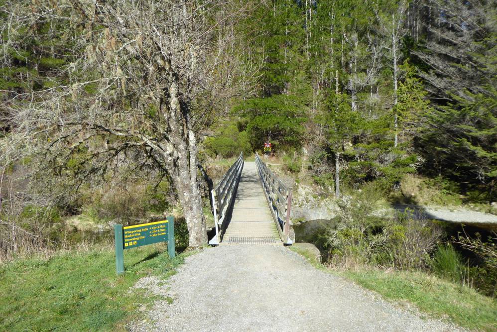
Hacket Track begins at Hacket car park, in Aniseed Valley. From Richmond, head south along State Highway 6 and turn left onto Aniseed Valley Rd. Follow the road over Aniseed Hill, and then for a further 8 km up Aniseed Valley, until you see the DOC sign indicating the turnoff to the car park on the right. There are toilets at the car park and a bridge across Roding River, beneath which there is a great swimming hole to cool off in during summer. At the car park bridge you will find an information panel with a map and track details.

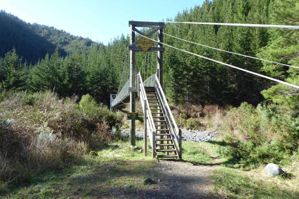
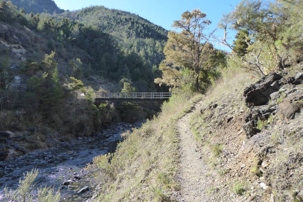
Hacket Track bridges Roding River at the car park and heads east up Hacket Valley, following the true right of Hacket Creek through pine forest. A suspension bridge crosses the creek and the road becomes a walking track, continuing on the true left through native bush and crossing into Mt Richmond Forest Park.
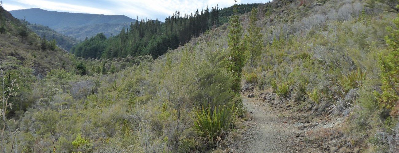
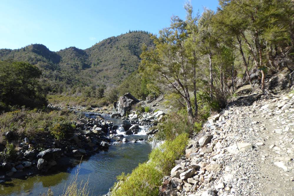
From here until the Whispering Falls turnoff, the valley narrows and the track sidles the steep slope above the creek. Erosion is a serious issue along here; in places the creek has undercut the bank beneath the track, causing it to fall away to the creekbed a few metres below. Some parts are very narrow and there are limited places to go if you need pass others, so proceed with caution. The western end of Old Chrome Road Circuit connects here (see next tab). A few hundred metres further on, the track crosses into the Dun Mountain Mineral Belt, where the surrounding vegetation becomes stunted and outcrops of ultramafic rock (namely dunite, rodingite and serpentinite) jut out from the hillside above the track. The track negotiates an active slip just before the turnoff to Whispering Falls.
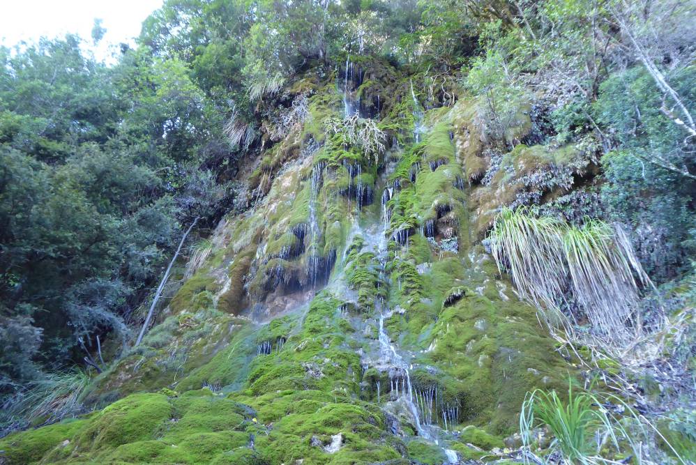
The track to Whispering Falls branches off to the left of Hacket Track and crosses Hacket Creek just above its confluence with Miner Creek. Note that the bridge that once crossed Hacket Creek was washed away in a flood in 2013 and has not been replaced. The creek will likely be impassable following rain. The track continues along the true left of Miner Creek and then bridges it; this roughly marks the geological boundary between the mineral belt and a sedimentary belt named Wooded Peak limestone, which is mainly composed of sandstone. The track climbs up over water-formed travertine terraces and through lush podocarp forest to Whispering Falls. A form of limestone, travertine has precipitated out of an unnamed stream to form a spectacular rock face and moss-covered overhangs, from which numerous trickles of water quietly fall. The falls are particularly spectacular following rain and when soil moisture is high during the colder months. Above the falls is a clearing with a picnic table that has good views across the scrubby hills of the mineral belt and further east to Mt Starveall. Return the way you came to get back to Hacket Track.
Shortly after the Whispering Falls turnoff is another turnoff to the eastern end of Old Chrome Road Circuit. Hacket Track continues along Hacket Creek through mineral belt scrub and a little further enters douglas fir plantation, through which it continues for the rest of the 2.6 km to Hacket Hut. You will reach another fork in track 1 km before the hut, where Browning Track heads left toward Browning Hut (3.1 km away). Browning Track is the main track for trampers who have come from Rocks Hut or Pelorus Valley and are finishing at Hacket car park.
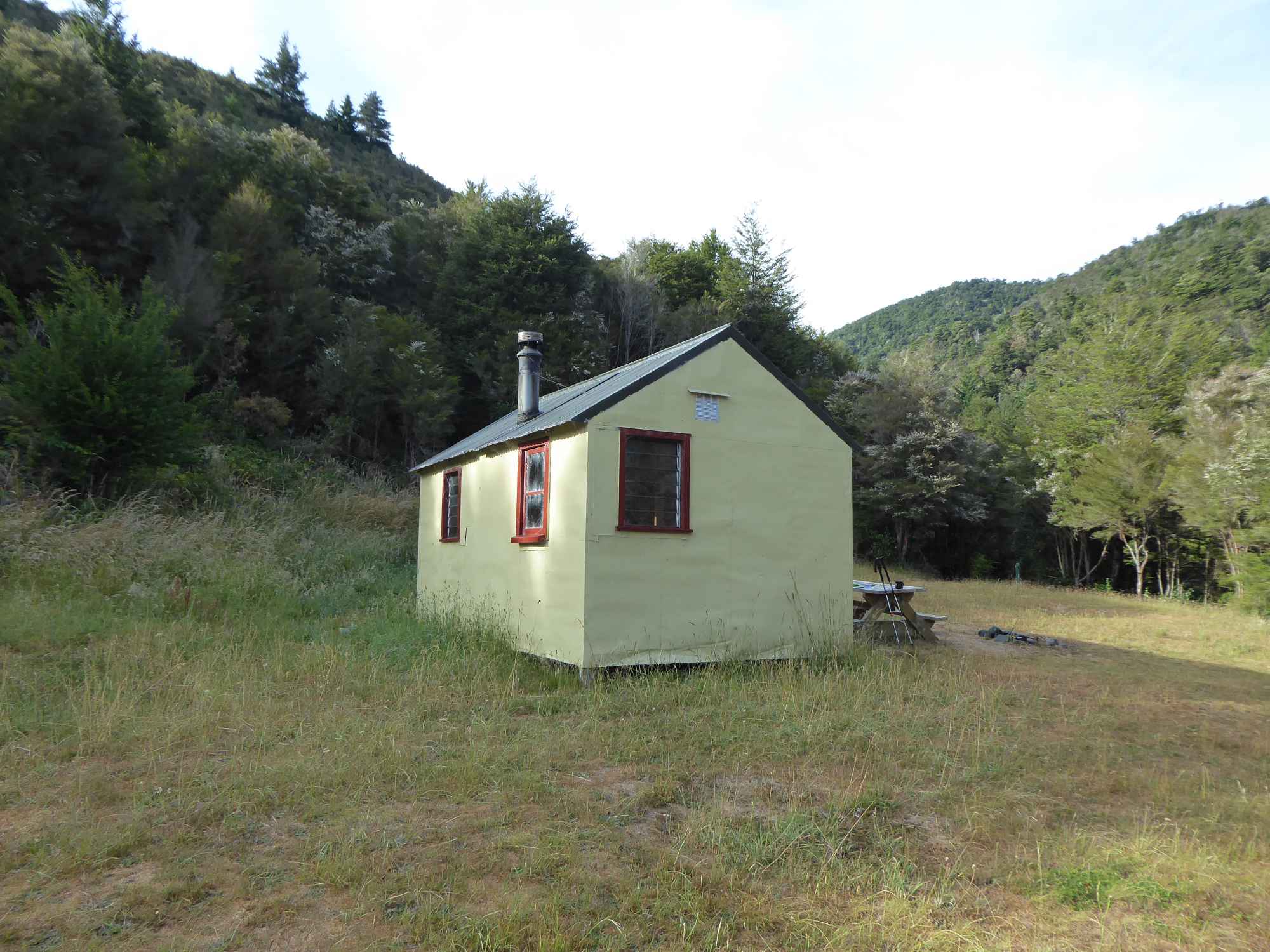
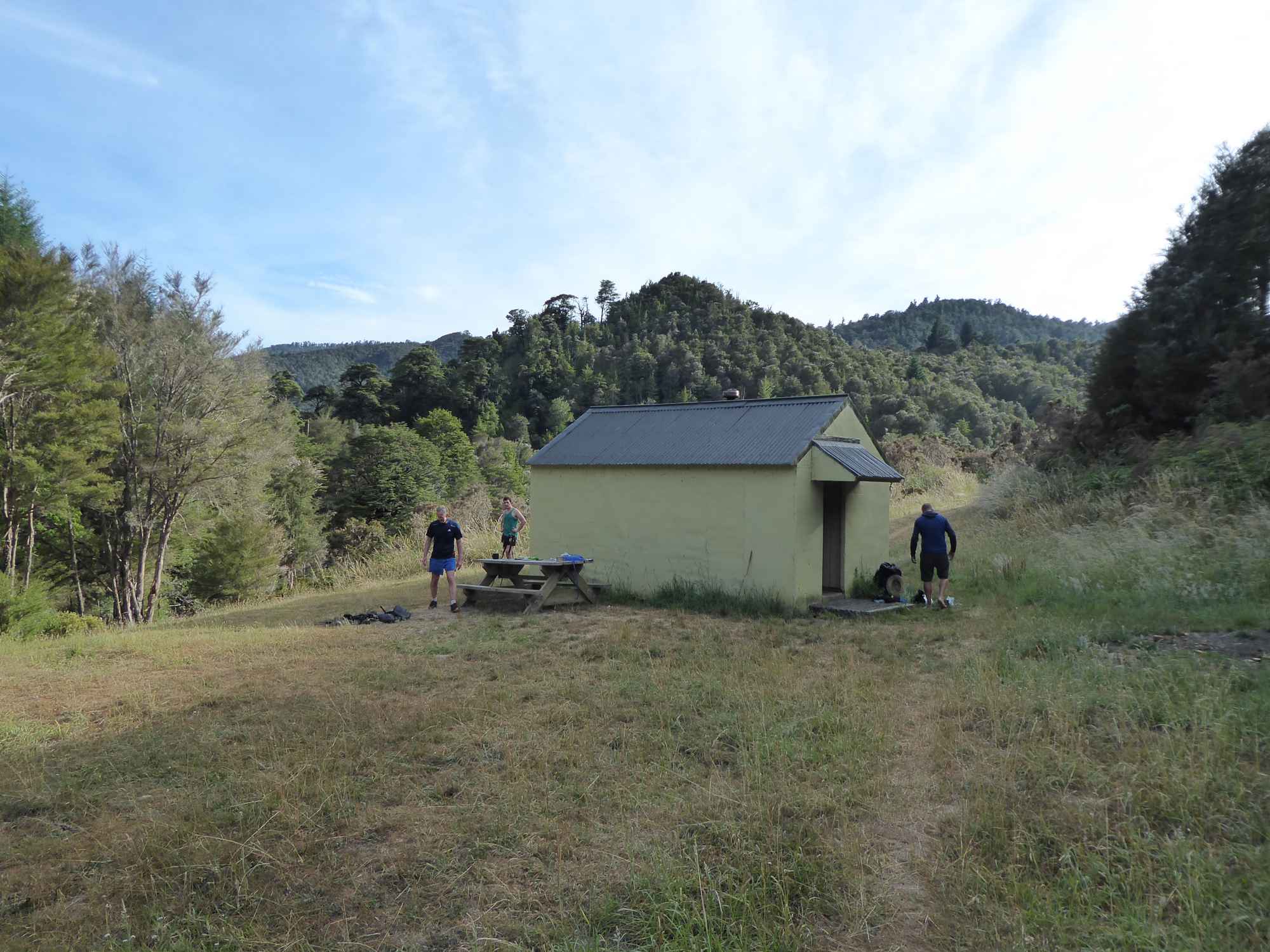
Cross the bridge over Hacket Creek to get to Hacket Hut, which stands in a grassy clearing. The hut has limited capacity, though there is plenty of room for tents outside.
| Hacket Hut | |
| Hut Type | Standard Hut |
| Capacity | 6 bunks |
| Bookings | Not required; first in, first served |
| Fee | 1 Standard Hut Ticket |
| Altitude | 270 m |
Hacket Track ends at the hut clearing. Te Araroa Trail continues east and south from here.
Head east to connect with Browning Track and loop back to Hacket Track (at the fork described in the paragraph above), or continue on to Browning Hut (Browning Track doubles as Te Araroa Track along this section). South of Hacket Hut, Te Araroa Trail continues as a challenging tramping track (known as the Richmond Alpine section), climbing to Starveall Hut (4-5 hrs away). This track has multiple creek crossings and reaches high elevation, and should not be attempted by those without proper preparation and equipment.


Updated 11 August 2020
Hacket Track follows Hacket Creek through the Dun Mountain Mineral Belt and gives access to Whispering Falls, historic chromite mines and tramping tracks deeper in Mt Richmond Forest Park. It’s a great option as a short walk or easy overnight tramp, with Hacket Hut and Browning Hut being the second and third closest huts to Nelson respectively. Hacket Track, Hacket Hut and Hacket Creek are named after Thomas Ridge Hacket (1830-84), a Nelson geologist who was the director of Dun Mountain Mining Company for a time, and also owned land in nearby Serpentine Valley.
| Details | |
| Length | 7.7 km return to Whispering Falls; 5.8 km one way to Hacket Hut; 8.1 km one way to Browning Hut |
| Time Required | 2 hr 15 min return to Whispering Falls; 2 hr one way to Hacket Hut; 3 hr one way to Browning Hut |
| Trail Type | Gravel road/Tramping track |
| Physical Difficulty | Moderate |
| Uses | Walking, trail running and MTB |
| Direction | Either |
| Start Elevation | 120 m (Hacket car park) |
| Max Elevation | 220 m (Whispering Falls) or 270 m (Hacket Hut) |
30 min from Nelson
Hacket Track begins at Hacket car park, in Aniseed Valley. From Richmond, head south along State Highway 6 and turn left onto Aniseed Valley Rd. Follow the road over Aniseed Hill, and then for a further 8 km up Aniseed Valley, until you see the DOC sign indicating the turnoff to the car park on the right. There are toilets at the car park and a bridge across Roding River, beneath which there is a great swimming hole to cool off in during summer. At the car park bridge you will find an information panel with a map and track details.
Hacket Track bridges Roding River at the car park and heads east up Hacket Valley, following the true right of Hacket Creek through pine forest. A suspension bridge crosses the creek and the road becomes a walking track, continuing on the true left through native bush and crossing into Mt Richmond Forest Park.
From here until the Whispering Falls turnoff, the valley narrows and the track sidles the steep slope above the creek. Erosion is a serious issue along here; in places the creek has undercut the bank beneath the track, causing it to fall away to the creekbed a few metres below. Some parts are very narrow and there are limited places to go if you need pass others, so proceed with caution. The western end of Old Chrome Road Circuit connects here (see next tab). A few hundred metres further on, the track crosses into the Dun Mountain Mineral Belt, where the surrounding vegetation becomes stunted and outcrops of ultramafic rock (namely dunite, rodingite and serpentinite) jut out from the hillside above the track. The track negotiates an active slip just before the turnoff to Whispering Falls.
The track to Whispering Falls branches off to the left of Hacket Track and crosses Hacket Creek just above its confluence with Miner Creek. Note that the bridge that once crossed Hacket Creek was washed away in a flood in 2013 and has not been replaced. The creek will likely be impassable following rain. The track continues along the true left of Miner Creek and then bridges it; this roughly marks the geological boundary between the mineral belt and a sedimentary belt named Wooded Peak limestone, which is mainly composed of sandstone. The track climbs up over water-formed travertine terraces and through lush podocarp forest to Whispering Falls. A form of limestone, travertine has precipitated out of an unnamed stream to form a spectacular rock face and moss-covered overhangs, from which numerous trickles of water quietly fall. The falls are particularly spectacular following rain and when soil moisture is high during the colder months. Above the falls is a clearing with a picnic table that has good views across the scrubby hills of the mineral belt and further east to Mt Starveall. Return the way you came to get back to Hacket Track.
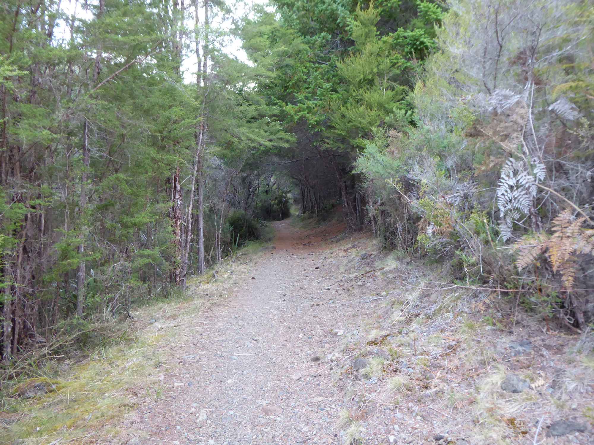
Shortly after the Whispering Falls turnoff is another turnoff to the eastern end of Old Chrome Road Circuit. Hacket Track continues along Hacket Creek through mineral belt scrub and a little further enters douglas fir plantation, through which it continues for the rest of the 2.6 km to Hacket Hut. You will reach another fork in track 1 km before the hut, where Browning Track heads left toward Browning Hut (3.1 km away). Browning Track is the main track for trampers who have come from Rocks Hut or Pelorus Valley and are finishing at Hacket car park.
Cross the bridge over Hacket Creek to get to Hacket Hut, which stands in a grassy clearing. The hut has limited capacity, though there is plenty of room for tents outside.
| Hacket Hut | |
| Hut Type | Standard Hut |
| Capacity | 6 bunks |
| Bookings | Not required; first in, first served |
| Fee | 1 Standard Hut Ticket |
| Altitude | 270 m |
Hacket Track ends at the hut clearing. Te Araroa Trail continues east and south from here.
Head east to connect with Browning Track and loop back to Hacket Track (at the fork described in the paragraph above), or continue on to Browning Hut (Browning Track doubles as Te Araroa Track along this section). South of Hacket Hut, Te Araroa Trail continues as a challenging tramping track (known as the Richmond Alpine section), climbing to Starveall Hut (4-5 hrs away). This track has multiple creek crossings and reaches high elevation, and should not be attempted by those without proper preparation and equipment.
Old Chrome Road is a historic road constructed to transport ore from the chromite mines situated just off Hacket Track. The circuit branches off Hacket Track and climbs to the chromite mining area, then traces the road to Serpentine Saddle.
| Details | |
| Length | 9 km return from Hacket car park; 3.7 km circuit back to Hacket Track |
| Trail Type | Tramping track |
| Physical Difficulty | Moderate |
| Uses | Walking |
| Direction | Either |
| Max Elevation | 400 m (Serpentine Saddle) |
If any layers fail to load, try clearing your cache and refreshing the page.
Aside from Hacket Track, this circuit does not connect to any other official tracks.
30 min from Nelson
Hacket Track begins at Hacket car park, in the Aniseed Valley. From Richmond, head south along State Highway 6 and turn left onto Aniseed Valley Rd. Follow the road over Aniseed Hill, and then for a further 8 km up Aniseed Valley, until you see the DOC sign indicating the turnoff to the car park on the right. There are toilets at the car park and a bridge across Roding River, beneath which there is a great swimming hole to cool off in during summer. At the car park bridge you will find an information panel with a map and track details.
Old Chrome Road Circuit is a loop track beginning and ending on Hacket Track. Therefore it is only accessible via Hacket Track.
Hacket Track bridges Roding River at the car park and heads east up Hacket Valley, following the true right of Hacket Creek through pine forest. A suspension bridge crosses the creek and the road becomes a walking track, continuing on the true left through native bush and crossing into Mt Richmond Forest Park.
From here until the Whispering Falls turnoff, the valley narrows and the track sidles the steep slope above the creek. Erosion is a serious issue along here; in places the creek has undercut the bank beneath the track, causing it to fall away to the creekbed a few metres below. Some parts are very narrow and there are limited places to go if you need pass others, so proceed with caution. The western end of Old Chrome Road Circuit connects here (see next tab). A few hundred metres further on, the track crosses into the Dun Mountain Mineral Belt, where the surrounding vegetation becomes stunted and outcrops of ultramafic rock (namely dunite, rodingite and serpentinite) jut out from the hillside above the track. The track negotiates an active slip just before the turnoff to Whispering Falls.
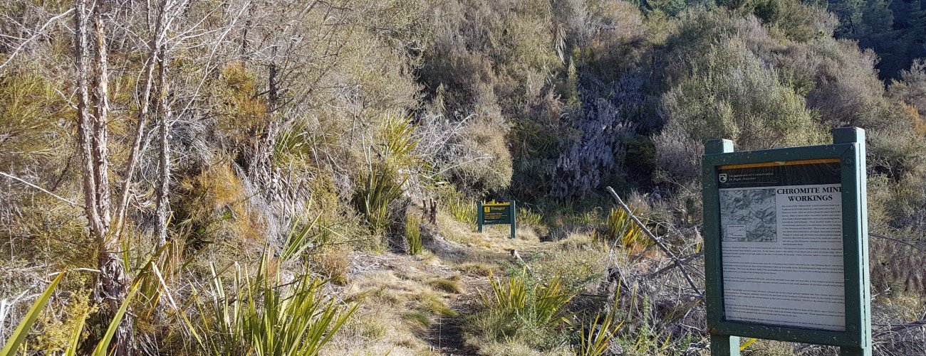
Almost immediately after the turnoff to Whispering Falls, Old Chrome Road Circuit branches off to the right. The rocky track heads up Chromite Creek Gully, through mineral belt scrub and wilding pines. The mining area is 1 km up the track, and consists of spoil piles, shallow open trenches and drives, most of which have long-since collapsed. There is at least one surviving drive that you can enter (at your own risk). Some of these mines are home to cave wētā, which have been known to leap on you when you shine a torch on them. The drives and trenches were constructed in the 1860s to extract chromite, though the small mineral resource meant they were never very profitable, and when the chromium price dropped due to the collapse of the cotton trade, production ceased. You can return the way you came back to Hacket Track, or continue upwards onto Old Chrome Road.
Old Chrome Road begins above the mines reaching the head of the gully and contouring the hillside high above Hacket Creek. The road, now just a rough track, was built in the 1860s to service the chromite mines, and the stacked rock of the road formation can still be seen on the track edge in places. The road reaches Serpentine Saddle (400 m elevation) 1.7 km beyond the mines. Old Chrome Road drops steeply west into Serpentine Valley through private land; it is thought that this route to the mines was chosen over the route Hacket Track follows to minimise the number of crossings of Roding River and Hacket Creek.
From Serpentine Saddle, the track descends through pine and scrub, dropping steeply into Hacket Creek valley and rejoining Hacket Track about 1 km upstream of the suspension bridge.


Old Chrome Road is a historic road constructed to transport ore from the chromite mines situated just off Hacket Track. The circuit branches off Hacket Track and climbs to the chromite mining area, then traces the road to Serpentine Saddle.
| Details | |
| Length | 9 km return from Hacket car park; 3.7 km circuit back to Hacket Track |
| Trail Type | Tramping track |
| Physical Difficulty | Moderate |
| Uses | Walking |
| Direction | Either |
| Max Elevation | 400 m (Serpentine Saddle) |
30 min from Nelson
Hacket Track begins at Hacket car park, in the Aniseed Valley. From Richmond, head south along State Highway 6 and turn left onto Aniseed Valley Rd. Follow the road over Aniseed Hill, and then for a further 8 km up Aniseed Valley, until you see the DOC sign indicating the turnoff to the car park on the right. There are toilets at the car park and a bridge across Roding River, beneath which there is a great swimming hole to cool off in during summer. At the car park bridge you will find an information panel with a map and track details.
Old Chrome Road Circuit is a loop track beginning and ending on Hacket Track. Therefore it is only accessible via Hacket Track.
Hacket Track bridges Roding River at the car park and heads east up Hacket Valley, following the true right of Hacket Creek through pine forest. A suspension bridge crosses the creek and the road becomes a walking track, continuing on the true left through native bush and crossing into Mt Richmond Forest Park.
From here until the Whispering Falls turnoff, the valley narrows and the track sidles the steep slope above the creek. Erosion is a serious issue along here; in places the creek has undercut the bank beneath the track, causing it to fall away to the creekbed a few metres below. Some parts are very narrow and there are limited places to go if you need pass others, so proceed with caution. The western end of Old Chrome Road Circuit connects here (see next tab). A few hundred metres further on, the track crosses into the Dun Mountain Mineral Belt, where the surrounding vegetation becomes stunted and outcrops of ultramafic rock (namely dunite, rodingite and serpentinite) jut out from the hillside above the track. The track negotiates an active slip just before the turnoff to Whispering Falls.
Almost immediately after the turnoff to Whispering Falls, Old Chrome Road Circuit branches off to the right. The rocky track heads up Chromite Creek Gully, through mineral belt scrub and wilding pines. The mining area is 1 km up the track, and consists of spoil piles, shallow open trenches and drives, most of which have long-since collapsed. There is at least one surviving drive that you can enter (at your own risk). Some of these mines are home to cave wētā, which have been known to leap on you when you shine a torch on them. The drives and trenches were constructed in the 1860s to extract chromite, though the small mineral resource meant they were never very profitable, and when the chromium price dropped due to the collapse of the cotton trade, production ceased. You can return the way you came back to Hacket Track, or continue upwards onto Old Chrome Road.
Old Chrome Road begins above the mines reaching the head of the gully and contouring the hillside high above Hacket Creek. The road, now just a rough track, was built in the 1860s to service the chromite mines, and the stacked rock of the road formation can still be seen on the track edge in places. The road reaches Serpentine Saddle (400 m elevation) 1.7 km beyond the mines. Old Chrome Road drops steeply west into Serpentine Valley through private land; it is thought that this route to the mines was chosen over the route Hacket Track follows to minimise the number of crossings of Roding River and Hacket Creek.
From Serpentine Saddle, the track descends through pine and scrub, dropping steeply into Hacket Creek valley and rejoining Hacket Track about 1 km upstream of the suspension bridge.
Aside from Hacket Track, this circuit does not connect to any other official tracks.
Updated 11 August 2020