Waikakaho-Cullens Creek Track follows an old gold miners route between Waikakako Valley on the northern side of the Wairau River, and Cullens Creek Valley near Linkwater. The track can be done as a day walk or ridden as an expert-grade MTB route. The track features historic mine shafts and associated mining relics from the late 19th century.
| Details | |
| Distances (from Waikakaho Valley) | 5.6 km to Village Clearing, 6.6 km to Waikakaho Saddle, 13.9 km to Cullen Creek road end |
| Time Required | 2 hr to Village Clearing; 2 hr 20 min to Waikakaho Saddle; 5 hr to Cullen Creek road end |
| Trail Type | Tramping track |
| Physical Difficulty | Moderate |
| Technical Difficulty | Expert |
| Uses | Walking, trail running and MTB |
| Direction | Either for walkers; south to north for MTB |
| Dog Access | Permit required for Mt Richmond Forest Park |
If any layers fail to load, try clearing your cache and refreshing the page.
Waikakaho-Cullens Creek Track does not connect to any other official tracks.
1 hr 45 min (Cullensville end) or 2 hr (Waikakaho end) from Nelson
Waikakaho Valley
Turn onto Kaituna-Tuamarina Rd on the northern side of the Wairau River from either SH6 or SH1. Turn onto Waikakaho Valley Rd and follow it to the end of the road (about 10 km). You will see a DOC sign and a small area for parking.
Cullensville
Turn onto Cullensville Rd from Queen Charlotte Drive at just west of Linkwater. There is a small parking area at the road end.
One way trips will require transport at the opposite end. Note it is 57 km between the respective road ends.
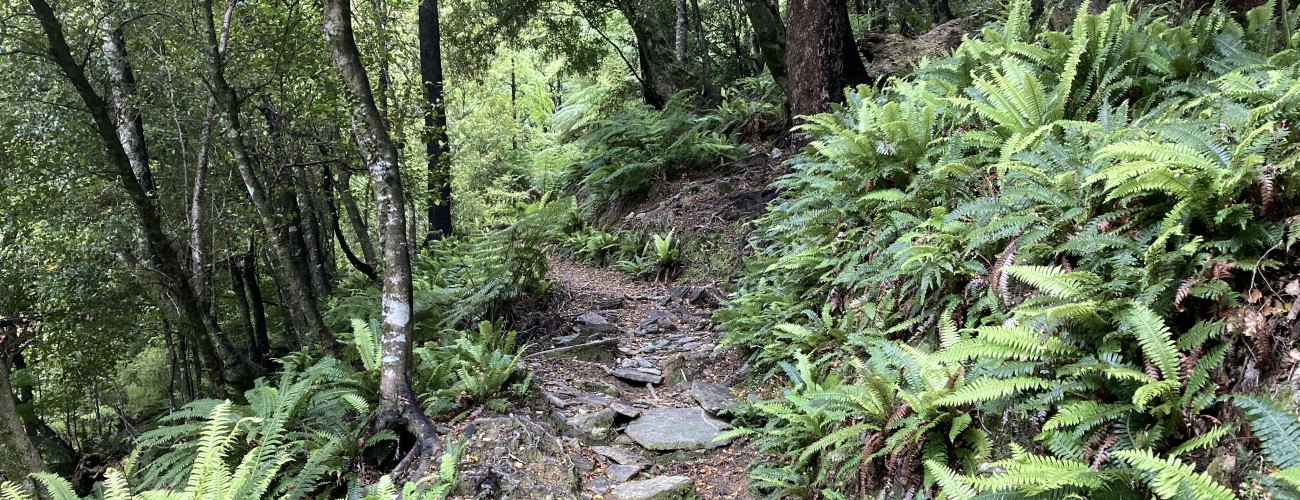
The first 2.5 km follows a farm road through private farmland. After crossing the Waikakaho River, the track enters Mt Richmond Forest Park and begins climbing a spur through kanuka scrub. The track is smooth though the clay surface can be slippery when wet. As you gain elevation the vegetation gradually transitions to mature beech-kamahi, and impressive semi-schist outcrops just out from the hillslope. You will reach Village Clearing, which is a small clearing with a few remnants of the 1890s mining era, including a stone chimney and hut foundations. Just before the clearing a short side track leads to Southern Cross Mine level three. The shaft is unsupported, often flooded and potentially dangerous, so entry is not advised. Five minutes above the clearing another side track leads to the upper level of Southern Cross Mine. As above, the shaft should not be entered.
Continue climbing for 30 min to reach Waikakaho Saddle. If you need to turn back to the Waikakaho Valley, this is the logical place to do so. A short side track leads to a lookout that gives views over Waikakaho Valley.
The track grade becomes rougher as it descends into the headwaters of Cullens Creek. You’ll reach a clearing featuring the remains of a mining-era hut, after which the track descends a spur through a corridor of pine forest. A private hut is a short detour off the main track and nearby are remnants of the village that once stood. The track then descends steeply and crosses Prospector Creek, and on the other side sidles above the creek where steep rocks walls were carved out by the miners. The track descends and crosses Cullen Creek to the road end and the site of the former mining town, Cullensville.


Waikakaho-Cullens Creek Track follows an old gold miners route between Waikakako Valley on the northern side of the Wairau River, and Cullens Creek Valley near Linkwater. The track can be done as a day walk or ridden as an expert-grade MTB route. The track features historic mine shafts and associated mining relics from the late 19th century.
| Details | |
| Distances (from Waikakaho Valley) | 5.6 km to Village Clearing, 6.6 km to Waikakaho Saddle, 13.9 km to Cullen Creek road end |
| Time Required | 2 hr to Village Clearing; 2 hr 20 min to Waikakaho Saddle; 5 hr to Cullen Creek road end |
| Trail Type | Tramping track |
| Physical Difficulty | Moderate |
| Technical Difficulty | Expert |
| Uses | Walking, trail running and MTB |
| Direction | Either for walkers; south to north for MTB |
| Dog Access | Permit required for Mt Richmond Forest Park |
1 hr 45 min (Cullensville end) or 2 hr (Waikakaho end) from Nelson
Turn onto Kaituna-Tuamarina Rd on the northern side of the Wairau River from either SH6 or SH1. Turn onto Waikakaho Valley Rd and follow it to the end of the road (about 10 km). You will see a DOC sign and a small area for parking.
Turn onto Cullensville Rd from Queen Charlotte Drive at just west of Linkwater. There is a small parking area at the road end.
One way trips will require transport at the opposite end. Note it is 57 km between the respective road ends.
The first 2.5 km follows a farm road through private farmland. After crossing the Waikakaho River, the track enters Mt Richmond Forest Park and begins climbing a spur through kanuka scrub. The track is smooth though the clay surface can be slippery when wet. As you gain elevation the vegetation gradually transitions to mature beech-kamahi, and impressive semi-schist outcrops just out from the hillslope. You will reach Village Clearing, which is a small clearing with a few remnants of the 1890s mining era, including a stone chimney and hut foundations. Just before the clearing a short side track leads to Southern Cross Mine level three. The shaft is unsupported, often flooded and potentially dangerous, so entry is not advised. Five minutes above the clearing another side track leads to the upper level of Southern Cross Mine. As above, the shaft should not be entered.
Continue climbing for 30 min to reach Waikakaho Saddle. If you need to turn back to the Waikakaho Valley, this is the logical place to do so. A short side track leads to a lookout that gives views over Waikakaho Valley.
The track grade becomes rougher as it descends into the headwaters of Cullens Creek. You’ll reach a clearing featuring the remains of a mining-era hut, after which the track descends a spur through a corridor of pine forest. A private hut is a short detour off the main track and nearby are remnants of the village that once stood. The track then descends steeply and crosses Prospector Creek, and on the other side sidles above the creek where steep rocks walls were carved out by the miners. The track descends and crosses Cullen Creek to the road end and the site of the former mining town, Cullensville.
Waikakaho-Cullens Creek Track does not connect to any other official tracks.
Updated 2 December 2021