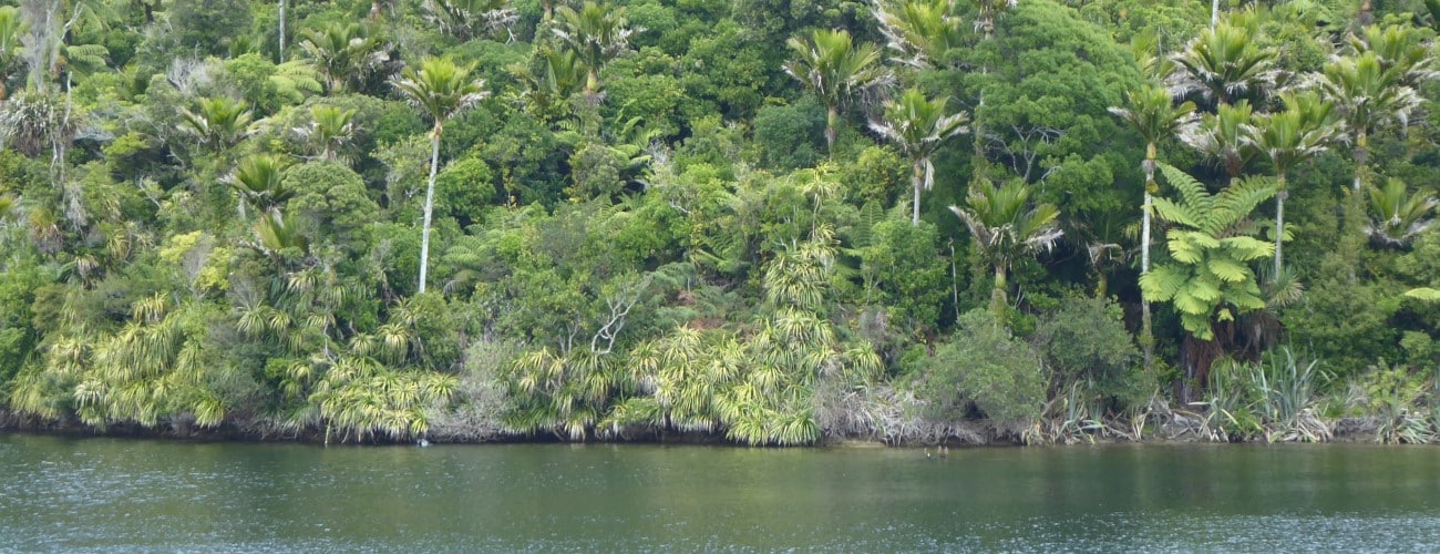
Kaihoka Lakes are a pair of coastal lakes in the far northwest of Golden Bay. A short walking track runs alongside the lakes through lush nikau forest.
| Details | |
| Length | 1.2 km return |
| Time Required | 20 min return |
| Trail Type | Walking track |
| Physical Difficulty | Easy |
| Uses | Walking |
| Direction | Return (out and back) |
If any layers fail to load, try clearing your cache and refreshing the page.
Kaihoka Lakes Track does not connect to any other tracks.
50 min from Takaka
From Takaka, head north along State Highway 60 to Collingwood, which is where State Highway 60 ends. Continue north along Collingwood-Puponga Main Rd to Pakawau and turn left onto Pakawau Bush Rd, which turns to gravel as it reaches Whanganui Inlet. Turn right onto Kaihoka Lakes Rd, and follow it for 6 km until you see Kaihoka Lakes Scenic Reserve on the right. There is a small parking area and toilet next to the first lake.
The track heads above the edge of the first lake through thick nikau and ferns. It continues in a more or less straight line to the edge of the second lake, where it ends. Here you will need to turn around to return the way you came. Do not try to get to the coast as the land surrounding the track is private.
The respective Maori names of the eastern and western lakes are Tinawhu and Whupa. Neither lake has permanent inflows or outflows, meaning their levels are controlled by rainfall, seepage and evaporation. They are relatively young, having formed as sand dunes migrated eastward from the coast. This process created basins that lacked a drainage path to the coast. Over time, water accumulated, transforming the basins into a swamps, and then lakes.


Kaihoka Lakes are a pair of coastal lakes in the far northwest of Golden Bay. A short walking track runs alongside the lakes through lush nikau forest.
| Details | |
| Length | 1.2 km return |
| Time Required | 20 min return |
| Trail Type | Walking track |
| Physical Difficulty | Easy |
| Uses | Walking |
| Direction | Return (out and back) |
50 min from Takaka
From Takaka, head north along State Highway 60 to Collingwood, which is where State Highway 60 ends. Continue north along Collingwood-Puponga Main Rd to Pakawau and turn left onto Pakawau Bush Rd, which turns to gravel as it reaches Whanganui Inlet. Turn right onto Kaihoka Lakes Rd, and follow it for 6 km until you see Kaihoka Lakes Scenic Reserve on the right. There is a small parking area and toilet next to the first lake.
The track heads above the edge of the first lake through thick nikau and ferns. It continues in a more or less straight line to the edge of the second lake, where it ends. Here you will need to turn around to return the way you came. Do not try to get to the coast as the land surrounding the track is private.
The respective Maori names of the eastern and western lakes are Tinawhu and Whupa. Neither lake has permanent inflows or outflows, meaning their levels are controlled by rainfall, seepage and evaporation. They are relatively young, having formed as sand dunes migrated eastward from the coast. This process created basins that lacked a drainage path to the coast. Over time, water accumulated, transforming the basins into a swamps, and then lakes.
Kaihoka Lakes Track does not connect to any other tracks.
Updated 16 August 2020