Red Hills Hut is the southernmost hut on the Mt Richmond section of the Te Araroa Trail and is located on the edge of the Dun Mountain Mineral Belt, a spectacular tree-less area of mineral-rich ultramafic geology. Being on the Maitland Ridge MTB circuit, it is also accessible by bike.
| Details | |
| Distance | 7 km one way to hut from Six Mile car park; 11.5 km one way from Porters Creek Hut |
| Time Required | 1 hr 30 min one way to hut from Six Mile car park; 4 hr one way from Porters Creek Hut |
| Trail Type | Shared track/4WD track |
| Physical Difficulty | Moderate |
| Technical Difficulty | Intermediate |
| Uses | Walking, trail running and MTB |
| Direction | Either |
| Start Elevation | 560 m (Six Mile car park) |
| FinishElevation | 910 m (Red Hills Hut) |
| Dog Access | Permit required for Mt Richmond Forest Park; see local DOC office |
If any layers fail to load, try clearing your cache and refreshing the page.
This elevation profile should be considered approximate. Its accuracy is determined by the quality of data available.
1 hr 5 min from Nelson
From Nelson, head south along SH6 and turn left at Belgrove onto Wai-iti Valley Rd. Continue all the way to the junction with SH63, where you will turn left and continue over Wairau Pass for 4 km. About 2 min past the Rainbow Skifield turnoff you will see a DOC sign indicating a car park on the left (just before the one way bridge). This is known as Six Mile car park.
Red Hills Hut is accessed via Red Hills Track, which is open to both trampers and mountain bikers.
The Red Hills Track begins off as a shared track through beech forest. The track is mainly smooth, though there are some slippery rooty sections and a couple of creek crossings to contend with. In two places the track forks between gentle (easy grade) and steep (advanced grade) sections; you have the option of taking either. After 2 km the track connects to a 4WD road, which climbs at a gentle gradient through kānuka forest.
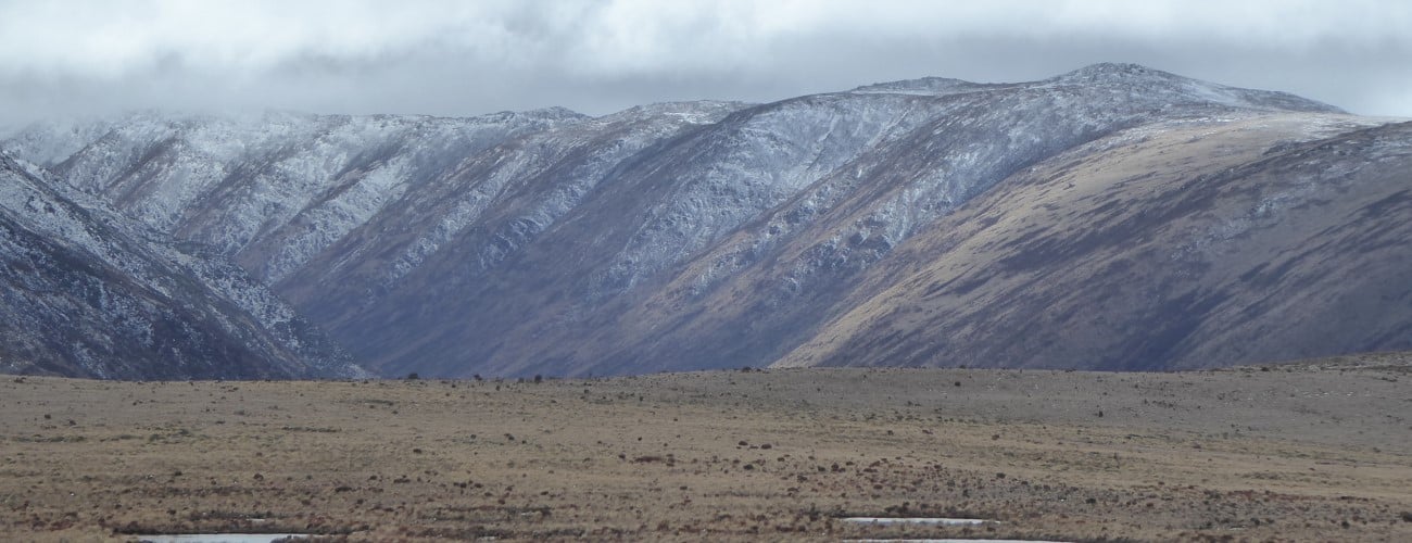
After 6 km you will transition into the mineral belt, where the road becomes noticeably rougher and a little steeper. This is OK if you’re descending, but on the way up you may be forced to walk your bike in a couple of places. You’ll enjoy good views across Wairau Valley to Raglan Range and down Rainbow Valley.
Red Hills Hut is positioned on a saddle overlooking a tussock valley with views towards Gordon’s Knob. Built in 2010, the hut replaced the previous hut which had fallen into a dilapidated state over its 60 year life. The hut gets a good amount of sunlight, though does not have any form of internal heating.
| Red Hills Hut | |
| Hut Type | Standard Hut |
| Capacity | 6 bunks |
| Bookings | Not required; first in, first served |
| Fee | 1 Standard Hut Ticket |
| Altitude | 910 m |
As Red Hills Hut is on the Te Araroa Trail, it can heavily-frequented during the summer months. From the hut, trampers heading south towards St Arnaud will usually continue along Maitland Ridge Track and descend to Tophouse Rd via Beeby’s Knob 4WD road (12.5 km, 4-5 hr). North of here, the next hut along Te Araroa Trail is Porters Creek Hut (11.5 km, 4 hr away). Mountain-bikers doing the Maitland Ridge Circuit will approach the hut from the west and will descend Red Hills Track to Six Mile car park (eventually they will be able to return to the bottom of Beeby’s Knob 4WD Road via a new track the MTB Trails Trust are constructing from Six Mile car park).
The Plateau (4-6 km return, allow 1 hr 30 min)
Above the hut, an area called The Plateau is well worth exploring. From behind the hut an old 4WD track continues for a little bit before petering out to a semi-worn route through tussock. The route climbs gradually up the gently sloping tussock slope, though it can be quite boggy underfoot. Occasional rock cairns mark the way further up. At around pt 1160 m, you will reach the brow of a small ridge that overlooks The Plateau. Here you will enjoy great views across the flat, tarn-speckled plateau and north towards Porters Ridge. You can continue exploring the area; the open tussock allows easy travel in all directions. To return to the hut, it is easiest to the head back the way you came up. Experienced parties can continue onward along Red Hills Ridge, eventually reaching Hunters Hut or Top Wairoa Hut via Maungakura / Red Hill (1791 m).


Red Hills Hut is the southernmost hut on the Mt Richmond section of the Te Araroa Trail and is located on the edge of the Dun Mountain Mineral Belt, a spectacular tree-less area of mineral-rich ultramafic geology. Being on the Maitland Ridge MTB circuit, it is also accessible by bike.
| Details | |
| Distance | 7 km one way to hut from Six Mile car park; 11.5 km one way from Porters Creek Hut |
| Time Required | 1 hr 30 min one way to hut from Six Mile car park; 4 hr one way from Porters Creek Hut |
| Trail Type | Shared track/4WD track |
| Physical Difficulty | Moderate |
| Technical Difficulty | Intermediate |
| Uses | Walking, trail running and MTB |
| Direction | Either |
| Start Elevation | 560 m (Six Mile car park) |
| FinishElevation | 910 m (Red Hills Hut) |
| Dog Access | Permit required for Mt Richmond Forest Park; see local DOC office |
1 hr 5 min from Nelson
From Nelson, head south along SH6 and turn left at Belgrove onto Wai-iti Valley Rd. Continue all the way to the junction with SH63, where you will turn left and continue over Wairau Pass for 4 km. About 2 min past the Rainbow Skifield turnoff you will see a DOC sign indicating a car park on the left (just before the one way bridge). This is known as Six Mile car park.
Red Hills Hut is accessed via Red Hills Track, which is open to both trampers and mountain bikers.
The Red Hills Track begins off as a shared track through beech forest. The track is mainly smooth, though there are some slippery rooty sections and a couple of creek crossings to contend with. In two places the track forks between gentle (easy grade) and steep (advanced grade) sections; you have the option of taking either. After 2 km the track connects to a 4WD road, which climbs at a gentle gradient through kānuka forest.
After 6 km you will transition into the mineral belt, where the road becomes noticeably rougher and a little steeper. This is OK if you’re descending, but on the way up you may be forced to walk your bike in a couple of places. You’ll enjoy good views across Wairau Valley to Raglan Range and down Rainbow Valley.
Red Hills Hut is positioned on a saddle overlooking a tussock valley with views towards Gordon’s Knob. Built in 2010, the hut replaced the previous hut which had fallen into a dilapidated state over its 60 year life. The hut gets a good amount of sunlight, though does not have any form of internal heating.
| Red Hills Hut | |
| Hut Type | Standard Hut |
| Capacity | 6 bunks |
| Bookings | Not required; first in, first served |
| Fee | 1 Standard Hut Ticket |
| Altitude | 910 m |
As Red Hills Hut is on the Te Araroa Trail, it can heavily-frequented during the summer months. From the hut, trampers heading south towards St Arnaud will usually continue along Maitland Ridge Track and descend to Tophouse Rd via Beeby’s Knob 4WD road (12.5 km, 4-5 hr). North of here, the next hut along Te Araroa Trail is Porters Creek Hut (11.5 km, 4 hr away). Mountain-bikers doing the Maitland Ridge Circuit will approach the hut from the west and will descend Red Hills Track to Six Mile car park (eventually they will be able to return to the bottom of Beeby’s Knob 4WD Road via a new track the MTB Trails Trust are constructing from Six Mile car park).
The Plateau (4-6 km return, allow 1 hr 30 min)
Above the hut, an area called The Plateau is well worth exploring. From behind the hut an old 4WD track continues for a little bit before petering out to a semi-worn route through tussock. The route climbs gradually up the gently sloping tussock slope, though it can be quite boggy underfoot. Occasional rock cairns mark the way further up. At around pt 1160 m, you will reach the brow of a small ridge that overlooks The Plateau. Here you will enjoy great views across the flat, tarn-speckled plateau and north towards Porters Ridge. You can continue exploring the area; the open tussock allows easy travel in all directions. To return to the hut, it is easiest to the head back the way you came up. Experienced parties can continue onward along Red Hills Ridge, eventually reaching Hunters Hut or Top Wairoa Hut via Maungakura / Red Hill (1791 m).
Updated 28 August 2020