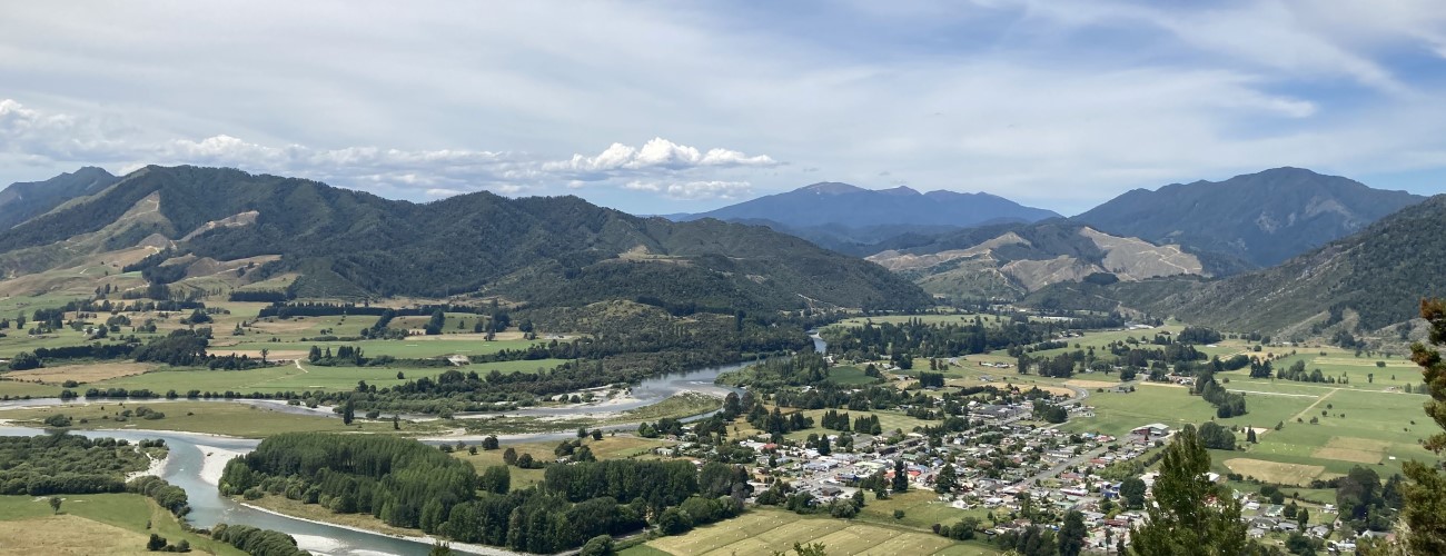
Skyline Walk is a short walk just outside of Murchison. Lookouts at the highest points of the walk provide views across the village and surrounding area.
| Details | |
| Distances | 3.2 km return |
| Time Required | 1 hr 15 min return |
| Trail Type | Walking track |
| Physical Difficulty | Moderate |
| Uses | Walking |
| Direction | Return |
| Start Elevation | 245 m |
| Max Elevation | 460 m |
If any layers fail to load, try clearing your cache and refreshing the page.
Skyline Walk does not connect to any other tracks.
2 min from Murchison
The walkway begins at the car park on the western side of the SH6 Matakitaki River Bridge, just outside of Murchison.
The walkway zig-zags up the hillside at a consistent gradient. The surrounding native bush is mainly regenerating, with remnant beech and a scattering of podocarps towering above. At the top, two lookouts with seats provide views over Murchison and the surrounding ranges and valleys.
Return the way you came.


Skyline Walk is a short walk just outside of Murchison. Lookouts at the highest points of the walk provide views across the village and surrounding area.
| Details | |
| Distances | 3.2 km return |
| Time Required | 1 hr 15 min return |
| Trail Type | Walking track |
| Physical Difficulty | Moderate |
| Uses | Walking |
| Direction | Return |
| Start Elevation | 245 m |
| Max Elevation | 460 m |
2 min from Murchison
The walkway begins at the car park on the western side of the SH6 Matakitaki River Bridge, just outside of Murchison.
The walkway zig-zags up the hillside at a consistent gradient. The surrounding native bush is mainly regenerating, with remnant beech and a scattering of podocarps towering above. At the top, two lookouts with seats provide views over Murchison and the surrounding ranges and valleys.
Return the way you came.
Skyline Walk does not connect to any other tracks.
Updated 17 December 2021