Short Walks
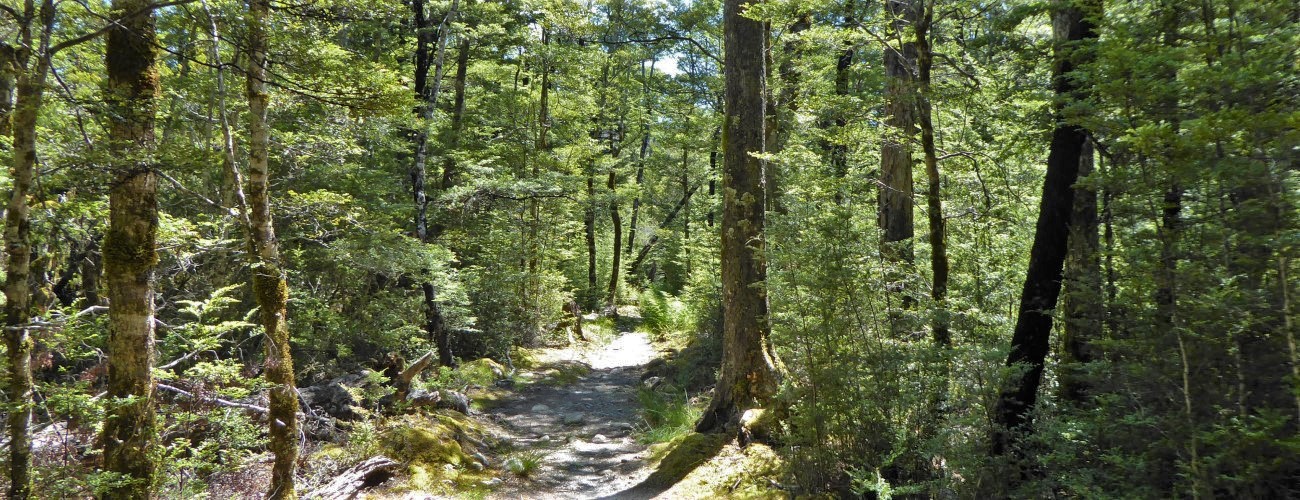
Lake Rotoiti and St Arnaud are considered the gateway to Nelson Lakes National Park. Though the iconic view down the lake from the shore of Kerr Bay is easily recognised, this is only a glimpse of the dramatic landscapes the national park encompasses. Despite this, you don’t have to go far to enjoy the beautiful native bush and spectacular views of the lake and ranges either side. There are multiple tracks beginning at the northern end of the lake that can be done on their own or combined with each other to create loops ranging in duration from very short to half-day.
If any layers fail to load, try clearing your cache and refreshing the page.
Lake Rotoiti Circuit
Walking and trail running
Mt Robert Circuit
Walking and trail running
St Arnaud Range
Walking and trail running
Teetotal-Big Bush Trail Area
Walking, trail running and MTB


1 hr 5 min from Nelson | 1 hr 20 min from Blenheim
Most of Lake Rotoiti’s short walks are accessed from Kerr Bay. From the SH63 in St Arnaud, turn left onto Kerr Bay Road and follow it down to the lake. There is plenty of parking at the lake edge next to the jetties on either side of the bay. At the eastern end next to the DOC campground, you will see a large information board with a map, and times and distances of the various tracks in the area.
West Bay is the other starting point for short walks. Head west along SH63 from St Arnaud and turn left onto Mt Robert Road. Follow the road to the lake edge, where there is a car park and jetty next to the DOC campground.
Nelson Lakes DOC Visitor Centre is located on View Road, St Arnaud. This is a good place to read up on the ecology, geology and history of St Arnaud and Nelson Lakes National Park, as well as check the latest alpine weather forecasts and speak to DOC staff about any warnings in place.
| Length | 300 m | Time Required | 10 min |
| Uses | Walking | Physical Difficulty | Very easy |
The shortest and easiest walk in the national park. A wheelchair-friendly track begins at the eastern end of Kerr Bay, next to the large information panel (this track also doubles as the start of Lakehead Track and St Arnaud Range Track). The track runs parallel to the lakeshore for a short distance, with information panels at regular intervals providing details on some of the native tree and plant species along the way. The track loops round to the left and returns to the car park.
| Length | 1.6 km | Time Required | 45 min |
| Uses | Walking | Physical Difficulty | Easy |
Honeydew Walk branches to the left from Bellbird Walk/Lakehead Track, a short distance from the car park. The short loop track is wide and smooth, and heads through impressive beech forest that is part of the Rotoiti Nature Recovery area. It then drops down to reconnect to Lakehead Track, which you can follow back along the lakeshore to where you started.
| Length | 4.2 km | Time Required | 1 hr 30 min |
| Uses | Walking and trail running | Physical Difficulty | Easy |
Like Bellbird Walk and Honeydew Walk, Loop Track begins at the eastern end of Kerr Bay. Follow Honeydew Walk until the junction where you can turn left follow to St Arnaud Range Track. The track from here is tramping grade and requires more care and attention than Honeydew Walk. The track climbs through red beech forest up old glacial moraine terraces. Just before Borlase Stream, Loop Track branches to the right and sidles the range for a bit, before gradually descending to connect with Lakehead Track. Turn right here and follow Lakehead Track back to the car park where you started.
| Length | 3.7 km one way | Time Required | 1 hr one way |
| Uses | Walking and trail running | Physical Difficulty | Easy |
Brunner Peninsula Track follows the shoreline of Brunner Peninsula, which separates Kerr Bay from West Bay. From the car park at the western end of Kerr Bay, follow the track as it follows a few metres above the lakeshore through beech forest. The track is fairly easy-going, with just a few stones and roots to look out for. In several places there are panels that describe some of the history of the area. Subtle dips in the track mark the location of the Alpine Fault trace, which you’ll cross on the way out from Kerr Bay and again on the way back along West Bay.
The track ends in West Bay next to the jetty and car park. You can return to Kerr Bay via Rotoiti Lodge and the visitor centre by heading back the way you came for a short distance and then turning left at the track junction. Otherwise, continue to the right along Mt Robert Road and then turn right onto Moraine Track, which heads around the northern side of Black Hill and alongside SH63 to St Arnaud.
| Length | 2.7 km one way | Time Required | 1 hr one way |
| Uses | Walking and trail running | Physical Difficulty | Easy |
Moraine Track begins at the junction of Lodge Road and SH63, at the western end of St Arnaud. The track runs parallel to the highway through manuka and kanuka trees, and around the base of Black Hill. On the western side of Black Hill the track crosses over old glacial moraine deposits and kettle ponds formed by Travers Glacier, which occupied the entire valley thousands of years ago and was the reason for Lake Rotoiti’s formation. The track continues across Mt Robert Rd and behind the DOC campground, and connects to Anglers Track next to Buller River.
From here, turn left back along Mt Robert Road toward the West Bay jetty and parking area. You can return to Kerr Bay via Brunner Peninsula Track, or take the shortcut over the peninsula via Rotoiti Lodge and the visitor centre.
| Length | 2 km one way | Time Required | 45 min one way |
| Uses | Walking and trail running | Physical Difficulty | Easy |
Anglers Walk follows the true right of the Buller River from where it exits Lake Rotoiti. The track begins on Mt Robert Road at the bridge across the Buller, which is a short distance from the DOC campground. So-named due to being a handy access track for trout anglers, the track more or less runs parallel to the river through kanuka forest, with a few access points leading down to the river edge. The western end of the track finishes at SH63. From here you’ll need to return the way you came, or else you can cross the highway and follow it around the corner to the right, where there is a connection track through to Skating Pond Loop, which is part of Teetotal-Big Bush trail area.
| Length | 10.9 km return | Time Required | 4 hr return |
| Uses | Walking and trail running | Physical Difficulty | Moderate |
Whisky Falls are accessed via Lakeside Track, which begins on Mt Robert Road, 1.8 km beyond the West Bay jetty. There is a small parking bay opposite the beginning of the track.
Lakeside Track heads along the base of Mt Robert through regenerating manuka and kanuka forest and crosses two scree slopes that drop from the upper slopes above. After 2 km of gradual descent you’ll arrive at the lake edge, which you’ll follow as the surrounding bush transitions to original beech forest. Whisky Falls are a short deviation to the right off the main track. The falls, nearly 40 m in height, are on Whisky Creek, which drains 1st Basin on Robert Ridge. There’s a jetty next to where Whisky Creek enters the lake (allowing the option of travel via water taxi).
Head back the way you came. Alternatively, you can continue along Lakeside Track to Coldwater Hut and then up the eastern side of the lake via Lakehead Track, though this is a full day affair.
Lake Rotoiti and St Arnaud are considered the gateway to Nelson Lakes National Park. Though the iconic view down the lake from the shore of Kerr Bay is easily recognised, this is only a glimpse of the dramatic landscapes the national park encompasses. Despite this, you don’t have to go far to enjoy the beautiful native bush and spectacular views of the lake and ranges either side. There are multiple tracks beginning at the northern end of the lake that can be done on their own or combined with each other to create loops ranging in duration from very short to half-day.
1 hr 5 min from Nelson | 1 hr 20 min from Blenheim
Most of Lake Rotoiti’s short walks are accessed from Kerr Bay. From the SH63 in St Arnaud, turn left onto Kerr Bay Road and follow it down to the lake. There is plenty of parking at the lake edge next to the jetties on either side of the bay. At the eastern end next to the DOC campground, you will see a large information board with a map, and times and distances of the various tracks in the area.
West Bay is the other starting point for short walks. Head west along SH63 from St Arnaud and turn left onto Mt Robert Road. Follow the road to the lake edge, where there is a car park and jetty next to the DOC campground.
Nelson Lakes DOC Visitor Centre is located on View Road, St Arnaud. This is a good place to read up on the ecology, geology and history of St Arnaud and Nelson Lakes National Park, as well as check the latest alpine weather forecasts and speak to DOC staff about any warnings in place.
| Length | 300 m |
| Time Required | 10 min |
| Uses | Walking |
| Physical Difficulty | Very easy |
The shortest and easiest walk in the national park. A wheelchair-friendly track begins at the eastern end of Kerr Bay, next to the large information panel (this track also doubles as the start of Lakehead Track and St Arnaud Range Track). The track runs parallel to the lakeshore for a short distance, with information panels at regular intervals providing details on some of the native tree and plant species along the way. The track loops round to the left and returns to the car park.
| Length | 1.6 km |
| Time Required | 45 min |
| Uses | Walking |
| Physical Difficulty | Easy |
Honeydew Walk branches to the left from Bellbird Walk/Lakehead Track, a short distance from the car park. The short loop track is wide and smooth, and heads through impressive beech forest that is part of the Rotoiti Nature Recovery area. It then drops down to reconnect to Lakehead Track, which you can follow back along the lakeshore to where you started.
| Length | 4.2 km |
| Time Required | 1 hr 30 min |
| Uses | Walking and trail running |
| Physical Difficulty | Easy |
Like Bellbird Walk and Honeydew Walk, Loop Track begins at the eastern end of Kerr Bay. Follow Honeydew Walk until the junction where you can turn left to follow St Arnaud Range Track. The track from here is tramping grade and requires more care and attention than Honeydew Walk. The track climbs through red beech forest up old glacial moraine terraces. Just before Borlase Stream, Loop Track branches to the right and sidles the range for a bit, before gradually descending to connect with Lakehead Track. Turn right here and follow Lakehead Track back to the car park where you started.
| Length | 3.7 km one way |
| Time Required | 1 hr one way |
| Uses | Walking and trail running |
| Physical Difficulty | Easy |
Brunner Peninsula Track follows the shoreline of Brunner Peninsula, which separates Kerr Bay from West Bay. From the car park at the western end of Kerr Bay, follow the track as it follows a few metres above the lakeshore through beech forest. The track is fairly easy-going, with just a few stones and roots to look out for. In several places there are panels that describe some of the history of the area. Subtle dips in the track mark the location of the Alpine Fault trace, which you’ll cross on the way out from Kerr Bay and again on the way back along West Bay.
The track ends in West Bay next to the jetty and car park. You can return to Kerr Bay via Rotoiti Lodge and the visitor centre by heading back the way you came for a short distance and then turning left at the track junction. Otherwise, continue to the right along Mt Robert Road and then turn right onto Moraine Track, which heads around the northern side of Black Hill and alongside SH63 to St Arnaud.
| Length | 2.7 km one way |
| Time Required | 1 hr one way |
| Uses | Walking and trail running |
| Physical Difficulty | Easy |
Moraine Track begins at the junction of Lodge Road and SH63, at the western end of St Arnaud. The track runs parallel to the highway through manuka and kanuka trees, and around the base of Black Hill. On the western side of Black Hill the track crosses over old glacial moraine deposits and kettle ponds formed by Travers Glacier, which occupied the entire valley thousands of years ago and was the reason for Lake Rotoiti’s formation. The track continues across Mt Robert Rd and behind the DOC campground, and connects to Anglers Track next to Buller River.
From here, turn left back along Mt Robert Road toward the West Bay jetty and parking area. You can return to Kerr Bay via Brunner Peninsula Track, or take the shortcut over the peninsula via Rotoiti Lodge and the visitor centre.
| Length | 2 km one way |
| Time Required | 45 min one way |
| Uses | Walking and trail running |
| Physical Difficulty | Easy |
Anglers Walk follows the true right of the Buller River from where it exits Lake Rotoiti. The track begins on Mt Robert Road at the bridge across the Buller, which is a short distance from the DOC campground. So-named due to being a handy access track for trout anglers, the track more or less runs parallel to the river through kanuka forest, with a few access points leading down to the river edge. The western end of the track finishes at SH63. From here you’ll need to return the way you came, or else you can cross the highway and follow it around the corner to the right, where there is a connection track through to Skating Pond Loop, which is part of Teetotal-Big Bush trail area.
| Length | 10.9 km return |
| Time Required | 4 hr return |
| Uses | Walking and trail running |
| Physical Difficulty | Moderate |
Whisky Falls are accessed via Lakeside Track, which begins on Mt Robert Road, 1.8 km beyond the West Bay jetty. There is a small parking bay opposite the beginning of the track.
Lakeside Track heads along the base of Mt Robert through regenerating manuka and kanuka forest and crosses two scree slopes that drop from the upper slopes above. After 2 km of gradual descent you’ll arrive at the lake edge, which you’ll follow as the surrounding bush transitions to original beech forest. Whisky Falls are a short deviation to the right off the main track. The falls, nearly 40 m in height, are on Whisky Creek, which drains 1st Basin on Robert Ridge. There’s a jetty next to where Whisky Creek enters the lake (allowing the option of travel via water taxi).
Head back the way you came. Alternatively, you can continue along Lakeside Track to Coldwater Hut and then up the eastern side of the lake via Lakehead Track, though this is a full day affair.
Updated 26 January 2021