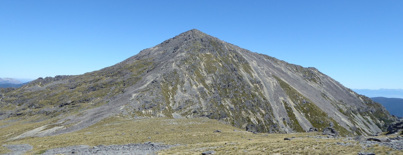
Mt Richmond
Mount Richmond Forest Park
Mt Richmond (1760 m) is the namesake of the forest park that encompasses it. It is the second-highest peak in the park (Red Hill is 30 m higher), though its prominence gives it some of the best views of any point on the Richmond Range. Richmond Saddle Hut is handily positioned a short distance from the summit, allowing overnight trips from Top Valley, or multi-day trips in combination with nearby Mt Fell Hut, or Pelorus Track. Fit parties can easily climb the peak in a single day.
| Details | |
| Distances | 6.1 km to Richmond Saddle Hut (add 3.6 km if you begin at Top Valley Stream ford; 1.4 km Richmond Saddle Hut to Mt Richmond summit (one way); 5 km Richmond Saddle Hut to Mt Fell Hut; 11 km Mt Fell Hut to Timms Creek; 11 km Mt Fell Hut to Middy Hut |
| Time Required | 3-4 hr to Richmond Saddle Hut (add 1 hr 30 min if you have to park at Top Valley Stream ford); 1-2 hr Richmond Saddle Hut to Mt Richmond summit (one way); 3-4 hr Richmond Saddle Hut to Mt Fell Hut |
| Trail Type | Tramping track/Poled route |
| Physical Difficulty | Hard |
| Uses | Walking and trail running |
| Start Elevation | 520 m (Richmond Saddle Rd) or 230 m (Top Valley Stream ford) |
| Max Elevation | 1200 m (Richmond Saddle Hut) or 1760 m (Mt Richmond) |
Mt Fell Hut
Walking and trail running
Middy Hut (Pelorus Track)
Walking and trail running
2 hr from Nelson | 1 hr from Blenheim
Mt Richmond is most easily accessed from Top Valley, on the northern side of the Wairau River.
From Nelson, head east along State Highway 6 all the way into Marlborough. Turn right onto Northbank Rd, which is just before the Wairau River bridge. Follow Northbank Rd for 33 km to the right-hand turnoff to Top Valley. Head up Top Valley and follow the DOC signs until the right-hand turn-off onto Jackson Creek Rd (which becomes Richmond Saddle Rd). At this point you will need to ford Top Valley Stream; a 4WD is recommended for this. If your vehicle cannot manage the ford, you’ll have to leave it here. On the other side of the ford, follow the DOC signs along the forestry road as it winds up the ridge to the start of the track (520 m elevation).
The well-worn track climbs at a steady rate up the crest of a spur through beech forest. After 4.5 km the ridge levels off and rocky points allow good views of the mass of Mt Richmond across the valley to the north. As the ridge keeps rising, the track sidles the eastern side of it, gently undulating through silver beech. The track is a little more rocky and rooty underfoot for the rest of the distance to Richmond Saddle Hut.
Richmond Saddle Hut is positioned in a grassy clearing in the saddle west of Mt Richmond. The saddle is open to the north, allowing views to the headwaters of the Pelorus River catchment.
| Richmond Saddle Hut | |||
| Hut Type | Standard Hut | Capacity | 8 |
| Bookings | Not required; first in, first served | Elevation | 1200 m |
Richmond Saddle Hut to Mt Richmond summit and Mt Fell Hut
The route to Mt Richmond summit (and onward to Mt Fell) continues from the hut, heading straight up from the saddle. After 20 min you’ll reach the tree line, above which the mountainside is largely a jagged boulder field, with imposing craggy outcrops jutting out above. Poles with orange triangles mounted on top give an approximate indication of where the route goes, though as the main path worn up the mountain is often loose and crumbly, you may find it easier to pick your own way. Take care not to dislodge rocks onto anyone below you.
Once on the summit ridge, it’s a straightforward walk to the summit. Enjoy the panoramic views of the Richmond Ranges, Wairau Valley and Tasman Bay. Particularly impressive are the dramatic ridges and rock formations of Johnston Peak and Mt Fell.
To return to Richmond Saddle Hut, return the way you came. Otherwise, continue east along the poled route as it drops off the summit through more craggy rocks and into the gentle tussock saddle known as ‘Devil’s Armchair’ between Mt Richmond and Johnston Peak. Once on the eastern side of the ridge that leads to Johnston Peak, the poled route follows the ridge towards Mt Fell through open tussock, with steep bluffs dropping to the west. The track here is not so worn, so take care with foot placement as the tussock obscures some of the rocks and uneven ground surface. Before the ridge starts rising toward the summit of Mt Fell, you’ll reach a track junction with the route to Middy Hut (6-8 hr away). To get to Mt Fell Hut, turn right here and drop down to the tree line. You’ll pass the original location of Mt Fell Hut and then it’s a short sidle through beech forest to its current position.
| Mt Fell Hut | |||
| Hut Type | Standard Hut | Capacity | 6 |
| Bookings | Not required; first in, first served | Elevation | 1280 m |


Mt Richmond is an alpine environment, so proper preparation is essential to ensure a safe trip. The track reaches a high elevation and is exposed above the tree line. You must always be prepared for freezing conditions and take extreme care if snow and ice are present. Do not rely on the Blenheim weather forecast as the alpine conditions in Mount Richmond Forest Park are likely to be drastically different. Make sure you carry plenty of water with you as there are no reliable water sources between Top Valley Stream and Richmond Saddle Hut.
See the Mountain Safety Council website for useful information on preparing for the outdoors.