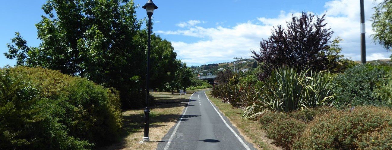
The Railway Reserve is one of Nelson’s greatest recreational assets, providing an almost unbroken length of off-road shared pathway linking Nelson, Stoke and Richmond. As the name indicates, the pathway follows the historic alignment of the Nelson-Glenhope Railway, which was in operation between 1876 and 1955. It is a popular and safe route for commuters, students and recreational users, and it connects to numerous roads, access ways and other pathways.
| Details | |
| Length | 8.4 km St. Vincent St to Orphanage Stream |
| Trail Type | Shared pathway |
| Physical Difficulty | Easy |
| Technical Difficulty | Easy |
| Uses | Walking, running and cycling |
| Direction | Either |
| Max Elevation | 70 m |
If any layers fail to load, try clearing your cache and refreshing the page.
5 min from central Nelson (northern end)
The northern end of Railway Reserve Pathway begins at St Vincent St, where connects directly to St Vincent St Cycleway. From here to Annesbrook, the pathway doubles as part of the Nelson-Richmond section of the Great Taste Trail.
The southern end begins at a track junction next to Orphanage Stream, between Wakatu Estate, Saxton Field and Whakatu Coastal Pathway.
As the pathway passes through nearly 8 km of urban area, there are numerous points of entry and connections to other pathways and tracks. There are two direct connections to Whakatu Coastal Pathway via underpasses beneath Whakatu Dr; one at Quarantine Rd, and the other at Orphanage Stream. Nelson City Council has good direction and distance signage along the way
From St. Vincent St, the pathway climbs gently at a steady rate along the former railway embankment to the saddle above Bishopdale. At the saddle, it crosses Beatson Road and runs parallel to Waimea Road until after the bridge across Jenkins Creek, where it turns back to Beatson Road. The latter section is the best option if you’re coming towards the city centre, though if you’re heading towards Stoke, you can take a shortcut down Beatson Road to save a couple of minutes. From the Whakatu Drive roundabout, the pathway continues alongside Whakatu Dr to Gracefield St Overbridge, and then across David Langdon Overbridge. Just past the overbridge, follow the pathway to the left to get on the main straight through Stoke. Alternatively, heading straight will take you to an underpass that connects to Whakatu Coastal Pathway, adjacent to World of Wearable Art.
The Railway Reserve Pathway continues in a straight line all the way to Songer St, with a very gentle uphill slope until the Andrew St crossing. Along this 1.8 km section there are road crossings at Jellicoe Ave, Newall Ave and Andrew St. Cyclists and pedestrians have priority at these crossings. At Broadgreen Intermediate there is a four-way junction with Poorman Stream Walkway.
South of Songer St, the 1.9 km stretch to Saxton Rd West slopes gently downhill, and there are no road crossings. Orchard Stream Pathway branches to the right adjacent to Byron Pl. An information panel just before Saxton Rd West provides some interesting historical details of the railway.
Cross Saxton Rd West, and continue briefly to four-way junction with Orphanage Stream Pathway, which marks the southern end of the Railway Reserve Pathway. At this junction you can travel left to Saxton Park via an underpass beneath Main Rd Stoke, right to Whakatu Coastal Pathway via an underpass beneath Whakatu Dr, or straight ahead across the bridge over Orphanage Stream to Wakatu Estate Industrial Park.


The Railway Reserve is one of Nelson’s greatest recreational assets, providing an almost unbroken length of off-road shared pathway linking Nelson, Stoke and Richmond. As the name indicates, the pathway follows the historic alignment of the Nelson-Glenhope Railway, which was in operation between 1876 and 1955. It is a popular and safe route for commuters, students and recreational users, and it connects to numerous roads, access ways and other pathways.
| Details | |
| Length | 8.4 km St. Vincent St to Orphanage Stream |
| Trail Type | Shared pathway |
| Physical Difficulty | Easy |
| Technical Difficulty | Easy |
| Uses | Walking, running and cycling |
| Direction | Either |
| Max Elevation | 70 m |
5 min from central Nelson (northern end)
The northern end of Railway Reserve Pathway begins at St Vincent St, where connects directly to St Vincent St Cycleway. From here to Annesbrook, the pathway doubles as part of the Nelson-Richmond section of the Great Taste Trail.
The southern end begins at a track junction next to Orphanage Stream, between Wakatu Estate, Saxton Field and Whakatu Coastal Pathway.
As the pathway passes through nearly 8 km of urban area, there are numerous points of entry and connections to other pathways and tracks. There are two direct connections to Whakatu Coastal Pathway via underpasses beneath Whakatu Dr; one at Quarantine Rd, and the other at Orphanage Stream. Nelson City Council has good direction and distance signage along the way
From St. Vincent St, the pathway climbs gently at a steady rate along the former railway embankment to the saddle above Bishopdale. At the saddle, it crosses Beatson Road and runs parallel to Waimea Road until after the bridge across Jenkins Creek, where it turns back to Beatson Road. The latter section is the best option if you’re coming towards the city centre, though if you’re heading towards Stoke, you can take a shortcut down Beatson Road to save a couple of minutes. From the Whakatu Drive roundabout, the pathway continues alongside Whakatu Dr to Gracefield St Overbridge, and then across David Langdon Overbridge. Just past the overbridge, follow the pathway to the left to get on the main straight through Stoke. Alternatively, heading straight will take you to an underpass that connects to Whakatu Coastal Pathway, adjacent to World of Wearable Art.
The Railway Reserve Pathway continues in a straight line all the way to Songer St, with a very gentle uphill slope until the Andrew St crossing. Along this 1.8 km section there are road crossings at Jellicoe Ave, Newall Ave and Andrew St. Cyclists and pedestrians have priority at these crossings. At Broadgreen Intermediate there is a four-way junction with Poorman Stream Walkway.
South of Songer St, the 1.9 km stretch to Saxton Rd West slopes gently downhill, and there are no road crossings. Orchard Stream Pathway branches to the right adjacent to Byron Pl. An information panel just before Saxton Rd West provides some interesting historical details of the railway.
Cross Saxton Rd West, and continue briefly to four-way junction with Orphanage Stream Pathway, which marks the southern end of the Railway Reserve Pathway. At this junction you can travel left to Saxton Park via an underpass beneath Main Rd Stoke, right to Whakatu Coastal Pathway via an underpass beneath Whakatu Dr, or straight ahead across the bridge over Orphanage Stream to Wakatu Estate Industrial Park.
Updated 20 February 2019