Speargrass Hut is one of the most accessible huts in Nelson Lakes National Park. It is great as an easy overnight tramp via Speargrass Track, or as part of multi-day trips via its connections with Sabine Hut and Angelus Hut. The hut has a nice outlook to the western side of Robert Ridge.
| Details | |
| Distances (to Speargrass Hut) | 7 km from Mt Robert car park; 11.4 km from Sabine Hut; 5 km from Angelus Hut |
| Time Required | 2 hr 30 min from Mt Robert car park; 4-5 hr from Sabine Hut; 2-3 hr from Angelus Hut |
| Trail Type | Tramping track |
| Physical Difficulty | Moderate |
| Uses | Walking and trail running |
| Direction | Either |
| Dog Access | Dogs are prohibited in Nelson Lakes National Park |
If any layers fail to load, try clearing your cache and refreshing the page.
1 hr 10 min from Nelson | 1 hr 20 min from Blenheim
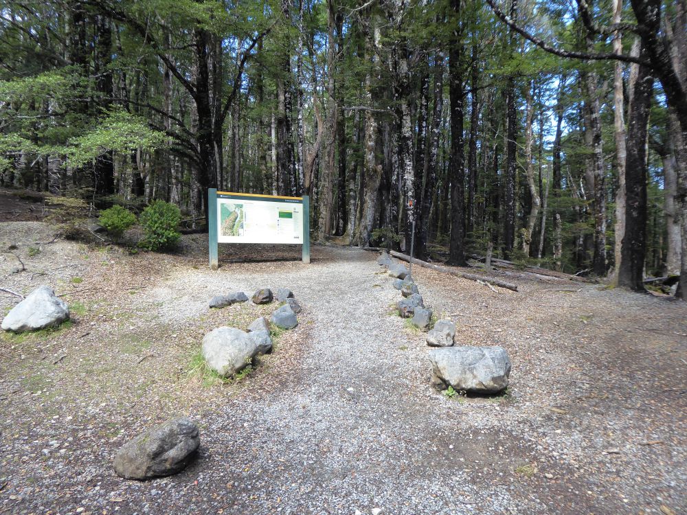
Speargrass Hut is most-easily accessed from Mt Robert car park, at the end of Mt Robert Road. The turnoff to Mt Robert Road a 2 minute drive west of St Arnaud along State Highway 63. Mt Robert Road passes West Bay where there is parking and a campsite, crosses the source of the Buller River and reaches Mt Robert car park at 900 m elevation. There is a small shelter, toilets and a trail info panel at the car park. The car park is large but fills up on busy weekends. The road can be icy in winter, so take care when driving.
Nelson Lakes DOC Visitor Centre is located on View Road, St Arnaud. This is a good place to read up on the ecology, geology and history of St Arnaud and Nelson Lakes National Park, as well as check the latest alpine weather forecasts and speak to DOC staff about any warnings in place.
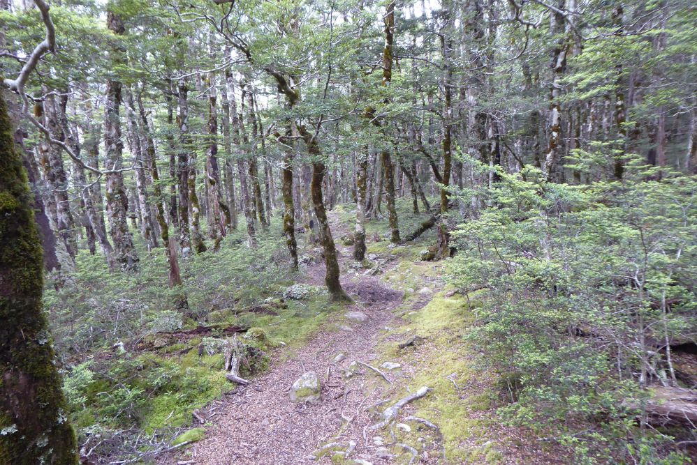
From Mt Robert car park, the track sets off through beech forest, following the curvature of the range in and out of gullies. There is a gradual descent for the first 2 km until you reach the true right of Speargrass Creek. Along the next section the track has been washed out in several places as Speargrass Creek has eroded the eastern bank. At one point there is an alternative flood route that you can take when the creek is running high. The track climbs gently for the remaining distance to the hut.
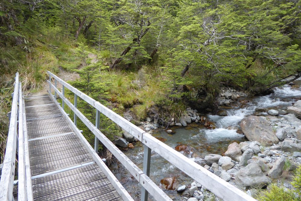
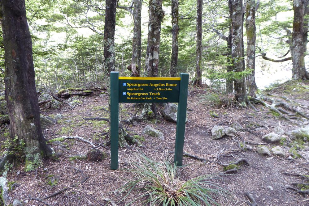
Just before the hut a bridge crosses Speargrass Creek, and on the other side there is a track junction with Speargrass Creek Route, which heads south up Speargrass Valley to connect with Robert Ridge Route near Angelus Hut.
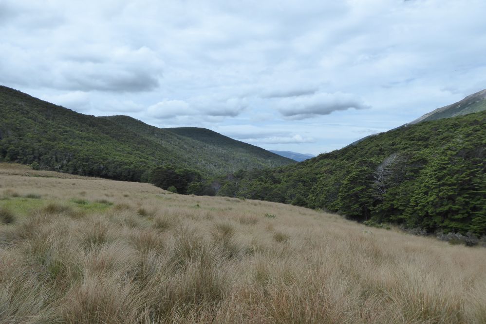
Speargrass Hut is positioned in a boggy tussock open. A boardwalk leads to the hut, which enjoys good views of the western side of Robert Ridge and Speargrass Valley.
| Speargrass Hut | |
| Hut Type | Serviced Hut |
| Capacity | 12 bunks |
| Bookings | Not required; first in, first served |
| Fee | 1 Serviced Hut Ticket |
| Altitude | 1060 m |
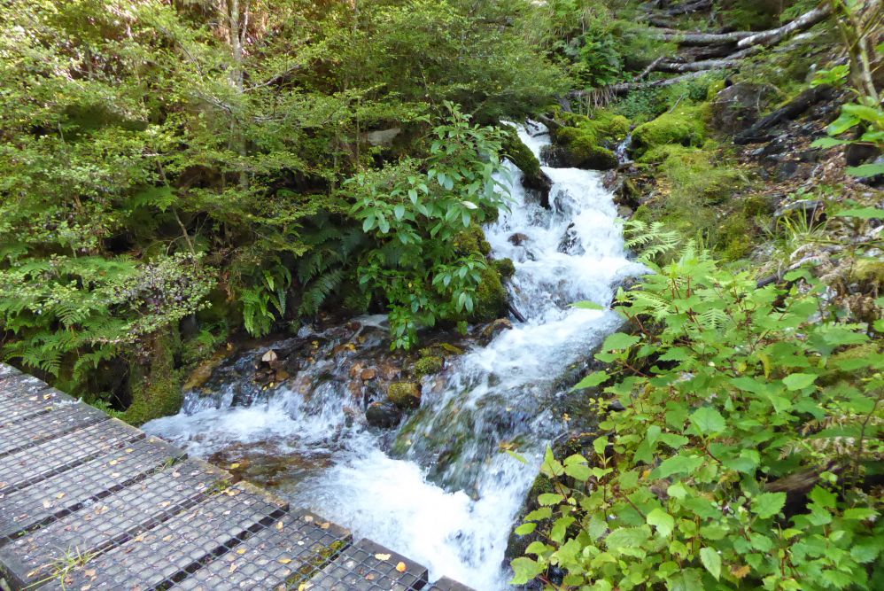
From Speargrass Hut the track climbs up to a ridge (approx. 1160 m elevation). This is the highest point en route to Sabine Hut and from here the track descends at a very gentle rate all the way to the Rotoroa lakeshore. From the high point, the old track used to head north toward the long-removed Howard Hut, before turning southwest toward Sabine Hut via Cedric Stream. The modern track sidles the base of the range above, following the curvature of the spurs with bridges crossing the largest of the bouldery streams flowing off them. Lengths of boardwalk also cross some of the boggier sections. The track passes little ponds surrounded by dense mountain beech before the final few kilometres to Sabine Hut, where you’ll descend through magnificent beech forest.
Speargrass Creek Route begins at the junction 2 min before Speargrass Hut. The route heads up Speargrass Valley, initially through beech forest and progressively into low sub-alpine scrub. The route, marked by cairns, weaves back and forth across Speargrass Creek, meaning there are numerous crossings. Further up the valley narrows, and the steep western side of Robert Ridge rises immediately on the left. Do not linger here as the masses of scree steeply pose a serious hazard. At times you will have to carefully sidle the loose rocky scree with a sharp drop to the creek below. The route steepens as you deviate from the main creek and climb a spur towards the head of the valley. At the top you’ll reach the junction with Robert Ridge Route, 15 min before Angelus Hut.
Note that Speargrass Creek Route will likely be impassable when the creek is running high.
Speargrass Hut is one of the most accessible huts in Nelson Lakes National Park. It is great as an easy overnight tramp via Speargrass Track, or as part of multi-day trips via its connections with Sabine Hut and Angelus Hut. The hut has a nice outlook to the western side of Robert Ridge.
| Details | |
| Distances (to Speargrass Hut) | 7 km from Mt Robert car park; 11.4 km from Sabine Hut; 5 km from Angelus Hut |
| Time Required | 2 hr 30 min from Mt Robert car park; 4-5 hr from Sabine Hut; 2-3 hr from Angelus Hut |
| Trail Type | Tramping track |
| Physical Difficulty | Moderate |
| Uses | Walking and trail running |
| Direction | Either |
| Dog Access | Dogs are prohibited in Nelson Lakes National Park |
1 hr 10 min from Nelson | 1 hr 20 min from Blenheim
Speargrass Hut is most-easily accessed from Mt Robert car park, at the end of Mt Robert Road. The turnoff to Mt Robert Road a 2 minute drive west of St Arnaud along State Highway 63. Mt Robert Road passes West Bay where there is parking and a campsite, crosses the source of the Buller River and reaches Mt Robert car park at 900 m elevation. There is a small shelter, toilets and a trail info panel at the car park. The car park is large but fills up on busy weekends. The road can be icy in winter, so take care when driving.
Nelson Lakes DOC Visitor Centre is located on View Road, St Arnaud. This is a good place to read up on the ecology, geology and history of St Arnaud and Nelson Lakes National Park, as well as check the latest alpine weather forecasts and speak to DOC staff about any warnings in place.
From Mt Robert car park, the track sets off through beech forest, following the curvature of the range in and out of gullies. There is a gradual descent for the first 2 km until you reach the true right of Speargrass Creek. Along the next section the track has been washed out in several places as Speargrass Creek has eroded the eastern bank. At one point there is an alternative flood route that you can take when the creek is running high. The track climbs gently for the remaining distance to the hut.
Just before the hut a bridge crosses Speargrass Creek, and on the other side there is a track junction with Speargrass Creek Route, which heads south up Speargrass Valley to connect with Robert Ridge Route near Angelus Hut.
Speargrass Hut is positioned in a boggy tussock open. A boardwalk leads to the hut, which enjoys good views of the western side of Robert Ridge and Speargrass Valley.
| Speargrass Hut | |
| Hut Type | Serviced Hut |
| Capacity | 12 bunks |
| Bookings | Not required; first in, first served |
| Fee | 1 Serviced Hut Ticket |
| Altitude | 1060 m |
From Speargrass Hut the track climbs up to a ridge (approx. 1160 m elevation). This is the highest point en route to Sabine Hut and from here the track descends at a very gentle rate all the way to the Rotoroa lakeshore. From the high point, the old track used to head north toward the long-removed Howard Hut, before turning southwest toward Sabine Hut via Cedric Stream. The modern track sidles the base of the range above, following the curvature of the spurs with bridges crossing the largest of the bouldery streams flowing off them. Lengths of boardwalk also cross some of the boggier sections. The track passes little ponds surrounded by dense mountain beech before the final few kilometres to Sabine Hut, where you’ll descend through magnificent beech forest.
Speargrass Creek Route begins at the junction 2 min before Speargrass Hut. The route heads up Speargrass Valley, initially through beech forest and progressively into low sub-alpine scrub. The route, marked by cairns, weaves back and forth across Speargrass Creek, meaning there are numerous crossings. Further up the valley narrows, and the steep western side of Robert Ridge rises immediately on the left. Do not linger here as the masses of scree steeply pose a serious hazard. At times you will have to carefully sidle the loose rocky scree with a sharp drop to the creek below. The route steepens as you deviate from the main creek and climb a spur towards the head of the valley. At the top you’ll reach the junction with Robert Ridge Route, 15 min before Angelus Hut.
Note that Speargrass Creek Route will likely be impassable when the creek is running high.
Updated 18 January 2021
