Trail Area
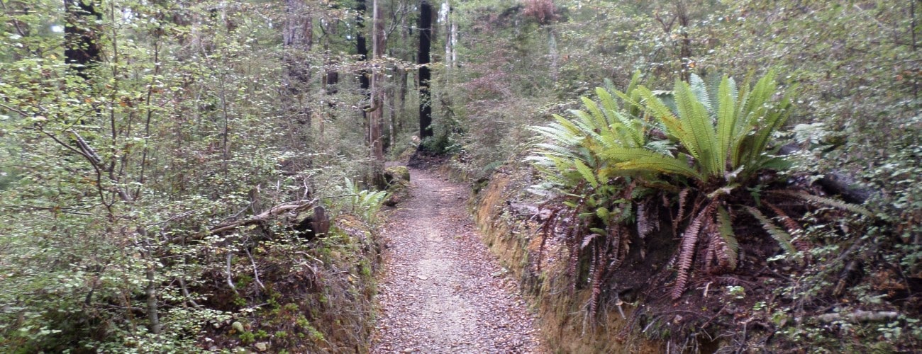
The Teetotal-Big Bush Trail Area is located just west of St Arnaud and includes a number of trails of varying length and difficulty that are great for trail running and MTB. The lower trails travel across Teetotal Flats, which are old river terraces of the Buller River, and climb through the beautiful beech forest of Big Bush Conservation Area. Big Bush is a 15,660 ha expanse of original native beech forest. Big Bush was described by surveyor Charles Hursthouse in 1859 as a ‘black forest region unfit for man nor domestic beast’, and to this day it remains largely untouched.
If any layers fail to load, try clearing your cache and refreshing the page.
Teetotal-Big Bush Trail Area connects to St Arnaud via two tracks; Village Link (walking, trail running and MTB) and Moraine Walk (walking and trail running).
1 hr 5 min from Nelson
Teetotal Flat car park and camp site is located 2 min west of St Arnaud along State Highway 63. St Arnaud is 75 km southwest of Nelson. At the car park there are toilets and an information panel with a map and trail details. The car park is also used for the nearby ice skating rink.
You can also get to the car park from St Arnaud by following the track that begins at Rotoiti Lodge Road runs alongside State Highway 63, around the base of Black Hill.
An easy loop track starting and finishing at Teetotal Flats car park, that can be done in either direction. Heading in a clockwise direction, the track crosses Teetotal Road and heads through kanuka forest on the western side of the council wastewater pond. Rattler Rim connects on the left, after which it crosses Teetotal Road and heads alongside a swampy area behind an old moraine mound. Along the native forest edge at the base of the ridge, it connects with Kaka Track (from which Sidewinder begins), then heads back across the grassy flats to where you began the loop.
| Length | 3.5 km | Trail Type | Shared track |
| Uses | Walking, trail running and MTB | Direction | Either |
| Physical Difficulty | Easy | Technical Difficulty | Easy |
Sidewinder begins a short distance from the bottom of Kaka Track. Follow Skating Pond loop from the car park and turn right onto Kaka Track. Sidewinder undulates along the base of the ridge through red beech forest, dipping in and out of a few small creeks. Note that the beech tree roots that the track crosses are very slippery when wet and can make riding difficult. Out of the beech forest the track passes through kānuka and grass clearings, and then re-enters beech forest at the bottom end of Flying Moa. The western end crosses grass to connect with Teetotal Road at the start of Nelson Forests Loop.
| Length | 3.1 km | Trail Type | Shared track |
| Uses | Walking, trail running and MTB | Direction | Either |
| Physical Difficulty | Moderate | Technical Difficulty | Advanced |
Rattler Rim begins at the western end of Teetotal Road, a few hundred metres beyond where Sidewinder ends. The trail heads through a mix of tall grass and kanuka forest, through which it makes a tightly-weaving path. Hummocky terrain, exposed rocks and the sawn-off stumps of kanuka trees make for a ‘rattly’ ride. Keep an eye out for the white plastic markers that guide the way. The track runs directly parallel with Teetotal Road on the edge of an old terrace of the Buller River. At several points you can cut back through to Teetotal Road and in one section Rattler Rim crosses to the other side of the road. The eastern end of the track connects with Skating Pond Loop.
| Length | 3.4 km | Trail Type | Shared track |
| Uses | Walking, trail running and MTB | Direction | Either |
| Physical Difficulty | Easy | Technical Difficulty | Intermediate |
Kaka Track provides the most straight-forward access to Big Bush Track and the other downhill tracks that descend from the ridge. The track climbs though beautiful beech forest with mossy undergrowth. The track is well-graded and suitable for walking and riding.
| Length | 1.8 km | Trail Type | Shared track |
| Uses | Walking, trail running and MTB | Direction | Either |
| Physical Difficulty | Moderate | Technical Difficulty | Intermediate |
Flying Moa descends from Big Bush Track to link with the western end of Sidewinder. It can be accessed by climbing the ridge via either Robin Banks Track or Kaka Track. Flying Moa winds down the ridge through lush beech forest. The track is quite rooty which can make it very slippery when wet.
| Length | 2.2 km | Trail Type | Singletrack |
| Uses | MTB | Direction | Downhill only |
| Physical Difficulty | Moderate | Technical Difficulty | Intermediate |
| Start Elevation | 850 m | Finish Elevation | 600 m |
Nelson Forests loop begins at the western end of Sidewinder. The loop follows a forestry road that climbs gradually up the ridge on the right, through pine forest. After 1.5 km, you’ll reach the edge of the native bush at Big Bush Conservation Area, where Robin Banks Track begins on the right. Follow the white markers as the road descends, weaving in and out of gullies and across skid sites. Once back on the flats, the road heads east back to where you started.
| Length | 5.2 km | Trail Type | 4WD road |
| Uses | Trail running and MTB | Direction | Either |
| Physical Difficulty | Moderate | Technical Difficulty | Easy |
Big Bush Track is the original DOC tramping track that traversed the ridge that runs parallel to Teetotal Flats, with all other recently developed MTB trails branching off it. It is an integral part of any circuit in the trail area.
| Length | 4.4 km | Trail Type | Tramping track |
| Uses | Walking, trail running and MTB | Direction | Either |
| Physical Difficulty | Moderate | Technical Difficulty | Intermediate |
An expert-grade singletrack that descends from Big Bush Track to Skating Pond Loop.
| Length | 1.3 km | Trail Type | Singletrack |
| Uses | MTB | Direction | Downhill only |
| Physical Difficulty | Moderate | Technical Difficulty | Expert |
| Start Elevation | 860 m | Finish Elevation | 605 m |
An advanced-grade singletrack that descends from Big Bush Track to Skating Pond Loop.
| Length | 1.9 km | Trail Type | Singletrack |
| Uses | MTB | Direction | Downhill only |
| Physical Difficulty | Moderate | Technical Difficulty | Advanced |
| Start Elevation | 870 m | Finish Elevation | 610 m |
Updated 06 March 2021
The Teetotal-Big Bush Trail Area is located just west of St Arnaud and includes a number of trails of varying length and difficulty that are great for trail running and MTB. The lower trails travel across Teetotal Flats, which are old river terraces of the Buller River, and climb through the beautiful beech forest of Big Bush Conservation Area. Big Bush is a 15,660 ha expanse of original native beech forest. Big Bush was described by surveyor Charles Hursthouse in 1859 as a ‘black forest region unfit for man nor domestic beast’, and to this day it remains largely untouched.
1 hr 5 min from Nelson
Teetotal Flat car park and camp site is located 2 min west of St Arnaud along State Highway 63. St Arnaud is 75 km southwest of Nelson. At the car park there are toilets and an information panel with a map and trail details. The car park is also used for the nearby ice skating rink.
An easy loop track starting and finishing at Teetotal Flats car park, that can be done in either direction. Heading in a clockwise direction, the track crosses Teetotal Road and heads through kanuka forest on the western side of the council wastewater pond. Rattler Rim connects on the left, after which it crosses Teetotal Road and heads alongside a swampy area behind an old moraine mound. Along the native forest edge at the base of the ridge, it connects with Kaka Track (from which Sidewinder begins), then heads back across the grassy flats to where you began the loop.
| Length | 3.2 km |
| Trail Type | Shared track |
| Uses | Walking, trail running and MTB |
| Physical Difficulty | Easy |
| Technical Difficulty | Easy |
Sidewinder begins a short distance from the bottom of Kaka Track. Follow Skating Pond loop from the car park and turn right onto Kaka Track. Sidewinder undulates along the base of the ridge through red beech forest, dipping in and out of a few small creeks. Note that the beech tree roots that the track crosses are very slippery when wet and can make riding difficult. Out of the beech forest the track passes through kānuka and grass clearings, and then re-enters beech forest at the bottom end of Flying Moa. The western end crosses grass to connect with Teetotal Road at the start of Nelson Forests Loop.
Rattler Rim begins at the western end of Teetotal Road, a few hundred metres beyond where Sidewinder ends. The trail heads through a mix of tall grass and kanuka forest, through which it makes a tightly-weaving path. Hummocky terrain, exposed rocks and the sawn-off stumps of kanuka trees make for a ‘rattly’ ride. Keep an eye out for the white plastic markers that guide the way. The track runs directly parallel with Teetotal Road on the edge of an old terrace of the Buller River. At several points you can cut back through to Teetotal Road and in one section Rattler Rim crosses to the other side of the road. The eastern end of the track connects with Skating Pond Loop.
| Length | 3.4 km |
| Trail Type | Shared track |
| Uses | Walking, trail running and MTB |
| Physical Difficulty | Easy |
| Technical Difficulty | Intermediate |
Kaka Track provides the most straight-forward access to Big Bush Track and the other downhill tracks that descend from the ridge. The track climbs though beautiful beech forest with mossy undergrowth. The track is well-graded and suitable for walking and riding.
| Length | 1.8 km |
| Trail Type | Shared track |
| Uses | Walking, trail running and MTB |
| Physical Difficulty | Moderate |
| Technical Difficulty | Intermediate |
Flying Moa descends from Big Bush Track to link with the western end of Sidewinder. It can be accessed by climbing the ridge via either Robin Banks Track or Kaka Track. Flying Moa winds down the ridge through lush beech forest. The track is quite rooty which can make it very slippery when wet.
| Length | 2.2 km |
| Trail Type | Singletrack |
| Uses | MTB |
| Direction | Downhill |
| Physical Difficulty | Moderate |
| Technical Difficulty | Intermediate |
| Start Elevation | 850 m |
| Finish Elevation | 600 m |
Nelson Forests loop begins at the western end of Sidewinder. The loop follows a forestry road that climbs gradually up the ridge on the right, through pine forest. After 1.5 km, you’ll reach the edge of the native bush at Big Bush Conservation Area, where Robin Banks Track begins on the right. Follow the white markers as the road descends, weaving in and out of gullies and across skid sites. Once back on the flats, the road heads east back to where you started.
Big Bush Track is the original DOC tramping track that traversed the ridge that runs parallel to Teetotal Flats, with all other recently developed MTB trails branching off it. It is an integral part of any circuit in the trail area.
| Length | 4.4 km |
| Trail Type | Shared track |
| Uses | Walking, trail running and MTB |
| Direction | Either |
| Physical Difficulty | Moderate |
| Technical Difficulty | Intermediate |
An expert-grade singletrack that descends from Big Bush Track to Skating Pond Loop.
An advanced-grade singletrack that descends from Big Bush Track to Skating Pond Loop.
Teetotal-Big Bush Trail Area connects to St Arnaud via two tracks; Village Link (walking, trail running and MTB) and Moraine Walk (walking and trail running).
Updated 06 March 2021