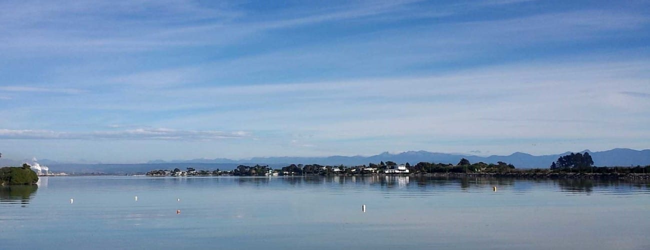
Monaco Peninsula is a short coastal circuit on quiet residential streets that is popular among walkers and casual cyclists. It is a particularly scenic route, offering expansive views across Waimea Inlet to Barnicoat Range, Oyster Island and Arthur Range.
| Details | |
| Length | 3.7 km circuit from car park next to Honest Lawyer |
| Time Required | 50 min for walkers |
| Trail Type | Shared pathway |
| Physical Difficulty | Easy |
| Uses | Walking, running and cycling |
| Direction | Either |
If any layers fail to load, try clearing your cache and refreshing the page.
15 min from central Nelson
Songer St provides the only road access to Monaco. There is no defined starting point though the small car park next to the Honest Lawyer on Point Rd (immediately after the Whakatu Drive Overbridge) is convenient for people driving to Monaco. If you’re on foot or bike, Whakatu Drive Coastal Pathway links directly into the Monaco Peninsula Circuit from both the north and south (refer to the map to see where).
The beginning of the route follows the Whakatu Coastal Pathway alongside Point Rd around the cove. Follow the wide pathway along the straight length of Point Rd. After 1 km Martin Street begins on the right. The peninsula loop can be completed in either direction, meaning you can continue straight along Point Rd, or turn right into Martin St. Note that Point Rd reverts to sand for about 300 m between Martin St and Rainier St and is impassable at high tide. In this case you will need to use Martin Street both ways, making a smaller loop by cutting through Rainier St, then complete the loop by returning to the intersection of Martin St and Point Rd. Head back the way you came along Point Rd.
Combine Monaco Peninsula with Nelson Airport Perimeter Walkway or Whakatu Coastal Pathway to create a longer walking or running route.
Note how the street names on the peninsula are related to the Principality of Monaco.
Monaco Peninsula is a short coastal circuit on quiet residential streets that is popular among walkers and casual cyclists. It is a particularly scenic route, offering expansive views across Waimea Inlet to Barnicoat Range, Oyster Island and Arthur Range.
| Details | |
| Length | 3.7 km circuit from car park next to Honest Lawyer |
| Time Required | 50 min for walkers |
| Trail Type | Shared pathway |
| Physical Difficulty | Easy |
| Uses | Walking, running and cycling |
| Direction | Either |
15 min from central Nelson
Songer St provides the only road access to Monaco. There is no defined starting point though the small car park next to the Honest Lawyer on Point Rd (immediately after the Whakatu Drive Overbridge) is convenient for people driving to Monaco. If you’re on foot or bike, Whakatu Drive Coastal Pathway links directly into the Monaco Peninsula Circuit from both the north and south (refer to the map to see where).
The beginning of the route follows the Whakatu Coastal Pathway alongside Point Rd around the cove. Follow the wide pathway along the straight length of Point Rd. After 1 km Martin Street begins on the right. The peninsula loop can be completed in either direction, meaning you can continue straight along Point Rd, or turn right into Martin St. Note that Point Rd reverts to sand for about 300 m between Martin St and Rainier St and is impassable at high tide. In this case you will need to use Martin Street both ways, making a smaller loop by cutting through Rainier St, then complete the loop by returning to the intersection of Martin St and Point Rd. Head back the way you came along Point Rd.
Combine Monaco Peninsula with Nelson Airport Perimeter Walkway or Whakatu Coastal Pathway to create a longer walking or running route.
Note how the street names on the peninsula are related to the Principality of Monaco.
Updated 18 February 2019