Mt Robertson
Robertson Range Scenic Reserve
Mt Robertson / Tokomaru (1036 m) is a peak on the Robertson Range, between Picton and Blenheim. The peak can be reached as a day walk from Pukatea / Whites Bay. Tokomaru is a culturally significant maunga for Ngāti Toa and Ngāti Rarua in Wairau, named after a peak in Hawaiki and referring to a sheltering pole that symbolically protects the Wairau Plains.
| Details | |
| Length | 16.5 km full circuit from Whites Bay; 11.6 km out-and-back from Port Underwood Rd; 7.2 km Loop Track alone; 6.4 km return Summit Route alone |
| Time Required | 6-8 hr full circuit from Whites Bay; 5-7 hr out-and-back from Port Underwood Rd |
| Trail Type | Tramping track |
| Physical Difficulty | Hard |
| Uses | Walking and trail running |
| Start Elevation | 5 m (Whites Bay); 140 m (southern end of Loop Route); 270 m (northern end of Loop Route) |
| Max Elevation | 1036 m |
Black Jack Track/Whites Bay Track
Walking and trail running
Pukaka Valley Track
Walking and trail running
30 min from Blenheim
The track network on Mt Robertson comprises two main tracks: the Mt Robertson Loop Route and the Mt Robertson Summit Route. The Loop Route follows two separate spurs rising from the coast and the main ridgeline, starting and finishing on Port Underwood Road, with its respective ends about 4.5 km apart. The Summit Route begins on the ridgeline at the northern end of the Loop Route.
The respective ends of the Loop Route are connected by the Black Jack Track and Whites Bay Track, which each begin on the opposite side of Port Underwood Road and lead to Whites Bay. This allows you to create a 16.5 km circuit beginning at Whites Bay, adding about 250 m of extra elevation gain compared with starting and finishing on Port Underwood Road.
For an out-and-back walk, starting at the northern end of the Loop Route is the shortest option at 11.6 km return (5-6 hr). An out-and-back from the southern end is 14.2 km return (6-7 hr) and involves an additional 130 m of elevation gain. If you have the option to leave a vehicle at each end of the Loop Route, climbing one leg, continuing to the summit, and descending the other leg is 12.9 km.
The northern end of the Loop Route starts as a 4WD road, which climbs the spur through pine forest to access a transmission line pylon. The end of the road marks the boundary of Mount Robertson Scenic Reserve, where the track enters kamahi forest and follows the spur upward to the main ridge.
At 680 m elevation, the track reaches a junction. Here, the Loop Route heads left to loop back to Port Underwood Road, while the Summit Route branches right.
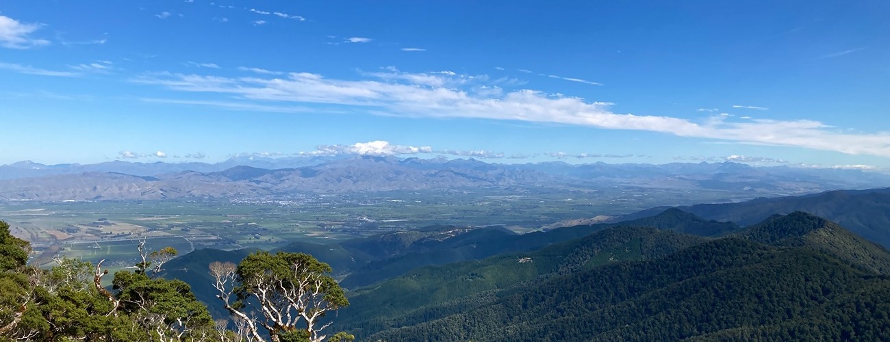
From the junction, the Summit Route continues with a gradual ascent north along the ridgeline to a hump in the ridge before encountering the steepest part of the climb up to the 900 m contour. Here, the sharp ridge opens up to provide some of the best views on the track, with Port Underwood and the Marlborough Plains visible below. The track then continues its gentle climb through mossy silver beech forest for the remaining kilometre to the summit.
The summit hosts an Airways New Zealand radar station. Being below the natural tree line, the summit unfortunately does not offer any views.
Return the way you came, back to the Loop Track junction.
Southern leg of Loop Route
From the junction, the southern leg of the Loop Route continues by descending the ridgeline to a junction with Pukaka Valley Track, which branches off to the right (Pukaka Valley Road is 3.6 km from here).
Continuing downhill, the Loop Route leaves the mature native forest and enters a mix of regenerating kānuka forest and wilding pines. It then turns east and descends to the pylon access road, which can be followed back to Port Underwood Road.


Black Jack Track/Whites Bay Track
Walking and trail running
Pukaka Valley Track
Walking and trail running