Mt Cloudesley
Mt Cloudesley (2107 m) is the second highest peak on the Craigieburn Range. An unofficial but well-worn route leads to the summit from Castle Hill Village.
| Details | |
| Length | 6.5 km one way from car park |
| Time Required | 3-4 hr one way from car park |
| Trail Type | Route |
| Physical Difficulty | Hard |
| Uses | Walking and trail running |
| Start Elevation | 750 m |
| Max Elevation | 2107 m |
Hogs Back Track
Walking, trail running and MTB
1 hr 15 min from Christchurch
From Christchurch, head west along SH73. Climb over Porter’s Pass and continue on to Castle Hill Village. Turn left here onto Castle Hill Dr and follow it to the DOC car park on the far side of the village.
Though it is on the Craigieburn Range, the route is within the Castle Hill Conservation Area, not the Craigieburn Forest Park.
From the car park, follow Hogs Back Track as it enters beech forest and begins climbing to the lower slopes of Long Spur. Continue until you reach the main Hogs Back Track, where the walking route rejoins the MTB track. A few metres to the right of this intersection, a worn route heads straight up the spur, curving to the left to follow the fringe of the beech forest for several hundred metres to about 1000 m elevation. Above here the spur is entirely treeless, and the route continues more or less directly up it. In clear conditions, the route is easy to follow as it continues upwards through tussock and alpine scrub.
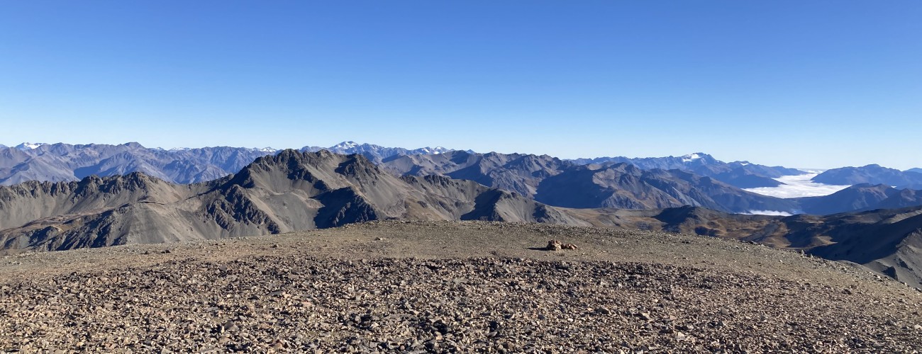
Above 1500 m elevation you’ll leave the vegetation behind and enter a world of loose greywacke scree, a defining feature of the Craigieburn Range. The route heads around the northern side of Pt 1855, where the mountainside is essentially one big scree slope, dropping steeply away into Long Creek valley to the right. Take care on this section, as loose gravel over compacted scree can be slippery underfoot. The route steepens and passes outcrops of bedrock that jut out of the scree as you near the summit.
A cairn marks the summit. Enjoy the panoramic views, with Castle Hill Basin and Torlesse Range to the east, and the craggy peak of Mt Olympus standing out to the west.
The peak is named after W. J. Cloudesley, who originally owned the Cass Hotel before taking over the Castle Hill Hotel in 1883 and Springfield Hotel in 1898.
Beyond Mt Cloudesley summit
From the summit it’s possible to continue both north and south along the Craigieburn Range.
To the south lies Mt Enys (2194 m), the highest point on the Craigieburn Range. It is a common extension from Mt Cloudesley, and the 3.5 km traverse between the two summits is relatively straightforward in clear conditions for experienced parties. The ridge between the two peaks is remarkably broad and gently sloping, allowing straightforward travel along its crest. Note that if you climb Mt Enys, you will have to return the way you came, or alternatively descend via Dead Man Spur and climb back over Leith Hill to return to where you started.
If you head north from Mt Cloudesley, you can reach the top of the Mt Cheeseman Ski Area via the summits of Mt Izard (2019 m) and Mt Cheeseman (2031 m). This traverse is also relatively straightforward, with the narrow ridge between Pt 1959 and Mt Cheeseman providing the most challenging section. From the ski area, descend via the Mt Cheeseman Ski Area access road and Hogs Back Track to return to the car park.


The Craigieburn Range is an alpine environment, so thorough preparation is essential to ensure a safe trip. The route is located at a high elevation and is extremely exposed. You must always be prepared for freezing conditions and take extreme care if snow and ice are present. Make sure you carry plenty of water with you as there are no water sources along the way. As this is an unmarked route, you must have appropriate navigation skills, especially when visibility is poor.
See the Mountain Safety Council website for useful information on preparing for the outdoors.
Hogs Back Track
Walking, trail running and MTB