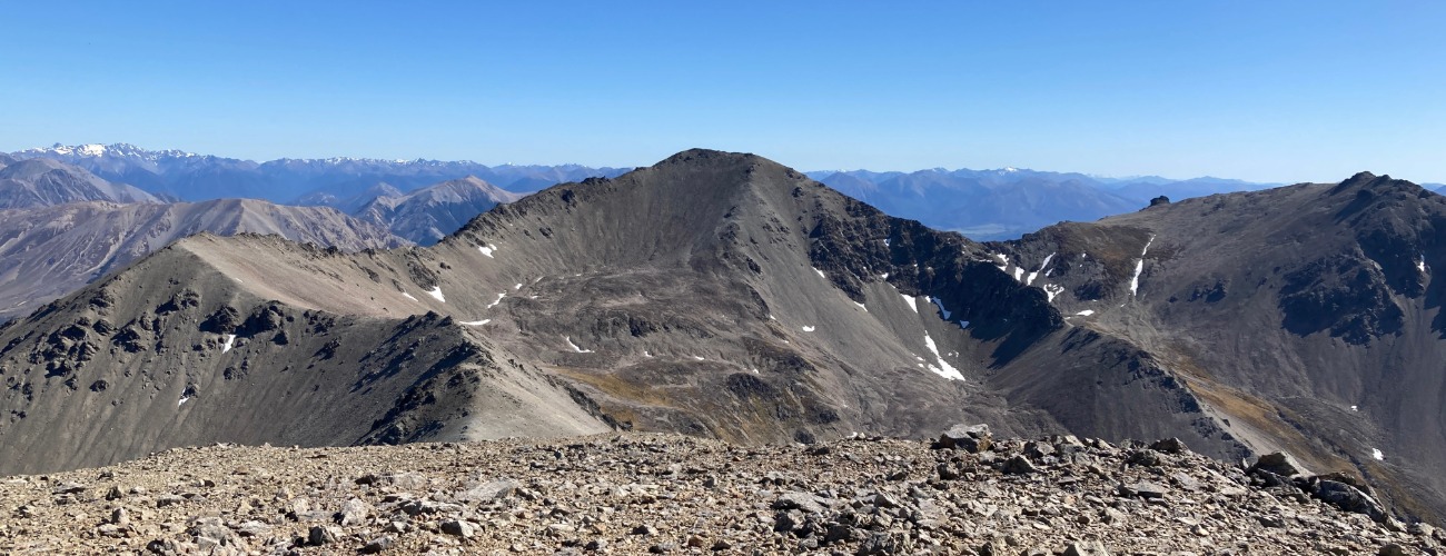
Mt Torlesse
Korowai/Torlesse Tussocklands Park
Mt Torlesse (1961 m) is the third highest and second most accessible peak on the Torlesse Range, a prominent feature on the western skyline for much of the northern Canterbury Plains. An unmarked but well-worn route climbs to the summit from SH73 at the base of Porters Pass. Be aware that the route passes through Brooksdale Station and permission should be sought beforehand. Mt Torlesse is named after Charles Torlesse (1825-1866), a surveyor for the Canterbury Association, who was the first European to climb the peak.
| Details | |
| Length | 18.3 km return to the summit from SH73 |
| Time Required | 6-9 hr return to the summit from SH73 |
| Trail Type | Unmarked route |
| Physical Difficulty | Hard |
| Uses | Walking |
| Start Elevation | 630 m |
| Max Elevation | 1961 m |
Mt Torlesse Route is an unofficial, unmarked route and does not connect with any other official tracks.
1 hr from Christchurch
Mt Torlesse is accessed directly from SH73 at the base of Porters Pass. There is a rest area next to the eastbound lane at a place called the Roadman’s Hut (which is on the opposite side of the road); heading west from Springfield, this rest area is located on the right after the second bridge across the Kowai River, just prior to where the highway begins the winding climb up to the pass (look out for the group of pine trees). A gate at the rest area provides access to the Kowai River Valley, which heads northeast towards Mt Torlesse.
The river flats on the valley floor are part of Brooksdale Station. You must seek permission prior to entering (phone or message 027 651 1422).
The route begins by heading along a farm track through Brooksdale Station, along river flats on the true right of the Kowai River. Leave the gates that you pass as you found them. As you make your way up the valley, Mt Torlesse will have an increasingly imposing presence ahead. The farm track ends at Foggy Stream, after which you must follow the river bed up the valley to the John Hayward Memorial Hut (built in 1973 as part of a high country catchment study), which can be seen on the true left of the river.
At the hut, you’ll need to pick up the worn route that follows the narrow but obvious spur to the left of the hut (on the true right of the stream adjacent to the hut). Climb the spur as it curves to the right, gradually ascending through knee-height subalpine scrub and tussock until about 1,300 m, above which the mountain slope is almost entirely bare rock and scree, which is loose in places. From here, it’s a continuous climb directly to the summit.
At the summit, enjoy the expansive views across the Canterbury Plains and the neighbouring peaks along the Torlesse Range.
Return the way you came.
Experienced parties can venture further along the Torlesse Range to the neighbouring peaks, or even make a circuit to the summit of Porters Pass via Castle Hill Peak.


The Torlesse Range is an alpine environment, so thorough preparation and care should be made to ensure a safe trip. The route is located at a high elevation and is extremely exposed, so proper outdoor clothing is essential. You must always be prepared for freezing conditions and take extreme care if snow and ice are present. Make sure you carry plenty of water with you as there are no water sources on the way up, and the entire route has virtually no tree cover. As this is an unmarked route, you must have appropriate navigation skills, especially when visibility is poor.
See the Mountain Safety Council website for useful information on preparing for the outdoors.
Mt Torlesse Route is an unofficial, unmarked route and does not connect with any other official tracks.