Helicopter Hill
Craigieburn Forest Park
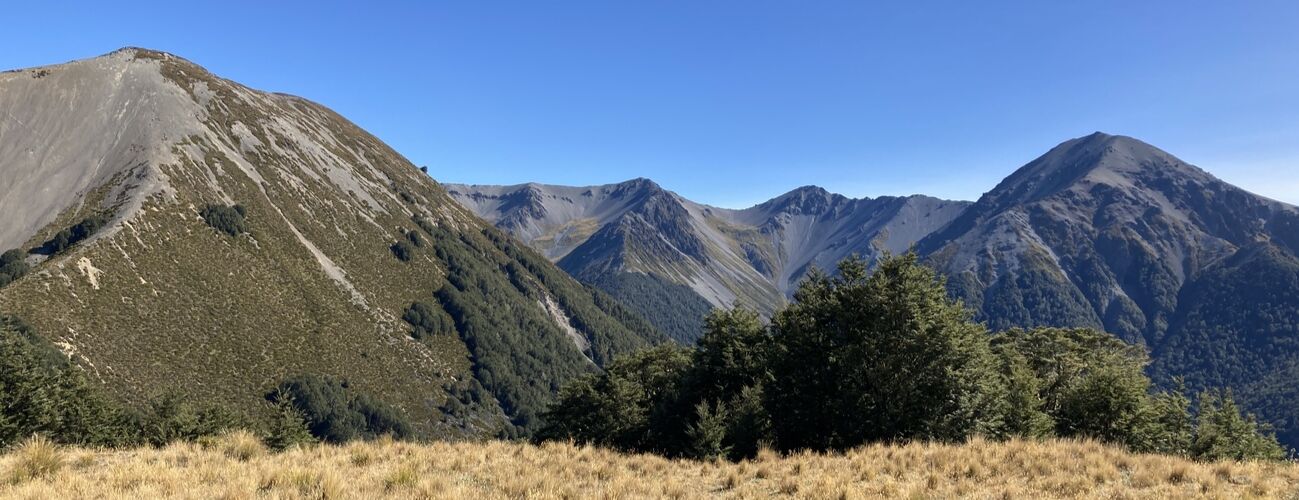
Helicopter Hill (1256 m) is a foothill on the Craigieburn Range and can be climbed as a short walk via several tracks. It is a relatively straightforward walk compared with the much higher peaks of the range proper, but it provides great views of the Castle Hill Basin and the surrounding ranges.
| Details | |
| Length | 5.2 km out-and-back; 7.5 km as a circuit (via Luge Track, Craigieburn Valley Rd and Sidle 73 Track) |
| Time Required | 2 hr out-and-back; 3 hr as a circuit (via Luge Track, Craigieburn Valley Rd and Sidle 73 Track) |
| Trail Type | Tramping track |
| Physical Difficulty | Moderate |
| Uses | Walking and trail running |
| Start Elevation | 800 m |
| Max Elevation | 1256 m |
Craigieburn Edge Track
Walking, trail running and MTB
Luge Track
Walking, trail running and MTB
1 hr 25 min from Christchurch
From Christchurch, head west along SH73. Climb over Porter’s Pass and continue for 10 minutes past Castle Hill Village until you reach the left-hand turn-off to Broken River Rd.
The track begins at the car park next to the DOC Mistletoe Flat campsite, which is a short distance up the road.
From Mistletoe Flat car park, cross the bridge over Cave Stream and follow Mistletoe Track as it heads up the valley and starts climbing the hillside, initially in black beech forest which transitions to mountain beech as you gain elevation towards Lyndon Saddle.
Once at the saddle, Helicopter Hill Track branches to the right, climbing the remaining 150 vertical metres through sections of open scree to the summit. The flat-topped summit is below the natural tree line but clear of trees, providing great views of the Castle Hill Basin, Torlesse Range and Craigieburn Range.
The hill got its name from being the first hill in New Zealand to be oversown using a helicopter-mounted “Sling King” seed bucket in the early 1980s. The surrounding slopes were heavily affected by wilding pines, a legacy of exotic conifers first planted in the Craigieburn area during the 1950s. Today, you can still see where these invasive trees have been removed as part of ongoing efforts to restore the open tussock landscape, reduce wildfire risk following several destructive fires in recent years, and maintain the open character of the Castle Hill Basin.
Return options
On the return leg, you can return the way you came via Mistletoe Track, or alternatively, make a circuit via Luge Track which also intersects the saddle as it runs between Broken River Rd and Craigieburn Edge Track (refer to map). Note that Luge Track is a shared track also used by mountain bikers.
For a shorter circuit, take Luge Track to the left (the same direction from which you arrived on Mistletoe Track). From the saddle, Luge Track sidles the hillside, before descending to connect with Broken River Rd, about 1.8 km up the valley from the car park. Follow the road downhill back to Mistletoe Flat.
The second circuit option is to take Luge Track to the right from the saddle, descending north to connect with Craigieburn Edge Track less than a kilometre from the saddle. Turn right and follow Craigieburn Edge Track, which runs parallel to Craigieburn Valley Rd lower on the hillside before descending to meet the road. Follow the road down to where it leaves the beech forest, and turn right at Sidle 73 Track, which crosses open grassland and a regenerating wildfire-affected area beside SH73, before dropping back to cross Cave Stream and returning to the Mistletoe Flat car park.
Lyndon Saddle to Camp Saddle
For experienced parties with navigation skills, you can also navigate to Camp Saddle from Lyndon Saddle. Note that this route is generally easier if done to in the Camp Saddle to Lyndon Saddle direction.
At Lyndon Saddle, head directly up the ridge along a vaguely worn track to the tree line (note that there are occasional markers, although they are generally only obvious when coming downhill). Once at the tree line, veer right and climb the rib of scree that is framed by tussock and scrub for part of the way up, continuing up up steep open scree to the crest of the ridge. Once on the crest of the ridge, it’s a straightforward traverse to Camp Saddle, where you pick up the marked track that leads off the saddle, back to the tree line and down to Broken River Rd.
Craigieburn Edge Track
Walking, trail running and MTB
Luge Track
Walking, trail running and MTB