Escarpment Track
Millerton
Escarpment Track is a short out-and-back walk in Millerton, a historic coal mining settlement north of Westport. Situated at 300 m elevation on a plateau above Granity, the unique settlement was the base for extensive underground coal mining from the 1890s until 1960. Escarpment Track showcases some of the surviving relics of this era and can be visited as part of a wider exploration of the historic sites scattered around the settlement.
| Details | |
| Length | 2.2 km return |
| Time Required | 1 hr return |
| Trail Type | Walking track/Route |
| Uses | Walking |
| Physical Difficulty | Moderate |
Escarpment Track does not connect to any other official tracks.
30 min from Westport
Escarpment Track begins at the historic Millerton Bathhouse.
Head north from Westport along SH67. At Granity, turn right onto Millerton Rd, the access road for both Stockton Mine and Millerton. The road climbs steeply and passes through a cutting locally dubbed the ‘Grand Canyon’. Turn right onto the signposted turnoff to Millerton, and once in the settlement, turn left onto Napier St after the Granity Creek bridge. Follow Napier St to its end, where a turning circle marks the beginning of the track.
The car park is located right beside the historic formation of the Old Dip Mine incline, self-acting tramway constructed between 1893-95 and in operation from 1896 to 1963. The half-buried uphill entrance to the long-collapsed Porridge Hill Tunnel on the incline can be seen on the right. The portal to Old Dip Mine is further uphill, though is overgrown and hard to access. This incline descended the hillside parallel to present-day Napier St, to the transfer station at the top of the main Millerton Inline; little evidence of this area remains, in amongst regenerating native bush near the old swimming pool at the end of High St.
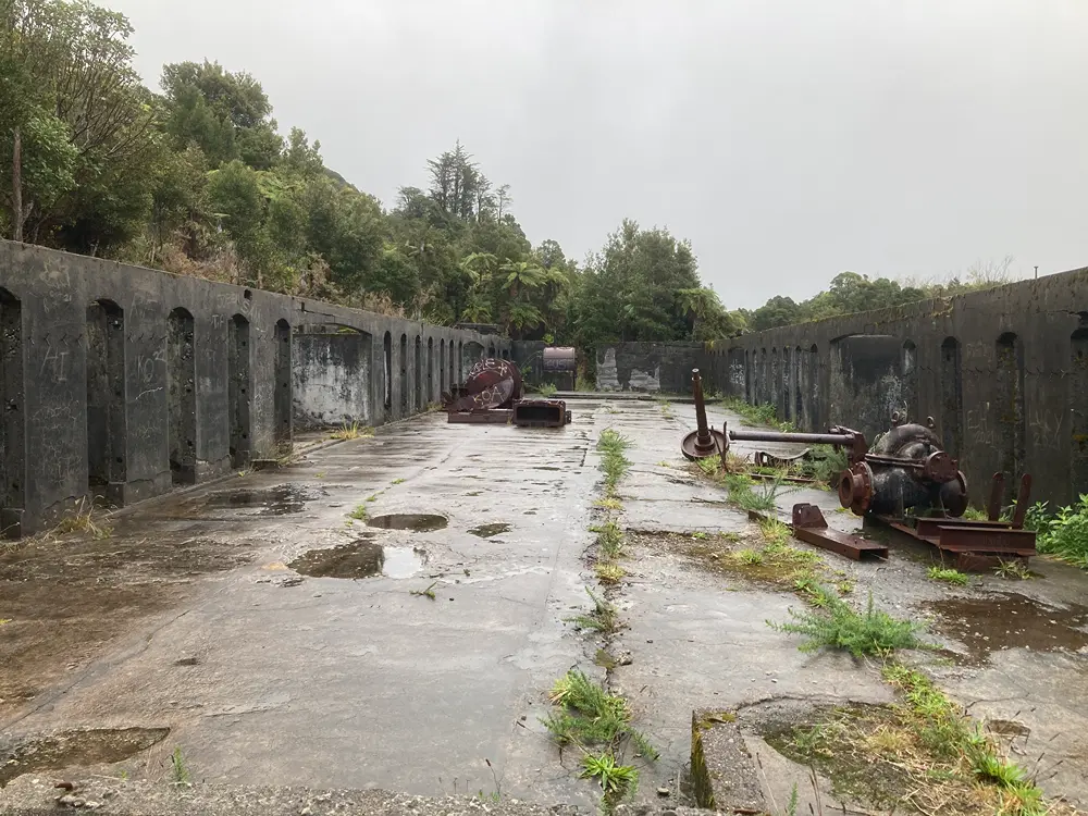
Immediately beyond the incline are the structural remains of the Millerton Bathhouse, built in 1920 by the Westport Coal Company. This served as the miners’ changing and washing facility and stands beside a former reservoir that supplied water to the mining complex.
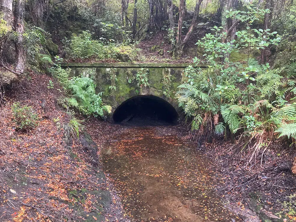
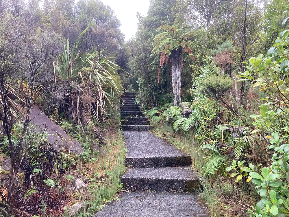
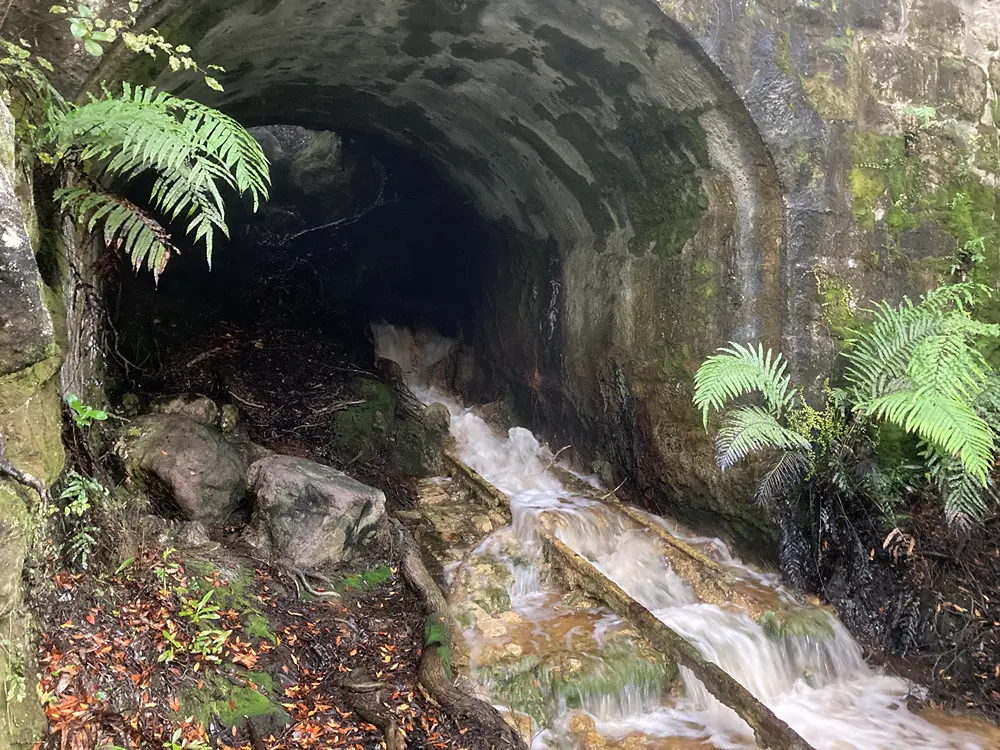
Right next to the bathhouse and signposted as ‘Escarpment Track’, a series of concrete steps enter the bush and climb the hillside behind the bathhouse. Follow these to the surviving entrance portal of Mine Creek Mine, opened in 1899 where another incline also descended to the transfer station. The incline passed beneath what is now Napier St, the same road used to access the track. The mine has long since collapsed, though the portal and the uppermost section of the incline track remain, now acting as a drainage path for an ephemeral watercourse.
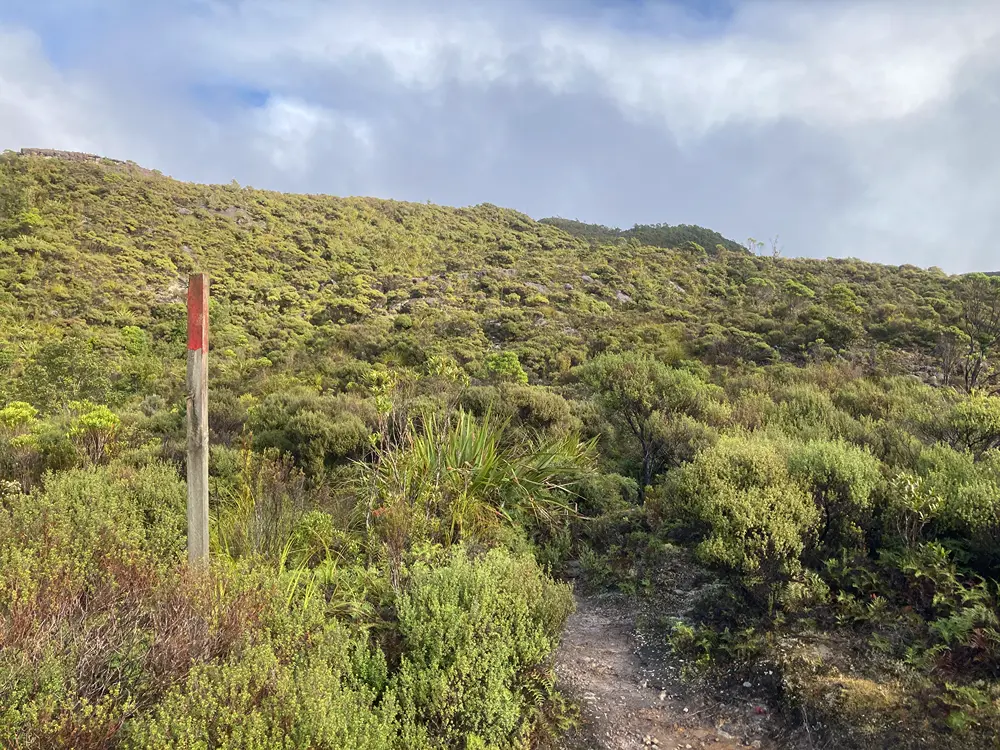
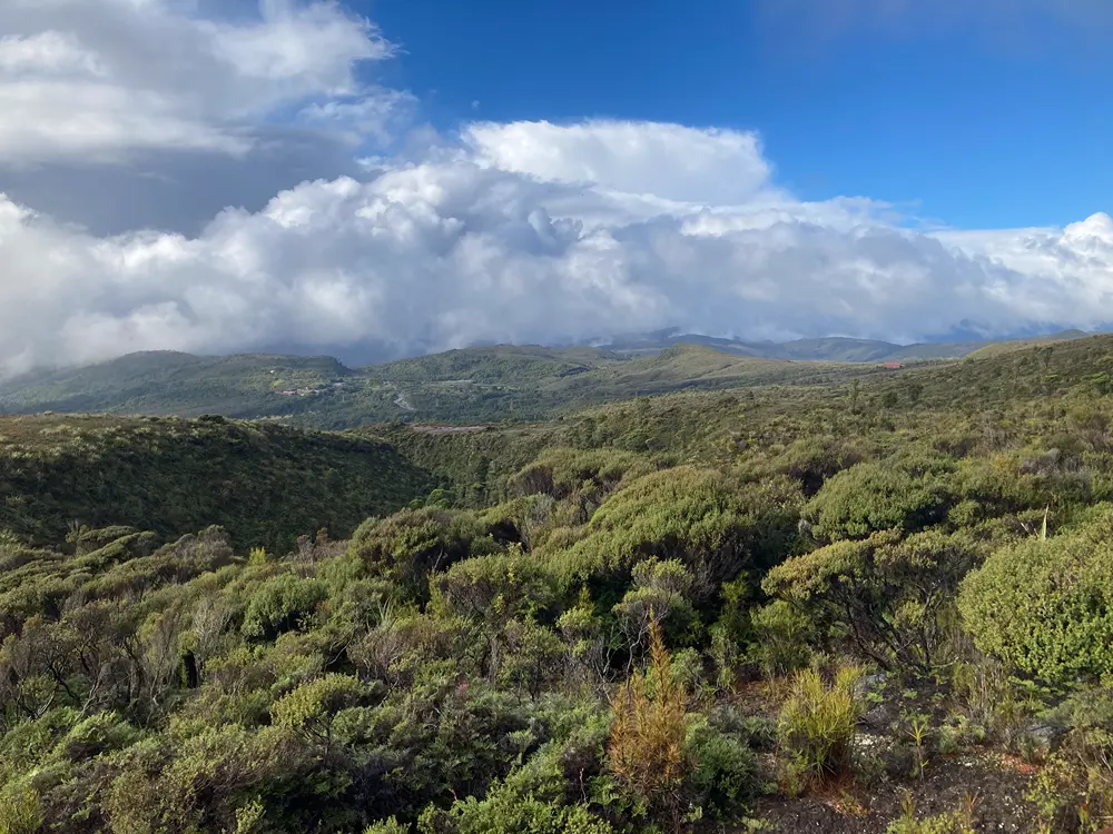
Follow the mossy stone steps that climb above the portal, where Escarpment Track continues up the hillside as a rocky path through low mānuka scrub, tangle fern and mountain flax, with wooden stakes marking the way ahead. This area is part of the Millerton Reserve; not official public conservation land, but an area advocated for by Millerton and Plateau Protection Society to preserve the area’s ecological and heritage values and act as a buffer between the settlement and the continuing operations of Stockton Mine.
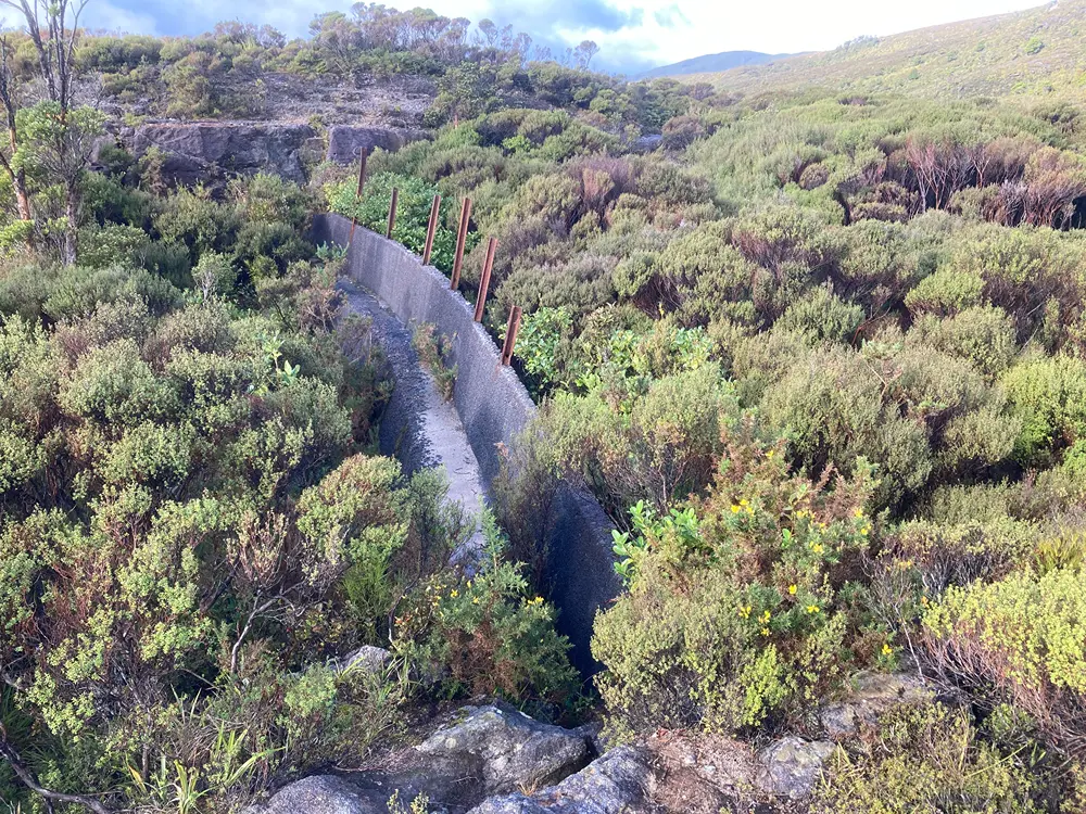
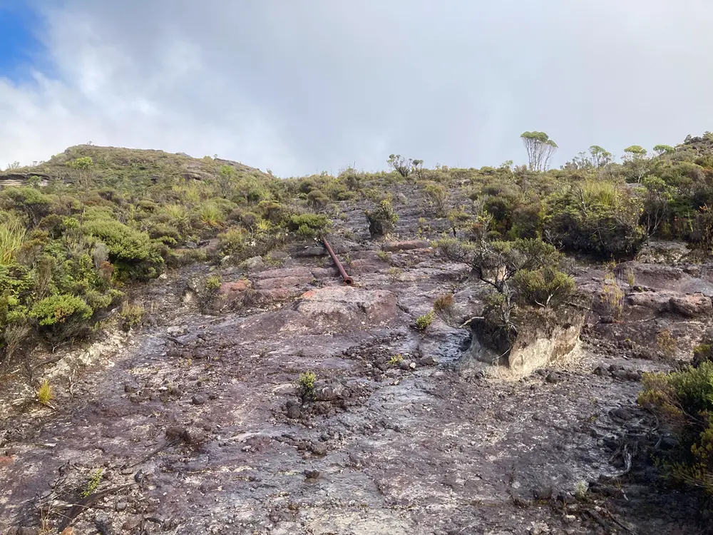
After around 300 m the hillside levels out and you’ll reach a small concrete dam, the remains of a now-empty reservoir. Above here the track follows areas where the topsoil has been stripped down to bedrock, and the rusty remains of a pipeline lie scattered, leading to the site of Mine Creek Settlement, a tiny mining community established in 1899 in a steep gully about 1 km east of the track and abandoned during the 1930s. Remains of the settlement have been gradually destroyed over the last century by the expanding works of Stockton Mine.
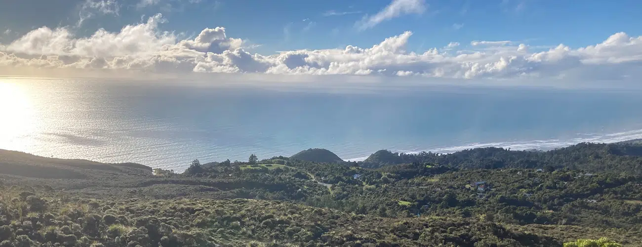
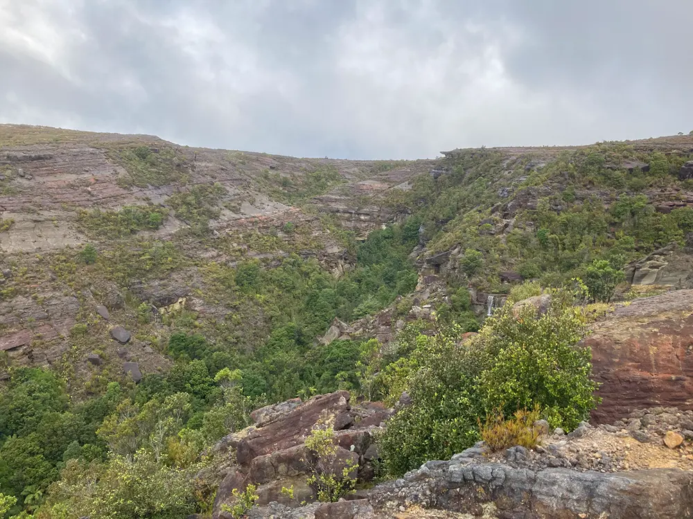
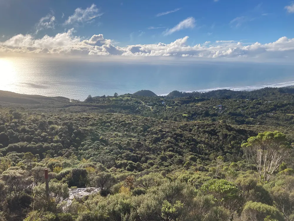
The last section of the track is not as well-defined; but stay on the obvious spur as it curves to the right toward a rocky crest on the ridge above, with the deep, bluffed gully of Miller Stream dropping away on the left. At the top of this you’ll reach the ‘escarpment’, a blocky sandstone outcrop on the edge of the plateau, featuring curious rock formations and fallen boulders. From this 500 m perch, clear days offer sweeping views across the Tasman Sea, which dominates the western horizon. The Buller coastline curves to the north, and in really clear conditions you’ll be able to see as far as Iwituaroa Range, north of the Heaphy River mouth, 80 km away. To the north, the Stockton Plateau slopes away towards the distinctive line of Stockton Mine’s aerial ropeway. This is where the track ends; return the way you came.
Geology and Ecology
Beyond its mining heritage, Millerton and the wider Stockton Plateau are notable for their interesting geology and flora. The topography is characterised by sandstone pavements, rocky benches and boulder fields, with steep escarpments and deeply incised gullies forming a distinctive coal-measure landscape above the coast. The plateau’s wet, nutrient-poor coal-measure soils support a patchwork of tussockland, mānuka and stunted forest unlike the surrounding West Coast bush. A variety of endemic alpine and subalpine species occur, rarely seen at such low elevations, giving the landscape a surprisingly upland character despite its modest height above sea level. The sheltered gullies and deep fissures support dense stands of mountain beech, southern rātā, kaikawaka and yellow-silver pine. In the open pavement areas, particularly on the modified ground above the escarpment, scattered southern rātā and kāmahi persist, with some hardy specimens growing directly from fractures in the bedrock.
Mining at Millerton ceased in 1960. Large-scale opencast mining at Stockton began in 1944, and much of the plateau has since been significantly modified by mining and rehabilitation works.
Do not leave the marked track. Mine relics and unstable structures are scattered throughout the area, many concealed by dense vegetation. Hidden shafts, rusty metalwork and collapsed earthworks pose potential hazards.
Beyond the end of Escarpment Track lies Stockton Mine, New Zealand’s largest opencast coal mine. This is an active industrial site and public access beyond authorised areas is not permitted. Warning signs mark areas affected by historic mine fires and toxic gases associated with burning coal seams. These hazards can be serious and should not be approached.
Escarpment Track does not connect to any other official tracks.