Heaphy Track is one of New Zealand’s Great Walks, and arguably its most topographically and botanically diverse. At 74 km in length, the track journeys over the subalpine interior of Kahurangi National Park between the Aorere Valley in Golden Bay, and the northern of the West Coast, and is typically completed in four days. While Maori settled the coastline around the Heaphy River mouth as early as the 13th century, the track largely follows the approximate route used by gold prospectors in the mid-19th century. It is named after Charles Heaphy (1820-81), an explorer and Victoria Cross recipient, who once completed an expedition around the Kahurangi Coast between Whanganui Inlet and Heaphy River mouth, but never actually followed the present-day inland route.
| Details | |
| Distances | 74 km full length; 16.3 km Brown Hut to Perry Saddle Hut; 6.7 km Perry Saddle Hut to Gouland Downs Hut: 5.4 km Gouland Downs Hut to Saxon Hut; 11.5 km Saxon Hut to James Mackay Hut; 18.1 km James Mackay Hut to Heaphy Hut; 15.7 km Heaphy Hut to Kohaihai |
| Time Required | 4-5 days |
| Trail Type | Shared track |
| Physical Difficulty | Moderate |
| Technical Difficulty | Advanced |
| Uses | Walking, trail running and MTB |
| Direction | Either |
If any layers fail to load, try clearing your cache and refreshing the page.
The track is located in one of the wettest parts of the country and reaches subalpine environments. Expect wet and freezing conditions at any time of year and prepare accordingly. Parts of the track along the Heaphy Coast are subject to inundation by high tides and large waves; check the DOC tide timetable prior to your trip so you can avoid high tide.
See the Mountain Safety Council website for useful information on preparing for the outdoors.
Hut and campsites must be booked prior to embarking.
Heaphy Track has two access points at each end. Aorere Valley, inland from Collingwood in Golden Bay, and Kohaihai, north of Karamea on the West Coast. The Heaphy is a standalone track, meaning no other official tracks connect to it.
Golden Bay end – 2 hr 30 min from Nelson
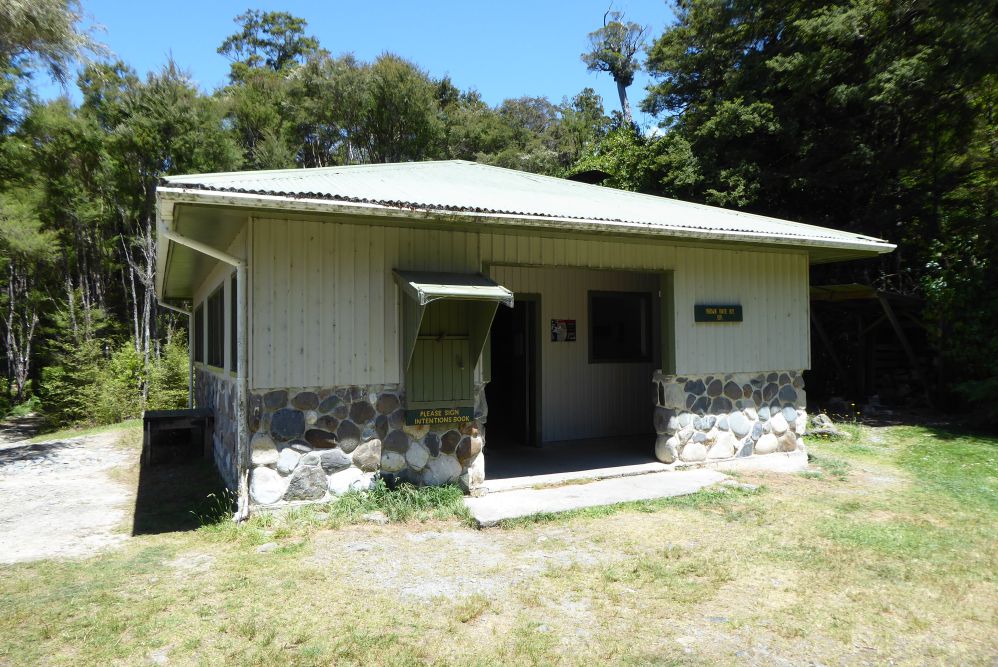
The Golden Bay/Collingwood end of the track is a 32 km drive up Aorere Valley from Collingwood. Just prior to entering Collingwood on SH60, take the lefthand turn and follow the ‘Heaphy Track’ signs directing you up Aorere Valley. The last several kilometres of Aorere Valley Road are unsealed. The first hut on the Golden Bay side, Brown Hut, is located only a 2 min walk along the track from the car park.
Karamea end – 15 min from Karamea | 4 hr 30 min from Nelson
The Karamea end of the track is at Kohaihai River, 16 km north of Karamea. Here there’s a DOC campsite with a picnic shelter and flush toilets, as well as an information panel on the Heaphy Track.
Being a Great Walk, the Heaphy Track is in high demand and bookings are essential. Excluding the respective road ends, there are five huts and three campsites along the way. The track is typically walked from east to west (Golden Bay end to Karamea end), as this is the easier direction (downhill overall). Several companies offer pick up, drop off and car relocation services to both ends of the track.
Mountainbikers are permitted to ride the Heaphy Track between 1 May and 30 November.
| Distance | 16.3 km |
| Time Required | 5-6 hr |
After the short distance from the car park to Brown Hut, the track climbs the western side of the Aorere Valley at a steady but gentle rate. This part of the track is entirely in bush, which gradually transitions from a beech-podocarp mix with dense undergrowth, to mainly kamahi, beech, and a bit of dracophyllum, as you climb. You’ll get only fleeting views toward Olympus Peak, to the southeast across the Aorere River valley. The turn-off to Shakespeare Flat (a dead-end track that descends to a river flat next Aorere River) is reached after 5.1 km, and Aorere Shelter after 11.7 km. Located at 800 m elevation, the open shelter provides a toilet, benchtop and sink, and a small camping area. Soon after you’ll reach Flanagan’s corner, which at 910 m is the highest point on the track. A short sidetrack leads to a lookout, providing views over the upper Aorere Valley.
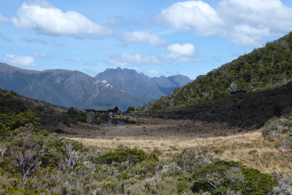
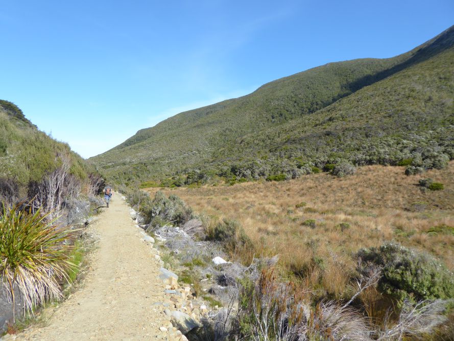
The large, modern, Perry Saddle Hut and campsite is located on Perry Saddle (890 m elevation), with views southeast towards the Douglas Range. The eastern side of the saddle drops steeply into the Aorere River Valley, but the western side slopes gently westward into a tussock valley. The birdlife around the hut is exceptional; kea and kaka are likely to be seen, and great spotted kiwi/roroa may be heard at night.
A short distance west of the hut, a side route leads to the summit of Mt Perry (1238 m); allow 90 mins for a return trip to the summit.
| Perry Saddle Hut | |
| Hut Type | Great Walk Hut |
| Capacity | 28 bunks |
| Bookings | Bookings required |
| Elevation | 890 m |
| Distances | 12.1 km |
| Time Required | 3-4 hr |
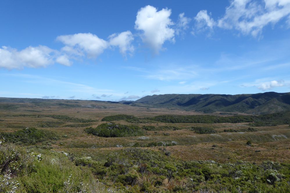
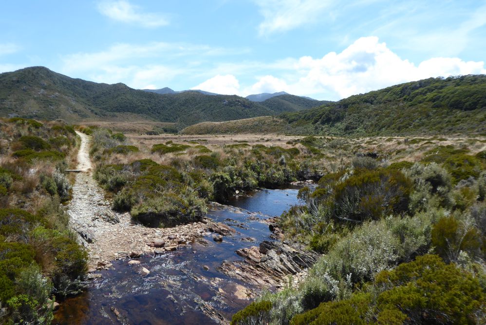
From Perry Saddle Hut the track descends gently westward down the Perry Creek valley, through mainly kamahi forest. After roughly 2.5 km you’ll reach the eastern edge of Gouland Downs, an ancient peneplain situated mainly between 600 and 800 m elevation. Infertile soil means the downs are largely cloaked in tussock, with beech forest growing in the steep gullies that have been dissected by streams. Gouland Downs are named after Henry Godfrey Gouland, who briefly ran sheep there in the mid 1800s. The downs are now the second stronghold of takahē, the latter having been released there in 2018, after concerted effort for pest control. This, combined with the downs’ topography, act as a natural barrier for cats and stoats, allowing existing populations of other native bird species to remain healthy. Gouland Downs Hut was built in 1936, having been rebuilt after its 1915-built predecessor burnt down in 1932. The hut is positioned next to a small, forested limestone belt, that features several small caves.
| Gouland Downs Hut | |
| Hut Type | Great Walk Hut |
| Capacity | 8 bunks |
| Bookings | Booking required |
| Elevation | 634 m |
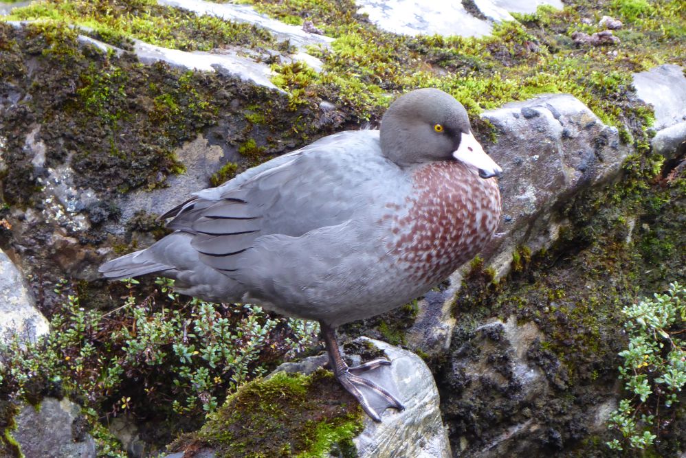
Onward from Gouland Downs Hut, the track continues west across the downs, crossing Shiner Brook, Big River and Weka Creek by bridges, then tracing the base of the Slate Range for the remainder of the distance to Saxon Hut. Keep an eye out for whio, which may be seen in the larger waterways.
Saxon Hut was built in 1982 and is named after James Buller Saxon, who was engaged in 1885 by the Collingwood County Council to survey a track to the Gouland Downs from Brown Hut. The hut is mostly surrounded by tussock and has a nice outlook to the east, with views of the Gouland Range.
| Saxon Hut | |
| Hut Type | Great Walk Hut |
| Capacity | 16 bunks |
| Bookings | Bookings required |
| Elevation | 705 m |
| Distances | 11.5 km |
| Time Required | 3-4 hr |
The track skirts the southern edge of Mackay Downs, characterised by low ridges and valleys of tussock. The infertility of the sandy granite and peaty soil means the surrounding vegetation is largely stunted manuka and mountain beech, and sections of boardwalk cross boggier sections. The Mackay Downs are similar in size to Gouland Downs though have much greater forest cover. The lonely Ministry of Works hut is situated roughly 4 km north of the Heaphy Track, via an unofficial and seldom-used route. The hut was built in 1970 by the Ministry of Works for surveyors prospecting a route for a proposed road between Collingwood and Karamea; thankfully, this never eventuated due to strong public opposition.
James Mackay Hut is perched at the southwestern edge of Mackay Downs, in a position that provides views out to the coast and the Heaphy River mouth.
| James Mackay Hut | |
| Hut Type | Great Walk Hut |
| Capacity | 28 bunks |
| Bookings | Bookings required |
| Elevation | 700 m |
| Distance | 18.1 km |
| Time Required | 5-6 hr |
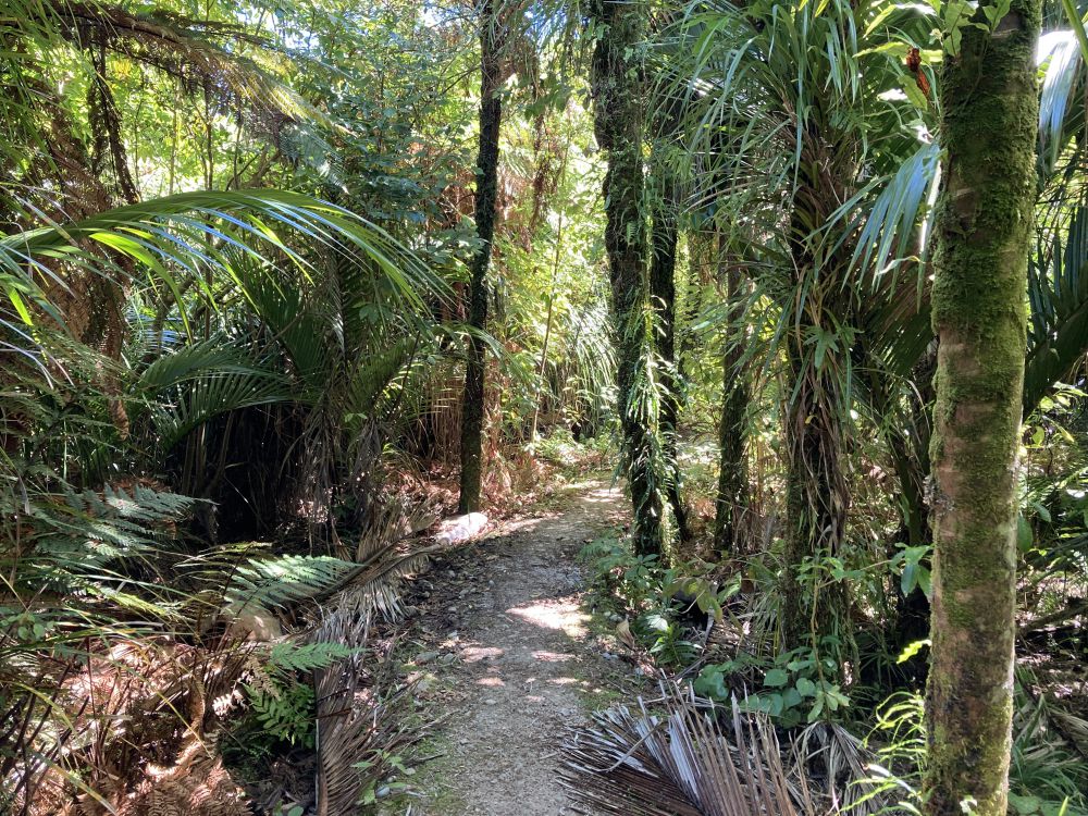
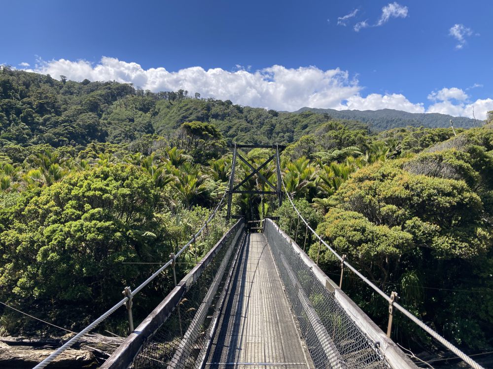
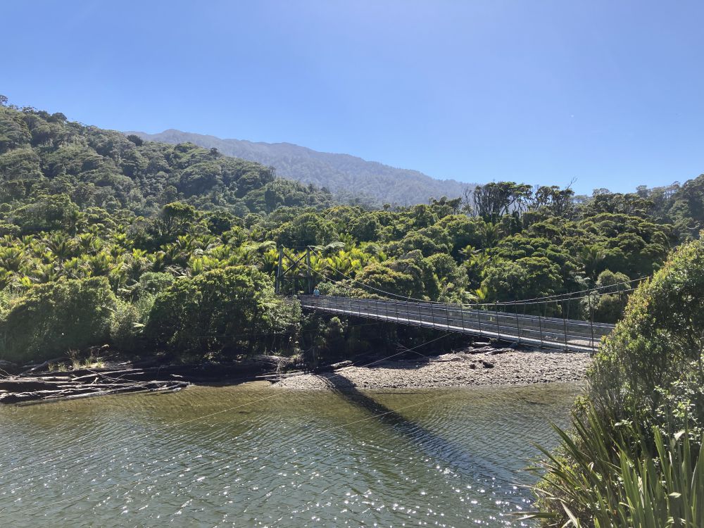
From James Mackay Hut, the track makes a long and gradual southwesterly descent along a spur that separates the Heaphy and Lewis rivers. Eventually it reaches Lewis Shelter (formerly a hut until 2018), located at the confluence of the Heaphy and Lewis rivers. A new 101 m-long bridge (October 2023) crosses the Lewis River, and another crosses the Heaphy River to the true left. Now at only 10 m elevation, the surrounding forest has a typically lush West Coast appearance, with podocarp, northern rata, and dense subcanopy of nikau, ferns and kiekie. The remaining distance to the coast is virtually flat, as track heads along the true left of the Heaphy River, skirting beneath some limestone bluffs and crossing Gunner River via a bridge. The forest becomes increasingly dominated by nikau as you get closer Heaphy Hut; the latter is positioned on a grassy terrace overlooking the river, just upstream of the mouth.
| Heaphy Hut | |
| Hut Type | Great Walk Hut |
| Capacity | 32 bunks |
| Bookings | Bookings required |
| Elevation | 10 m |
| Distances | 15.7 km |
| Time Required | 4-5 hr |
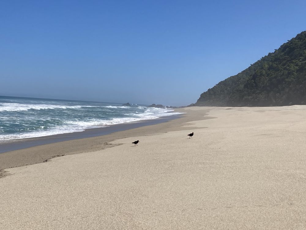
From Heaphy Hut the track heads south along the coast. For most of distance from the Heaphy River mouth to Kohaihai, the track is wedged between the steep forested hillside and the Tasman Sea. This section of the Heaphy Track is often considered the highlight, given the novelty of walking along the coast next to pristine white beaches and pounding surf, and through dense nikau groves. Note that this section is often muddy.
Occasional access points to the sand beaches that headlands with beach in between, some rocky and some sandy. There are bridges across Wekakura Creek and Katipo Creek, and after crossing the latter you will reach Katipo Creek Shelter and Campsite, roughly 7 km from Heaphy Hut.
Parts of the track between Katipo Creek Shelter and Scotts Beach can be overtopped by waves during rough seas and high tide. In this situation you will have to wait until the tide recedes enough for you to safely pass.
It’s another 5.5 km to Scotts Beach (a great place for a wander, and a popular day walk destination from Kohaihai). The track climbs steadily to a saddle above Scotts Beach, in order to avoid the impassable Kohaihai Bluff. It then descends toward the Kohaihai River, passing through a dense grove of nikau (through which the short Nikau Walk passes) before crossing the river and reaching the Kohaihai track end.
Heaphy Track is one of New Zealand’s Great Walks, and arguably its most topographically and botanically diverse. At 74 km in length, the track journeys over the subalpine interior of Kahurangi National Park between the Aorere Valley in Golden Bay, and the northern of the West Coast, and is typically completed in four days. While Maori settled the coastline around the Heaphy River mouth as early as the 13th century, the track largely follows the approximate route used by gold prospectors in the mid-19th century. It is named after Charles Heaphy (1820-81), an explorer and Victoria Cross recipient, who once completed an expedition around the Kahurangi Coast between Whanganui Inlet and Heaphy River mouth, but never actually followed the present-day inland route.
| Details | |
| Distances | 74 km full length; 16.3 km Brown Hut to Perry Saddle Hut; 6.7 km Perry Saddle Hut to Gouland Downs Hut: 5.4 km Gouland Downs Hut to Saxon Hut; 11.5 km Saxon Hut to James Mackay Hut; 18.1 km James Mackay Hut to Heaphy Hut; 15.7 km Heaphy Hut to Kohaihai |
| Time Required | 4-5 days |
| Trail Type | Shared track |
| Physical Difficulty | Moderate |
| Technical Difficulty | Advanced |
| Uses | Walking, trail running and MTB |
| Direction | Either |
Heaphy Track has two access points at each end. Aorere Valley, inland from Collingwood in Golden Bay, and Kohaihai, north of Karamea on the West Coast. The Heaphy is a standalone track, meaning no other official tracks connect to it.
Golden Bay end – 2 hr 30 min from Nelson
The Golden Bay/Collingwood end of the track is a 32 km drive up Aorere Valley from Collingwood. Just prior to entering Collingwood on SH60, take the lefthand turn and follow the ‘Heaphy Track’ signs directing you up Aorere Valley. The last several kilometres of Aorere Valley Road are unsealed. The first hut on the Golden Bay side, Brown Hut, is located only a 2 min walk along the track from the car park.
Karamea end – 15 min from Karamea | 4 hr 30 min from Nelson
The Karamea end of the track is at Kohaihai River, 16 km north of Karamea. Here there’s a DOC campsite with a picnic shelter and flush toilets, as well as an information panel on the Heaphy Track.
Being a Great Walk, the Heaphy Track is in high demand and bookings are essential. Excluding the respective road ends, there are five huts and three campsites along the way. The track is typically walked from east to west (Golden Bay end to Karamea end), as this is the easier direction (downhill overall). Several companies offer pick up, drop off and car relocation services to both ends of the track.
Mountainbikers are permitted to ride the Heaphy Track between 1 May and 30 November.
| Distances | 16.3 km |
| Time Required | 5-6 hr |
After the short distance from the car park to Brown Hut, the track climbs the western side of the Aorere Valley at a steady but gentle rate. This part of the track is entirely in bush, which gradually transitions from a beech-podocarp mix with dense undergrowth, to mainly kamahi, beech, and a bit of dracophyllum, as you climb. You’ll get only fleeting views toward Olympus Peak, to the southeast across the Aorere River valley. The turn-off to Shakespeare Flat (a dead-end track that descends to a river flat next Aorere River) is reached after 5.1 km, and Aorere Shelter after 11.7 km. Located at 800 m elevation, the open shelter provides a toilet, benchtop and sink, and a small camping area. Soon after you’ll reach Flanagan’s corner, which at 910 m is the highest point on the track. A short sidetrack leads to a lookout, providing views over the upper Aorere Valley.
The large, modern, Perry Saddle Hut and campsite is located on Perry Saddle (890 m elevation), with views southeast towards the Douglas Range. The eastern side of the saddle drops steeply into the Aorere River Valley, but the western side slopes gently westward into a tussock valley. The birdlife around the hut is exceptional; kea and kaka are likely to be seen, and great spotted kiwi/roroa may be heard at night.
| Perry Saddle Hut | |
| Hut Type | Great Walk Hut |
| Capacity | 28 bunks |
| Bookings | Bookings required |
| Elevation | 890 m |
A short distance west of the hut, a side route leads to the summit of Mt Perry (1238 m); allow 90 mins for a return trip to the summit.
| Distance | 12.1 km |
| Time Required | 3-4 hr |
From Perry Saddle Hut the track descends gently westward down the Perry Creek valley, through mainly kamahi forest. After roughly 2.5 km you’ll reach the eastern edge of Gouland Downs, an ancient peneplain situated mainly between 600 and 800 m elevation. Infertile soil means the downs are largely cloaked in tussock, with beech forest growing in the steep gullies that have been dissected by streams. Gouland Downs are named after Henry Godfrey Gouland, who briefly ran sheep there in the mid 1800s. The downs are now the second stronghold of takahē, the latter having been released there in 2018, after concerted effort for pest control. This, combined with the downs’ topography, act as a natural barrier for cats and stoats, allowing existing populations of other native bird species to remain healthy. Gouland Downs Hut was built in 1936, having been rebuilt after its 1915-built predecessor burnt down in 1932. The hut is positioned next to a small, forested limestone belt, that features several small caves.
| Gouland Downs Hut | |
| Hut Type | Great Walk Hut |
| Capacity | 8 bunks |
| Bookings | Booking required |
| Elevation | 634 m |
Onward from Gouland Downs Hut, the track continues west across the downs, crossing Shiner Brook, Big River and Weka Creek by bridges, then tracing the base of the Slate Range for the remainder of the distance to Saxon Hut. Keep an eye out for whio, which may be seen in the larger waterways.
Saxon Hut was built in 1982 and is named after James Buller Saxon, who was engaged in 1885 by the Collingwood County Council to survey a track to the Gouland Downs from Brown Hut. The hut is mostly surrounded by tussock and has a nice outlook to the east, with views of the Gouland Range.
| Saxon Hut | |
| Hut Type | Great Walk Hut |
| Capacity | 16 bunks |
| Bookings | Bookings required |
| Elevation | 705 m |
| Distances | 11.5 km |
| Time Required | 3-4 hr |
The track skirts the southern edge of Mackay Downs, characterised by low ridges and valleys of tussock. The infertility of the sandy granite and peaty soil means the surrounding vegetation is largely stunted manuka and mountain beech, and sections of boardwalk cross boggier sections. The Mackay Downs are similar in size to Gouland Downs though have much greater forest cover. The lonely Ministry of Works hut is situated roughly 4 km north of the Heaphy Track, via an unofficial and seldom-used route. The hut was built in 1970 by the Ministry of Works for surveyors prospecting a route for a proposed road between Collingwood and Karamea; thankfully, this never eventuated due to strong public opposition.
James Mackay Hut is perched at the southwestern edge of Mackay Downs, in a position that provides views out to the coast and the Heaphy River mouth.
| James Mackay Hut | |
| Hut Type | Great Walk Hut |
| Capacity | 28 bunks |
| Bookings | Bookings required |
| Elevation | 700 m |
| Distances | 18.1 km |
| Time Required | 5-6 hr |
From James Mackay Hut, the track makes a long and gradual southwesterly descent along a spur that separates the Heaphy and Lewis Rivers. Eventually it reaches Lewis Shelter (formerly a hut until 2018), located at the confluence of the Heaphy and Lewis rivers. A new 101 m-long bridge (October 2023) crosses the Lewis River, and another crosses the Heaphy River to the true left. Now at only 10 m elevation, the surrounding forest has a typically lush West Coast appearance, with podocarp, northern rata, and dense subcanopy of nikau, ferns and kiekie. The remaining distance to the coast is virtually flat, as track heads along the true left of the Heaphy River, skirting beneath some limestone bluffs and crossing Gunner River via a bridge. The forest becomes increasingly dominated by nikau as you get closer Heaphy Hut; the latter is positioned on a grassy terrace overlooking the river, just upstream of the mouth.
| Heaphy Hut | |
| Hut Type | Great Walk Hut |
| Capacity | 32 bunks |
| Bookings | Bookings required |
| Elevation | 10 m |
| Distances | 15.7 km |
| Time Required | 4-5 hr |
From Heaphy Hut the track heads south along the coast. For most of distance from the Heaphy River mouth to Kohaihai, the track is wedged between the steep forested hillside and the Tasman Sea. This section of the Heaphy Track is often considered the highlight, given the novelty of walking along the coast next to pristine white beaches and pounding surf, and through dense nikau groves. Note that this section is often muddy.
Occasional access points to the sand beaches that headlands with beach in between, some rocky and some sandy. There are bridges across Wekakura Creek and Katipo Creek, and after crossing the latter you will reach Katipo Creek Shelter and Campsite, roughly 7 km from Heaphy Hut.
Parts of the track between Katipo Creek Shelter and Scotts Beach can be overtopped by waves during rough seas and high tide. In this situation you will have to wait until the tide recedes enough for you to safely pass.
It’s another 5.5 km to Scotts Beach (a great place for a wander, and a popular day walk destination from Kohaihai). The track climbs steadily to a saddle above Scotts Beach, in order to avoid the impassable Kohaihai Bluff. It then descends toward the Kohaihai River, passing through a dense grove of nikau (through which the short Nikau Walk passes) before crossing the river and reaching the Kohaihai track end.
The track is located in one of the wettest parts of the country and reaches subalpine environments. Expect wet and freezing conditions at any time of year and prepare accordingly. Parts of the track along the Heaphy Coast are subject to inundation by high tides and large waves; check the DOC tide timetable prior to your trip so you can avoid high tide.
See the Mountain Safety Council website for useful information on preparing for the outdoors.
Hut and campsites must be booked prior to embarking.
Updated 20 November 2023

