From Richmond, the Great Taste Trail heads south across the Waimea Plains, passing through vineyards and farmland to connect the villages of Brightwater and Wakefield. It is known as the Railway Section as it follows the former alignment of the historic Nelson-Glenhope Railway for much of its length.
| Details | |
| Length | 10 km Richmond to Brightwater; 19 km Richmond to Wakefield |
| Time Required | 1 hr – 1 hr 30 min Richmond to Wakefield (by MTB) |
| Trail Type | Shared track |
| Physical Difficulty | Easy |
| Technical Difficulty | Easy |
| Uses | Walking, trail running and MTB |
| Direction | Either |
If any layers fail to load, try clearing your cache and refreshing the page.
15 min from central Nelson (Richmond end)
The Richmond to Wakefield section of the Great Taste Trail begins at the sign-posted junction with the Richmond-Mapua section, at the southern end of Whakatu Coastal Pathway, next to the Reservoir Creek underpass through to Champion Rd.
As it links directly to Nelson’s network of urban routes, namely Whakatu Coastal Pathway and Railway Reserve Pathway, most Nelson residents can access the trail directly from home with little on-road travel.
For trail users doing a return trip to Brightwater or Wakefield, there are suitable car parks at Champion Rd (next to Richmond Aquatic Centre) and Lower Queen St. If you are doing the trail in the opposite direction (heading toward Richmond), there is plenty of street parking in both Brightwater and Wakefield. In Wakefield there is a public car park in the town centre on Whitby Way. See map for parking locations.
The trail is regularly marked with blue plastic posts and informative signs.
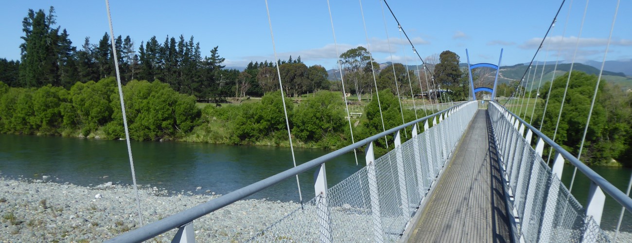
Heading south from Reservoir Creek underpass, the trail runs alongside Richmond Deviation as a shared pathway and crosses Lower Queen Street at the traffic lights (take care when crossing). The trail continues alongside Jubilee Park and passes beneath the State Highway 60 overbridge, one of only two bridges that were built over the railway line. This section continues south in a straight line through vineyards for 1.5 km to Ranzau Road, at which point it deviates from the original railway alignment and heads along the northern side of Ranzau Road. The trail remains sealed for a short distance before turning to gravel just before turning south to Pugh Road. After 2.4 km Pugh Road drops down an old river terrace and the trail crosses Waimea River via a suspension bridge, then continues along the true left of the river to Bryant Road in Brightwater.
A short distance down Bryant Road the trail turns left down a pedestrian access way to Somerville Lane, then crosses Ellis Street, the main street of Brightwater. Here you will find cafes and shops. Continue straight for a further The trail turns right down Charlotte Lane and back onto the original railway alignment, which is a grassed corridor through residential properties. An underpass goes beneath SH6 to Lord Rutherford Rd South. The Sir Ernest Rutherford Birthplace monument is located just to the right of the underpass, across Lord Rutherford Rd North.
Snowden’s Bush, one of the only remaining tracts of lowland podocarp forest (tōtara and matai) on the Waimea Plains, is a worthy deviation from the trail while you’re passing through Brightwater. Head west along Ellis Street to the roundabout with Bryant Rd and continue straight for a further 500 m until you see it on your right. Head back the way you came to get back on the trail.
South of Brightwater, the trail again leaves the former rail alignment and runs alongside Lord Rutherford Road South (which becomes Higgins Road) for 4.8 km, before reaching a gate at the road end. The trail is off-road for 1 km as it passes through a small grove of totara (which is what the surrounding landscape was once forested in), then connects to Edward Street, which it runs alongside for the remaining few hundred metres to Wakefield.
From Wakefield, the Great Taste Trail crosses Wai-iti River and continues south to Belgrove, Spooners Tunnel, Kohatu and Tapawera.
Brightwater and Wakefield are of similar size and also have similar amenities and services. Both have cafes, a pub and a small supermarket. There are several wineries within a short deviation from the trail in Brightwater. There are public toilets in Hope (Hope Community Centre), Brightwater and Wakefield.
From Richmond, the Great Taste Trail heads south across the Waimea Plains, passing through vineyards and farmland to connect the villages of Brightwater and Wakefield. It is known as the Railway Section as it follows the former alignment of the historic Nelson-Glenhope Railway for much of its length.
| Details | |
| Length | 10 km Richmond to Brightwater; 19 km Richmond to Wakefield |
| Time Required | 1 hr – 1 hr 30 min Richmond to Wakefield (by MTB) | Trail Type | Shared track |
| Physical Difficulty | Easy |
| Technical Difficulty | Easy |
| Uses | Walking, trail running and MTB |
| Direction | Either |
15 min from central Nelson (Richmond end)
The Richmond to Wakefield section of the Great Taste Trail begins at the sign-posted junction with the Richmond-Mapua section, at the southern end of Whakatu Coastal Pathway, next to the Reservoir Creek underpass through to Champion Rd.
As it links directly to Nelson’s network of urban routes, namely Whakatu Coastal Pathway and Railway Reserve Pathway, most Nelson residents can access the trail directly from home with little on-road travel.
For trail users doing a return trip to Brightwater or Wakefield, there are suitable car parks at Champion Rd (next to Richmond Aquatic Centre) and Lower Queen St. If you are doing the trail in the opposite direction (heading toward Richmond), there is plenty of street parking in both Brightwater and Wakefield. In Wakefield there is a public car park in the town centre on Whitby Way. See map for parking locations.
The trail is regularly marked with blue plastic posts and informative signs.
Heading south from Reservoir Creek underpass, the trail runs alongside Richmond Deviation as a shared pathway and crosses Lower Queen Street at the traffic lights (take care when crossing). The trail continues alongside Jubilee Park and passes beneath the State Highway 60 overbridge, one of only two bridges that were built over the railway line. This section continues south in a straight line through vineyards for 1.5 km to Ranzau Road, at which point it deviates from the original railway alignment and heads along the northern side of Ranzau Road. The trail remains sealed for a short distance before turning to gravel just before turning south to Pugh Road. After 2.4 km Pugh Road drops down an old river terrace and the trail crosses Waimea River via a suspension bridge, then continues along the true left of the river to Bryant Road in Brightwater.
A short distance down Bryant Road the trail turns left down a pedestrian access way to Somerville Lane, then crosses Ellis Street, the main street of Brightwater. Here you will find cafes and shops. The trail turns right down Charlotte Lane and back onto the original railway alignment, which is a grassed corridor through residential properties. An underpass goes beneath SH6 to Lord Rutherford Rd South. The Sir Ernest Rutherford Birthplace monument is located just to the right of the underpass, across Lord Rutherford Rd North.
Snowden’s Bush, one of the only remaining tracts of lowland podocarp forest (tōtara and matai) on the Waimea Plains, is a worthy deviation from the trail while you’re passing through Brightwater. Head west along Ellis Street to the roundabout with Bryant Rd and continue straight for a further 500 m until you see it on your right. Head back the way you came to get back on the trail.
South of Brightwater, the trail again leaves the former rail alignment and runs alongside Lord Rutherford Road South (which becomes Higgins Road) for 4.8 km, before reaching a gate at the road end. The trail is off-road for 1 km as it passes through a small grove of totara (which is what the surrounding landscape was once forested in), then connects to Edward Street, which it runs alongside for the remaining few hundred metres to Wakefield.
From Wakefield, the Great Taste Trail crosses Wai-iti River and continues south to Belgrove, Spooners Tunnel, Kohatu and Tapawera.
Brightwater and Wakefield are of similar size and also have similar amenities and services. Both have cafes, a pub and a small supermarket. There are several wineries within a short deviation from the trail in Brightwater. There are public toilets in Hope (Hope Community Centre), Brightwater and Wakefield.
Updated 4 November 2020